
It was cold, wet and miserable when we set up camp at Winnejup. Shelters and a fire improved the outlook immeasurably.
-

- Camp nearly set up at Winnejup.
-
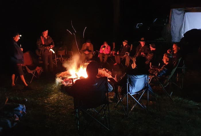
- Campfire at Winnejup.
There was consistent rain and wind throughout the night. The popups were welcome.
Saturday
-

- Blackwood River early morning.
-
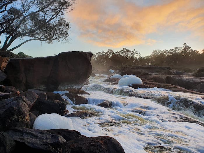
- Winnejup Rapids
-

- Jeff, Greg, Joe and Kim around the campfire early Saturday morning
We planned to drive to Yeagarup via Yornup, Wheatley, and Deanmill, rather than just beat down the bitumen to Manjimup and Pemberton. We changed our plan to stay ay Black Point, electing instead to stay two nights at our private camp at Winnejup Falls.
-

- WINNEJUP TO YEAGARUP AND RETURN
The way out of camp was blocked by a downed tree. We made short work or removing it from the road.
-
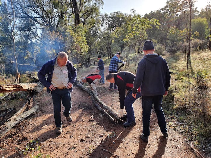
- We had to clear a fallen tree on the track out of camp.
-

- Blackwood River at Winnejup.
-

- Tweed Road, Blackwood River Valley.
-
- Tweed Road, Blackwood River Valley.
The Road Trip through the forest provided the opportunity to inspect a few interesting features.
-

- Track through the forest around Wheatley.
-

- Kim explains the purpose of the ‘hockey stick’ markers often seen on bush roads and tracks.
-
- In the bush near Deanmill.
-
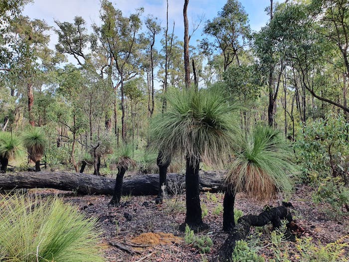
- A good stand of grass trees (Xanthorrhoea preissii).
-

- Kim explains how forestry Reference Trees were used to locate position. This tree is more important as it is a Survey Tree, These were used as the start point in a survey of a block or property in contrast to Reference Trees that merely denote a location.
-

- Reference Trees and Survey Trees are rarely used now, largely being superseded by the use of GPS. This Survey Tree is Ross Swamp SW Survey Tree.
As expected with the recent lifting of Covid19-related travel restrictions, it was very busy at the Air Down Point at the end of Ritter Road. Busier than an Australia Day long weekend.
-

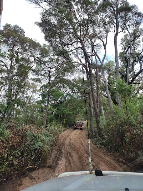
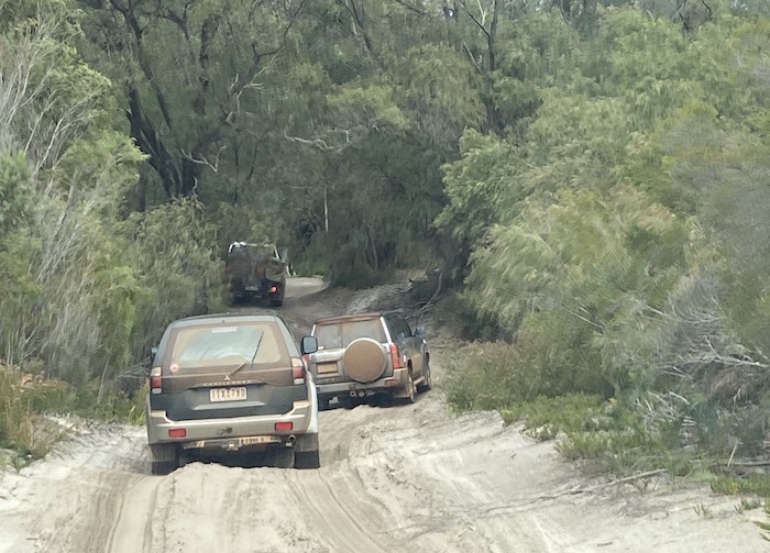
- Bush track on the way to Yeagarup.
-
- Near Lake Yeagarup.
-
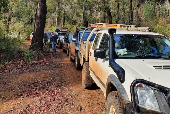
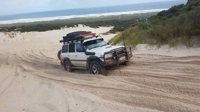
- Vehicle lineup on top of first dune.
-
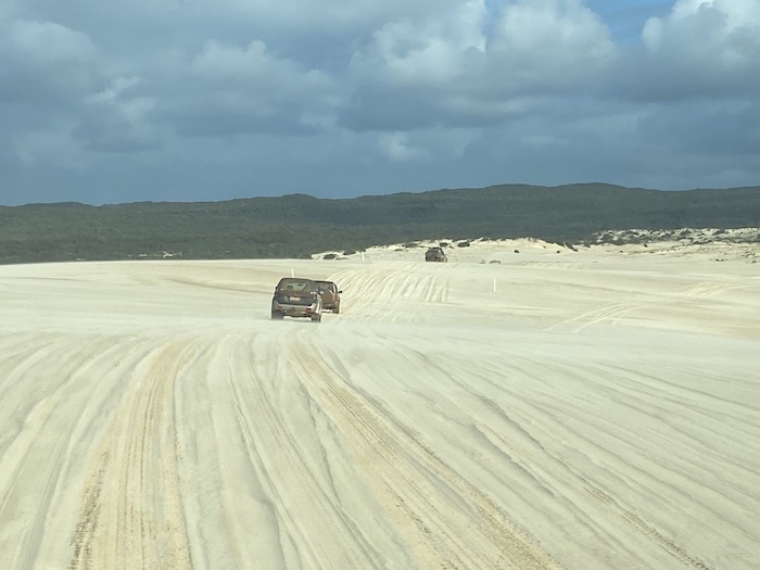
- Driving across the Yeagarup Dunes.
-

- Approaching storm.
-

- Across Yeagarup Dunes.
After the first set of dunes it is another five kilometres of bush driving to the beach.
-
- Driving to the beach.
From the Air Down Point to the beach is just over 10 kilometres. Full details of the Yeagarup Track here.
-

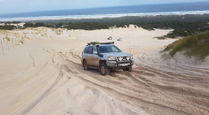
- Descending Yeagarup Hill.
There were lengthy delays getting to the beach as inexperienced drivers in other groups got stuck, bogged or both. The final dune before the beach was a challenge to a low slung Vitara and resulted in quite a delay.
-
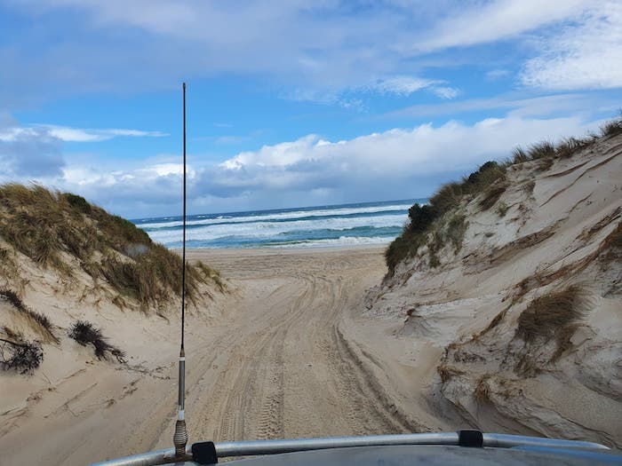
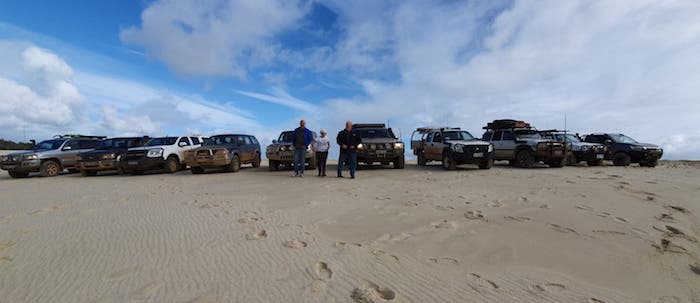
- Onto the beach.
-

- The Southern Ocean at Warren Beach.
The weather was unfriendly. We drove to the Warren River, contemplated the situation – particularly the wind and rain – and drove back to the exit off the beach.
-

- Mike drives his Patrol up Yeagarup Hill.
-
- Jeff and Micaela in their Prado.
-
- Stuart drives his ‘Cruiser up Yeagarup Hill.
The sand was damp and compacted and only mildly cut up so getting up Yeagarup Hill was not the challenge it normally presents.
-

- On the track out of Yeagarup.
With no time to visit Lake Jasper we headed to Pemberton, refuelled and drove back to Winnejup.
-

- Jeff preparing damper for Jeff preparing damper for serving
Sunday
Today was going to be a cruisy day.
-

- WINNEJUP TO NANNUP TO WILGA
We followed the Blackwood along Tweed Road to Bridgetown and continued to hug the river out to The Peninsula and then along Radiata Road.
-
- The track leading up the hill was blocked but the views were goodThe track leading up the hill was blocked but the views were good.
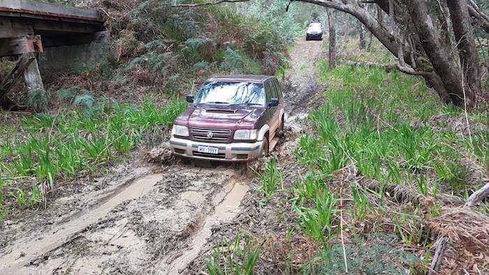
The river crossing at Southhampton was a departure from plan that took us to Greenbushes and then Balingup.
-

- Neil crossing the Blackwood in his Mitsubishi.
-
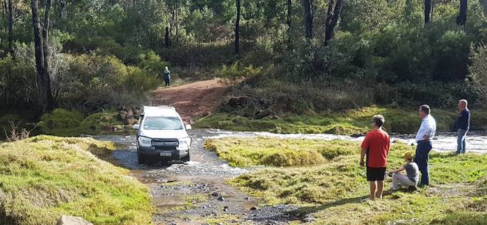
- Greg drives his Colorado across the river.
-
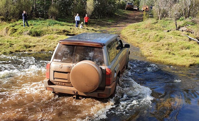
- Peter takes his Patrol across the Blackwood River.
-

- The Blackwood River.
-

- Mike takes his Patrol across.
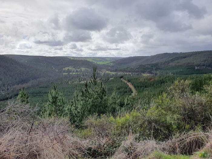
The Greenbushes Mine viewing platform was closed due to Covid 19 worries so we drove to Balingup. The road from Balingup to Nannup is considered by many motoring enthusiasts to be one of the great drives in Western Australia.
Sweeping bends offer seemingly never ending views of forests or farmland. The Blackwood River is on the right and tall tree covered slopes on the left. The 41 kilometres of road between the two towns has 90 bends, making it popular with motorcycle and driving enthusiasts alike.
Lunch was at a very crowded Nannup and we then drove through the forest to the north of that hamlet.
We arrived at Grimwade early afternoon and found a good campsite, although most of the readily available firewood was a bit green.
-

- Our camp at Grimwade.
-

- Andrew and Joanne’s temporary home.
-

- Liam did his bit to load the fire.
-

- Around the fire at Grimwade.
Monday
Making a bee line for home on the last day of a trip is a no-no and, besides, we had plenty planned for the day.
-
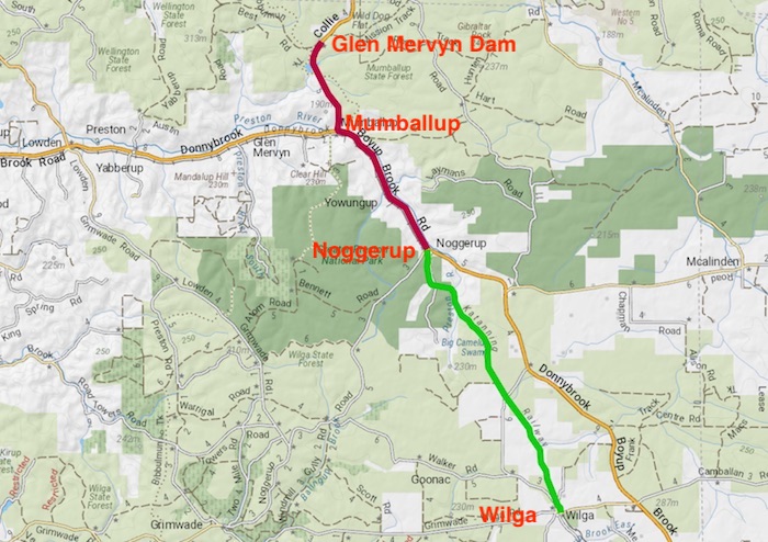
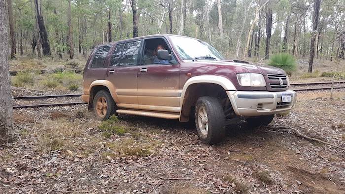
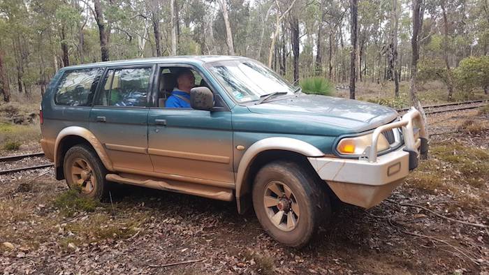
- WILGA TO MUMBALLUP
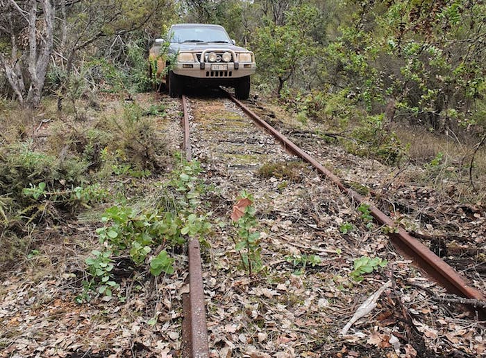
At Wilga we got onto the abandoned Katanning-Donnybrook railway with a view to pushing through to Noggerup. That required a lot of swapping from one side of the railway to the other and much pushing through scrub.
-
- Joanne takes the Jackaroo off the railway.
-

- Mike drives his Patrol to the side track
-
- Neil takes his Mitsubishi off the railway.
-

- One of the many swaps from railway to track.
We pushed through a particularly overgrown section of the railway and the side track then became serviceable.
-
- At the end of the overgrown section.
-
- Peter near the end of tough section.
-

- Peter takes the Patrol through the mud.
-
- Joanne takes her Jackeroo through.
-

- Greg in the Colorado.
After we cleared a fallen tree across the track at Noggerup the Road Trip was essentially finished. There remained only the drive back to Perth.
Feel free to use any part of this document but please do the right thing and give attribution to adventures.net.au. It will enhance the SEO of your website/blog and Adventures.
See Terms of Use.og and this website.
1018 words, 50 photographs, three images.
Text and Layout
Kim Epton
Photographs
Micaela Anderson
Joanne Newhouse
Kim Epton
See Terms of Use