
The two most easterly parts of the Hunt Track – Southern Cross to Kambalda and Kambalda to Spinifex Range and Hunt Pinnacles – are entirely in the Great Western Woodland. It was the setting for another Road Trip.
Surveyor C.C. Hunt explored by horseback to Spinifex Range (140 kilometres east of Kalgoorlie) in 1866 and also to what he called Three Pinnacles (now Hunt Pinnacles) 100 kilometres north-east of Kalgoorlie.
Given the limited resources available to him, the unseasonally dry conditions and the remoteness from ‘civilisation’, his achievement in pushing so far east was remarkable. Though remarkable, the realisation that the country was essentially waterless, coupled with the afore-mentioned limiting factors, lead to the abandonment of the goal of finding a path through to the eastern colonies. His 1865 and 1866 expeditions concentrated on locating pastoral land.
-

- Extent of the Great Western Woodland.
The Great Western Woodland is the largest intact mediterranean woodland on the planet.
Yerdanie to Prince of Wales Mine
The turnoff from Great Eastern Highway is at 31°10’16.28″S 120°33’55.03″E and can be difficult to see. This track is part of the Hunt Track from Woolgangie to Yerdanie.
-

- Directional sign at Yerdanie Rock.
Our six day Road Trip to follow the Hunt Track to his ‘Furthest East’ point – in the Spinifex Range, 140 kilometres east of Kalgoorlie, started on Wednesday 11 September 2019.
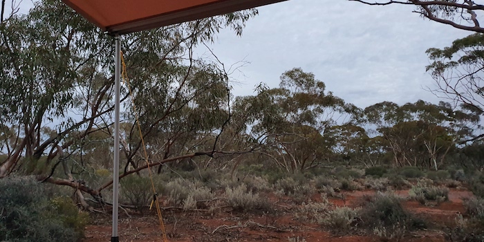
Heading east it gets darker earlier (this is why) and the light was fading so I pulled into a known camping area near the Prince of Wales (abandoned) mine. Plenty of space and plenty of firewood.
-

- Mushy cooking his
-

- Mushy’s dinner.
-

- Kim preparing dinner.
-

- Mushy’s camp.
-

- Dusk at the Prince of Wales campsite.
-

- We had plenty of firewood at our overnight camp.
Along Hunt Track to Gnarlbine

The drive east from our campsite to Gnarlbine was an uncomplicated, easy run. Gnarlbine Soak was an extremely important source of water for prospectors in the 1890s and even after Coolgardie was established it was a vital resource until condensors were constructed, and the Mundaring to Kalgoorlie pipeline was eventually put through.
-

- Gnarlbine Well.
-

- Bicentennial plaque at Gnarlbine.
-

- Information wall at Gnarlbine,
At Gnarlbine we searched for a known, second well, 200 metres SSE of the main well. The scrub is extremely thick in this area and previous searches had been unsuccessful. After I described the general area where I expected the well to be, it was found within minutes. The well is accessible from a gravel ‘carpark’ just south of the Rock. A path leads to the well at 31°9’18″S 120°57’32.26″E. [A photograph of the access track taken after this Trip is here].
-

- The second well at Gnarlbine.
Nepean Mine
We drove out to Victoria Rock Road and headed north of Gnarlbine Rock, searching for a track east that would lead to the Nepean-Spargoville Road. After a couple of false starts we found a track that followed a long since abandoned railway.
This track lead to the abandoned Nepean Mine.
-

- Poppet head at Nepean Mine
-

- Very edible damper courtesy Mushy.
The Nepean-Spargoville Road took us to the Coolgardie-Esperance Highway which we followed to the turnoff into Kambalda.
At Kambalda we visited Little Industries. Their rock crushing operation supplies railways, mines and roads throughout the goldfields and beyond.
King Battery
Leaving Kambalda, we headed to historic King Battery.
-

- At King Battery.
-

- At King Battery.
-

- At King Battery.
Karonie
Our route took us through Woolibar Station to Mount Monger Station where we had lunch and waited for Scott Wilson to join us for the drive to Hunt’s furthest point east.
This was a chance to tour some of Scott’s prospecting/mining leases, past and present. The view from Bordenkoobing Hill was impressive. We headed north and had to do a bit of cross country driving searching for the track before Scott was able to pick it up again and get to the Trans Australia Railway Access Road near Curtin Siding.
It was then a long push to Karonie. We crossed the railway and followed the track north to Cardunia Rocks. The ‘camping area’ looked to be picked pretty well clean of firewood so we moved 750 metres north-east to a clearing replete with wood.
-
- Showers threatening at the Cardunia Rocks campsite.
The threat of rain as we set up camp became real just before dusk, however, it lasted less than a minute.
-

- Our camp near Cardunia Rocks.
Hunt’s Furthest East at Spinifex Range
-

- Dawn
In the morning we climbed Cardunia Rocks and investigated the entire water harvesting complex.
-

- The Government Dam at Cardunia Rocks.
-

- Greg at Cardunia Dam.
-

- Harvest wall.
-

- The striking Flannel Bush is a common sight. They occur throughout Western Australia except for the south coast and north of Port Hedland. Solanum lasiophyllum is a member of the Solanaceae family and as the name implies, is a family and genus that loves the sun. The leaf description, lasiophyllum, comes from the Greek, lasios meaning shaggy or hairy (flannel-like) and phyllon, leaf; hence, hairy leaf.
-

- Concrete uprights in the reservoir at Cardunia Rocks once supported a corrugated iron roof that reduced evaporation.
The search for the track that would take us to Hunt’s furthest east started back near the Trans Line. Nothing presented as a possibility. Mushy went to the Trans Line and decided that the track along the railway was our way east. We followed this track along the railway for seven kilometres before it turned north-east – confirmation that it was the track we wanted.
-

- Overgrown track near Emu Flat on the way to Nancara Rockhole.
The track was tight and overgrown for many kilometres – mulga and other acacias. Not long after we passed through a gateway to head north-east Mushy had an altercation with a King Brown snake. It reared up at his vehicle before slithering off the track into the scrub.
-

- King Brown near Emu Flat.
The King Brown snake or Mulga snake is found over most of mainland Australia, except for the extreme south and southeast coastal regions. Despite its name, it is actually a black snake, Pseudechis australis. Although it is only the 14th most venomous snake in Australia (measured by LD50 value) it is aggressive and strikes rapidly and repeatedly and may hang on and chew. It produces more venom than other Australian snakes, making it more dangerous.
-

- Dingo Rock dam.
-

- On Dingo Rock
-

- Windmill at Dingo Rock dam.
As we approached a permanently open gate the route became unclear but I soon picked up the track heading in the required direction.
-

- It’s been a while since this gate was shut.
Babington Rockhole
Eleven kilometres further on, and soon after a sharp turn to the north-west, we came upon the interesting Babington Rockhole.
-

- Babington Rockhole.
-

- Old railway sleepers protect the water supply.
-

- The water around Babington Rock has dried up, however, there is still sufficient moisture to sustain some plant life..
-

- Railways sleepers have been used to slow water loss through evaporation and prevent animals falling into the water.
This rockhole was located by an exploring party led by John Muir in May 1901 and referred to in his report as Jumannia – and later rendered as Jumnania. In 1979 it was ascertained that it could not be Jumnania – recorded by W.P. Goddard in 1890 – so it was renamed after Muir’s second-in-command, C.H. Babington.
As we entered the Coonana Timber Reserve the track improved markedly.
-

- The track improved once on the Coonana Timber Reserve.
Nancara Rockhole is eight kilometres into the Coonana Timber Reserve, towards the northern end of the Spinifex Range.
-

- At Nancara Rockhole.
-

- Nancara Rockhole.
There are hundreds of aboriginal artefacts in the vicinity of the rockhole.
-

- Camel bones at rockhole.
Taking a Shortcut
Rather than return to Karonie we took a chance that some indistinct tracks we could see on Google Earth would lead us to the track north to Hunt Pinnacles. As it turned out, the latter track was overgrown and tough and the tracks we took from Spinifex Range to Silica Hill Dam were ok.
Mount Quin
We abandoned our quest to get to Mount Hunt after meeting with some prospectors who advised that the only track in was a circuitous route a few kilometres back the way we had come. We pushed on to Mount Quin. After five kilometres of eastward travel we hit a creek line and lost the track.
-

- Mount Quin. Hunt named this hill after Mr Lewis Quin, describing it as “the highest trap hill NE of Mt Monger.”
Hunt named this hill after Mr Lewis Quin, describing it as “the highest trap hill NE of Mt Monger.” A ‘trap hill’ is formed by the exposure of a dolerite/microgabbro sill or dike, common in the Yilgarn Craton.
Hunt Pinnacles
Leaving the Mount Quin track we headed north, past the Kurnalpi Road, past Yindi homestead and turned west towards Hunt Pinnacles. That track wasn’t too bad but getting close to Hunt Pinnacles proved to be impossible.
To Red Dust Revival at Lake Perkolilli
It was time to think about getting to Lake Perkolilli, our planned overnight stop. The sun sets earlier this far east. The track south was both tortuous and torturous. Overgrown, tight and dusty.
The push south was abandoned and we headed east towards the Yindi Road, taking a fire access track to the Kurnalpi-Yindi Road. We then made good time to Perkolilli, scene of the Red Dust Revival.
Though we set up camp well away from the race track and main camping area, the dust from newly-formed tracks was still stifling. It was thick and unhealthy. A breeze came in around 7.00 p.m. and made conditions more liveable.
© Kim Epton 2019-2024
1617 words, 41 photographs.
Feel free to use any part of this document but please do the right thing and give attribution to adventures.net.au. It will enhance the SEO of your website/blog and Adventures.
See Terms of Use.