
A three day, 520 kilometre Road Trip – mostly on the beach.
-

- BREMER BAY TO ESPERANCE
-

- Leaving Bremer Bay.
Departing Bremer Bay our route took us through the Fitzgerald River National Park, a reserve unique in this world but unfriendly to vehicle adventurers – being designed and managed more for walkers.
Fitzgerald River National Park
-

- Royal Hakea in Fitzgeral River National Park.
After a false start trying to find re-aligned roads we made our way through the Park, not intending to visit any of the features/attractions on this western side. Near the turnoff to Quaalup Homestead I stopped to get photographs of the spectacular Royal Hakea shrub/bush. Worldwide, it is found only between Albany and Esperance, concentrated in the Fitzgerald River National Park.
-

- On the South Coast Highway repacking Jo and Andrew’s swag on the roofrack.
Hopetoun
-
- View of Culham Inlet at Hopetoun.
-

- The name for the Lookout is derived from East Mt Barren immediately behind it.
-

- Wheelchair-friendly Barrens Lookout offers fantastic views of Hopetoun and the Southern Ocean.
-

- At Barrens Lookout.
-

- Royal Hakea at Barrens Lookout.
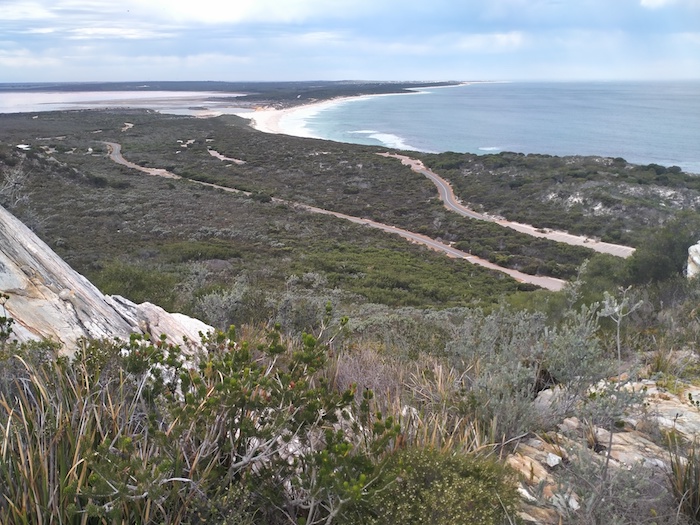
From the Lookout we drove down to the beach at Culham Inlet, looking to get to Hopetoun on the sand.
-

- FROM BOAT RAMP TO HOPETOUN ALONG FOUR MILE BEACH
The 700 metres of beach to the groyne at Hopetoun was inaccessible and we turned around and found a way off the beach. We aired up in a car park and drove into town to regroup with those who had left the beach earlier.
We took Southern Ocean Road out of Hopetoun 30 kilometres to a track that led to the coast. Two kilometres later we came upon an installation nestled among the rocks. Without confidence – and mainly because of substantial power lines feeding in to the installation – we tentatively proclaimed it as a desalination plant.
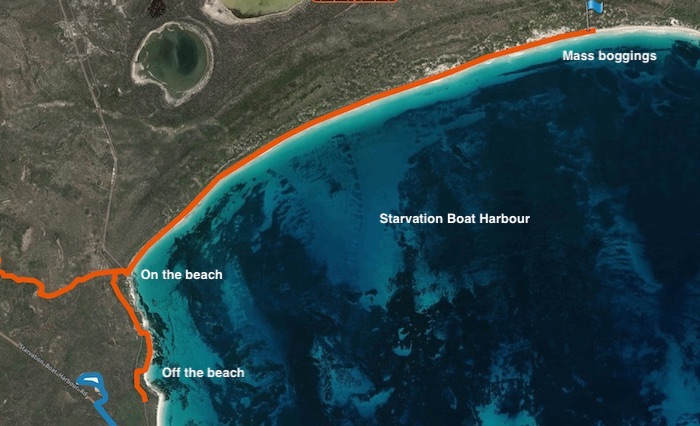
We continued on Southern Ocean Road, dropped in to Mason Bay Campground to check it out, and drove on to Starvation Boat Harbour Campground, where we stayed the night.
-

- HOPETOUN TO STARVATION BOAT HARBOUR
-
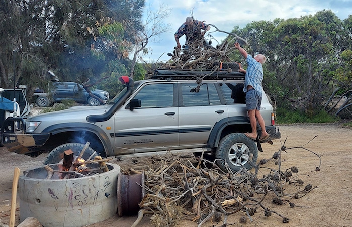
- Offloading firewood at Starvation Boat Harbour campground.
-

- Campground at Starvation Boat Harbour.
-
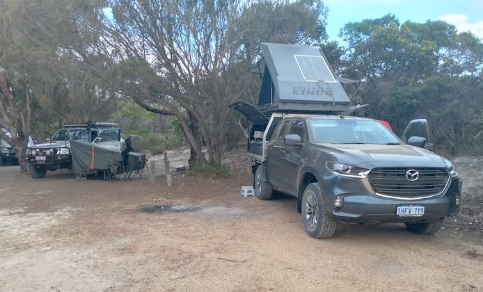
- Greg setup at Starvation Bay Campground.
-
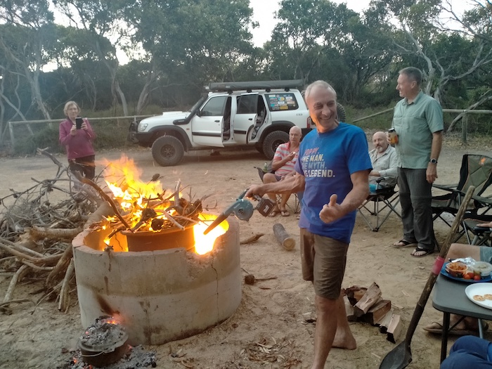
- Greg used his blower to accelerate the fire.
-
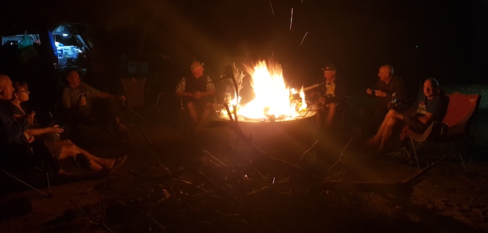
- At Starvation Boat Harbour Campground.
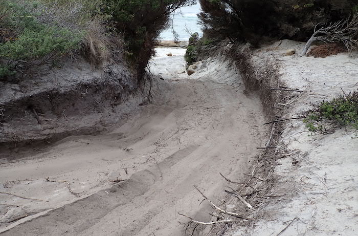
Starvation Boat Harbour Beach
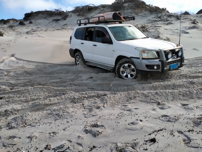
We left camp and made our way to the beach. After four hundred metres the way was blocked and there was only one, sketchy exit off the sand. Inconveniently positioned rocks at the beginning of the exit made it more difficult. However, with a bit of care, judiciously-placed wheels and application of the right foot at the appropriate time all vehicles made it up the narrow track with ease and with no damage.
-

- Greg manoeuvres his BT50 through rocks.
-
- Exit from beach.
-

- Graham takes his Prado off the beach.
-

- Greg takes his BT50 off the beach.
-

- Greg’s turn next to get off the beach.
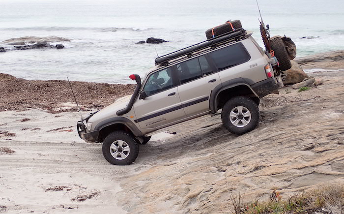
Eight hundred metres along a bush track we were again able to access the beach via a rock ledge.
-

- Howezit takes his Patrol over the rock ledge.
-

- Greg and Margot in their new BT50 drop onto the beach.
-

- Joanne and Andrew in their Prado.
-
- Scott takes his Patrol onto the beach.
-

- Graham and Kim watching Peter drive Prado down rock.
We headed east for nearly five kilometres. The beach narrowed and as it did so its angle increased, both factors mitigating against further eastward travel.
-
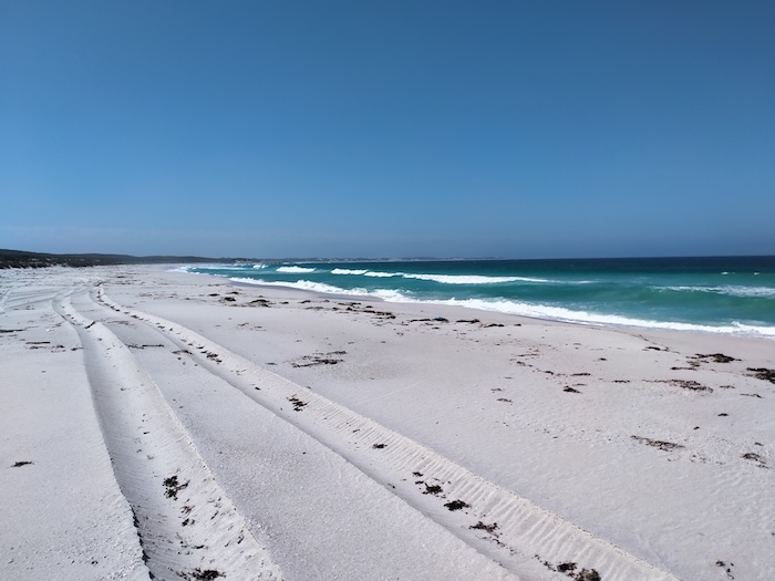
- WA Beach 222, east of Starvation Boat Harbour.
-
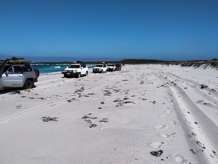
- Our convoy on WA Beach 222 not long before it narrowed and angled.
Turning around was easier said than done. With an incoming tide on an already narrow beach it was a hazardous proposition.
Graham was bogged but managed to get unbogged reasonably easily. Joanne reversed the Prado along the beach to a break in the dunes to where she was able to turn around. Peter, Graham and Scott had also turned around at this point. We returned along the beach, drove up the rock ledge and took a bush track out to Springdale Road.
-

- Jo turned around the Prado with a bit of help from bystanders.
-
- Joanne reversed the Prado into a break in the dunes.
-

- Peter turns the Hilux on an unnamed beach (WA Beach 222) before the point where the Patrol was bogged.
-

- Proof that these are not just roof rack ornaments.
-
- STARVATION BOAT HARBOUR
-

- STARVATION BOAT HARBOUR TO MUNGLINUP BEACH
We retreated to Springdale Road and headed to Munglinup Beach to check out the campground. It is small and not suitable for groups. We left, retraced our tracks for a few ks and turned east on Washpool Road. This took us to Washpool Road Beach (WA Beach 209). We drove all but the last 600 metres of the beach before returning and finding a track off the beach back on to Washpool Road.
The track led to a large area of flat rocks.
-

- Flat rocks at East Munglinup.
-

- The flat rocks at East Munglinup were a good spot for lunch.
Deciding that the beach going forward (east) from these rocks was too hazardous we retreated to Washpool Road, hoping that we could drive through Lake Shaster Nature Reserve. It was not to be and we had to head out to Springdale Road to allow us to find our way back to the coast.
-

- We were hoping to head east at this point but closed tracks because of disease forced us to head out to Springdale Road.
-

- Farmland out to Springdale Road.
Munglinup
An unnamed track off Springdale Road took us down to East Munglinup Beach. We drove down to the beach along belting-covered tracks. With a mental flip of the coin we turned east.
-

- The track down/up to East Munglinup Beach.
-

- Nearly on the beach.
-
- A bit dramatic but probably based on past experience.
-
- East Munglinup Beach
We drove carefully around the point on a rocky beach and continued for about 1.5 kilometres. The beach was narrowing, getting soft and looking altogether too hazardous. We made our way back to the beach entry point.
-
- Beach at East Munglinup.
-

- Our convoy at the entry to East Munglinup Beach.
It was time to tackle the 5+ kilometres of the beach to the west.
Within 600 metres a washed away beach forced us up into the vegetation. We were two metres higher than the beach – a steep, unstable drop off. The track was rough and was causing the vehicle to bounce around radically. With each bounce the Patrol moved closer to the drop off. One, two, three, four bounces and the vehicle was right on the edge of the drop off. The fifth bounce could have taken us over the edge or forward to safety. The Patrol landed on the now firm, level, benign sand.
We were presented with a dilemma. We knew that we couldn’t get off the beach by going forward – however good the beach looked – because we had seen at Munglinup that it narrowed and became impassable. We certainly weren’t going back the way we had come.
-

- EAST MUNGLINUP BEACH DROPOFF AND TURN AROUND
Our best option was to climb a steep sand dune off the beach and then work our way through the dune system back to where the others were waiting. Easy to say. And after a few anxious moments, successfully completed. With two ‘on the limit’ experiences this was one of the scariest the scariest day of my 40+ years of four wheel driving.
We returned to Springdale Road, seeking a camp for the night. At Lone’s suggestion we turned into Skippy Rock and found a perfectly acceptable camp.
-
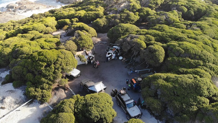
- Skippy Rock Campground
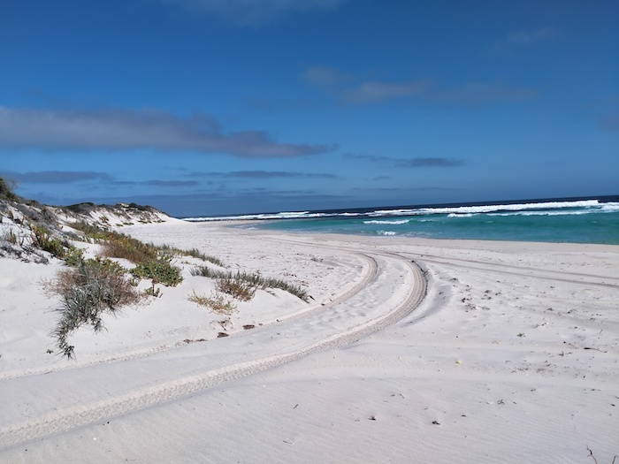
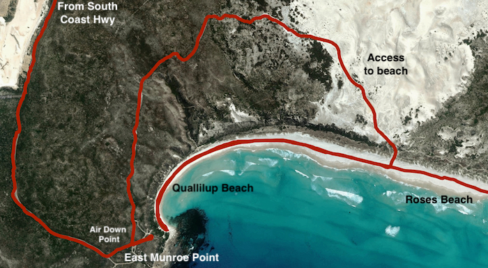
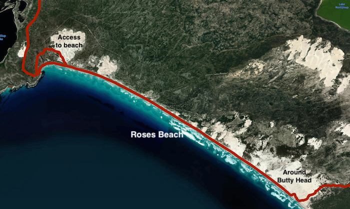
Roses Beach/Quallilup Beach
Between Skippy Rock and Roses Beach/Quallilup Beach the coast is accessible at only four points at the end of four tracks. The uncertainty of access due to track closures as a result of disease was a factor in us choosing to travel direct to Roses Beach – 85 kilometres from Skippy Rock.
On the way out we had a look at the Torradup River inlet that leads into Margaret Cove.
-

- Torradup River Inlet
-

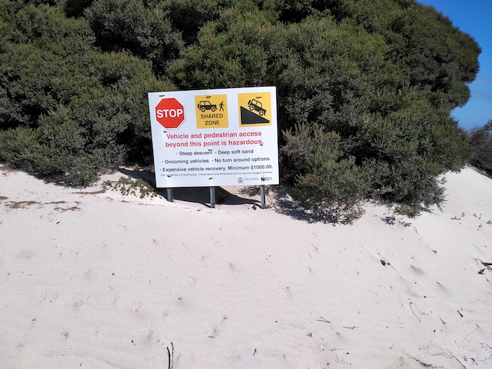
- A realistic sign on Murray Road after the bitumen ends.
-

- Track down to Roses Beach.
Access to Roses Beach is via Murray Road past a lime quarry. With road trains constantly on the road it is both dusty and very corrugated. On approach to the coast there are tracks everywhere. A headland at the end of the main track provides sweeping ocean and beach views but no hint of how to get down to the beach. We took a track north (away from the beach) that eventually led to the dunes. It was then a matter of finding a safe way through and across the dunes down to sea level.
-
- ACCESS TO ROSES BEACH
-
- Greg and Margot descending sand dune to Roses Beach.
-

- Descending sand dune to Roses Beach.
-

- Howezit descending sand dune to Roses Beach.
-
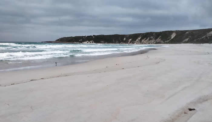
- Western end of Roses Beach (aka Quallilup Beach) with Munroe Point lookout/headland in the background.
-

- Vehicle lineup on Roses Beach.
-

- Lunch on Roses Beach.
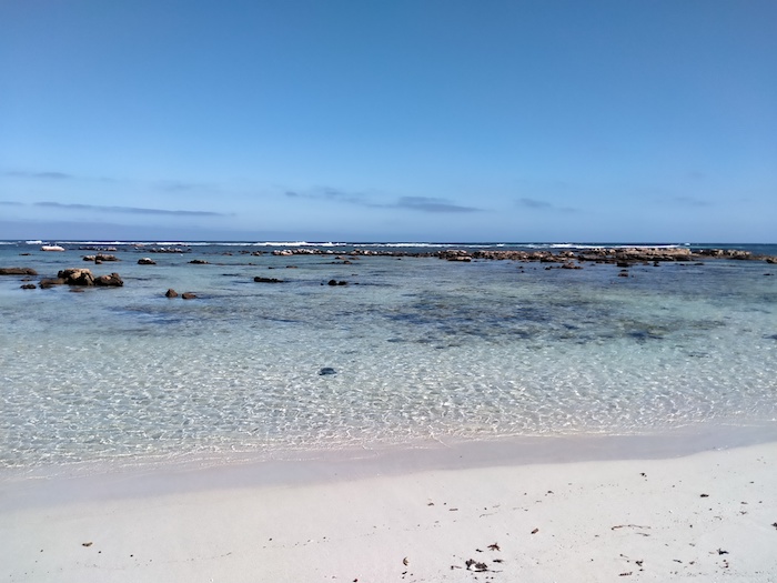
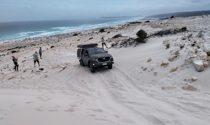
We were able to follow this beach for many kilometres. Satellite images showed an indistinct track around Butty Head but no connecting track from the beach. About two kilometres before Butty Head we left the beach and spent considerable time trying to find a way round this headland.
-
- ROSES BEACH
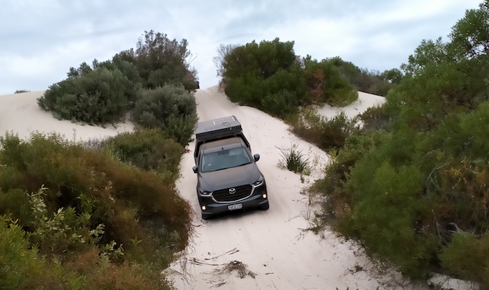
Peter put up his drone and found the track I was looking for. We worked out a possible route through the dunes, did some spadework to even out the track at a pinch point, and started the climb.
-

- Jo drives the Prado through the section of track that we made.
-

- Coming off Roses Beach to get around Butty Head.
-
- Greg drives his BT50 off Roses Beach to get around Butty Head.
A rough, dusty track leads down to Butty Harbour, allowing a further 3.5 kilometres of eastward travel along the beach.
-

- AROUND BUTTY HEAD
The beach was looking less and less inviting and we found a suitable point to exit. Just over two kilometres further on we were on bitumen – Twilight Beach Road. This coast-hugging road (one of my Great Drives of WA) took us into Esperance.
Esperance
The seven caravan parks in Esperance were all full (school holidays) and we were directed to the Sportsground. Great facilities and plenty of room.
-
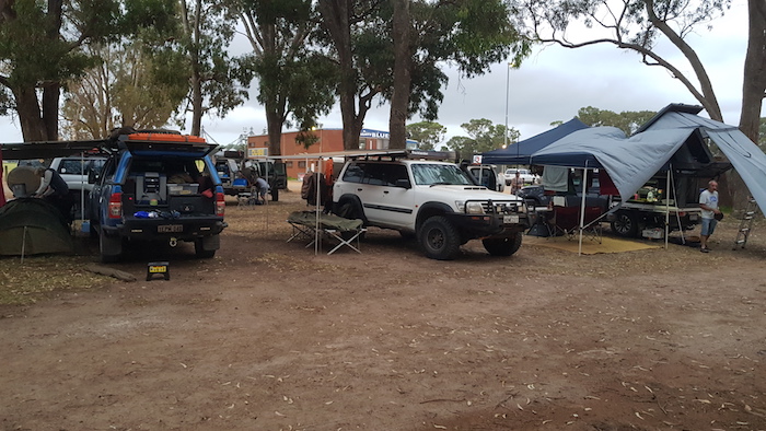
- Our campsite at the Esperance showgrounds.
We left Esperance bound for Eyre Highway via the Balladonia Track.
© Kim Epton 2021-2024
1752 words, 57 photographs, 9 images.
Photographs
Kim Epton
Lone Neilsen
Graham ‘Howezit’ Howe
Feel free to use any part of this document but please do the right thing and give attribution to adventures.net.au. It will enhance the SEO of your website/blog and Adventures.
See Terms of Use.