
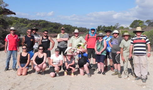
An easter 2017 getaway.
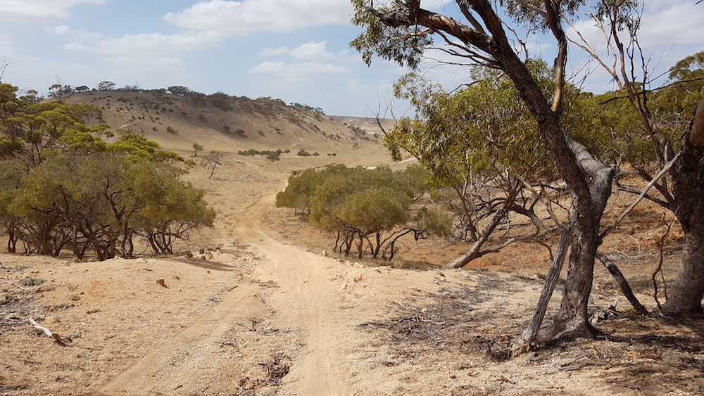
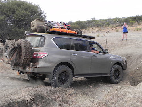
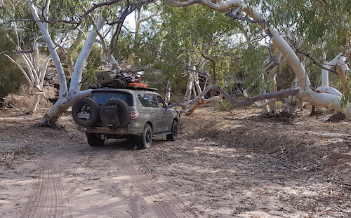
On the way to Murchison House Station I called into Hardabut Rapids. The turnoff is not marked and the narrow track is closely edged with scratchy vegetation. Close to the river the condition of the track requires one to slow to walking pace but overall it is no great challenge to get to the Rapid.
-

- Pool at Hardabut Rapids.
-

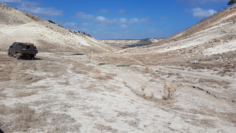
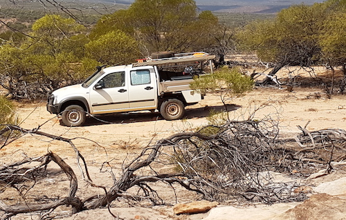
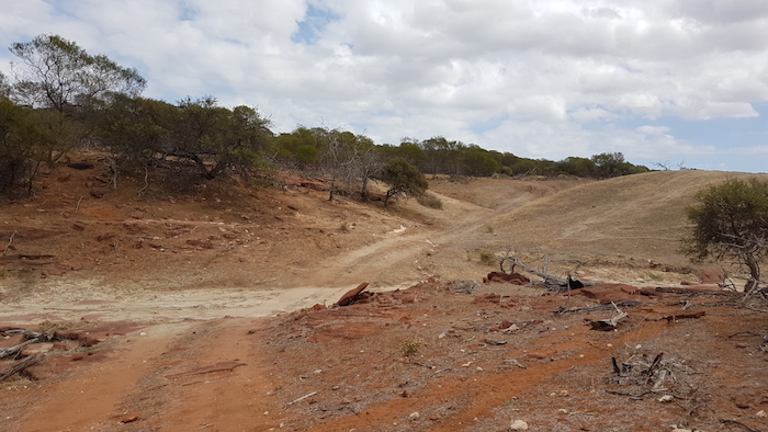
- Hardabut Rapids with no water.
Hardabut Rapids was the scene of a near disaster on our 1995 boating expedition downriver from Galena Bridge after Cyclone Bobby dumped enough rain to create record floods.
-
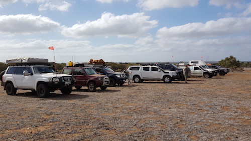
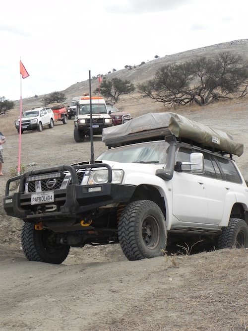
- Trip outline
We arrived at Murchison House Station at 4.00 p.m., signed in, and made a visit to the Western Patrol Club on the way to our camp at Tutula Well on the northern bank of the Murchison River. While our campsite was not the best we had ever selected once darkness fell and a campfire was lighted the perception of any shortcomings receded.
Tutula Well to Beach Camp (Friday)
Andrew and Steve arrived next morning and we got away on time with Joe Natoli as Trip Leader for the day.
-

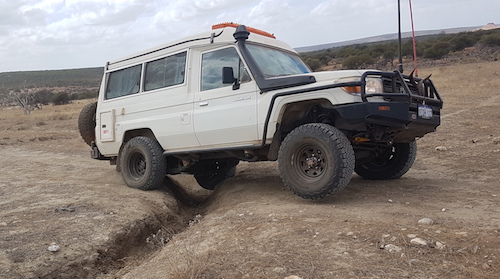
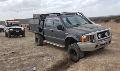
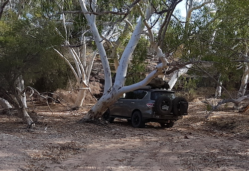
- Andrew’s GQ
-

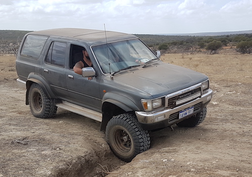
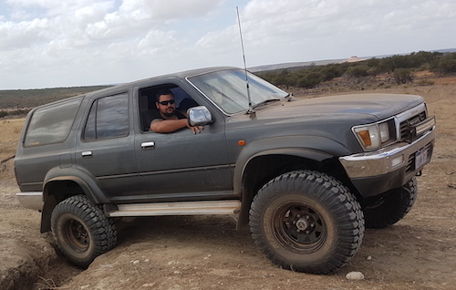
- Steve’s Toyota camper.
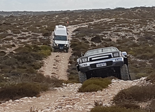
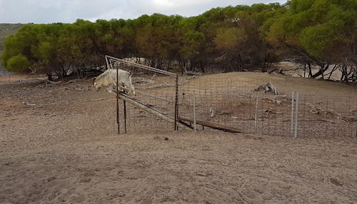
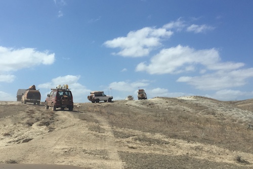
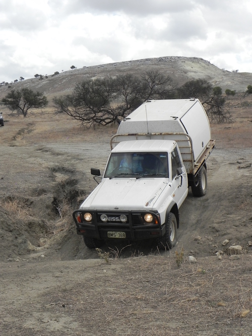
The first challenge on the track north was a fence blocking the way. On closer inspection it was clear that it was part of a goat trap. We had passed the detour around it so it initially presented a challenge. Those further back in the convoy located the detour and we were back on track.
-

- On the track north.
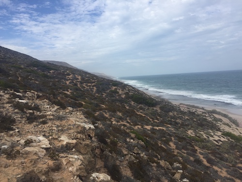
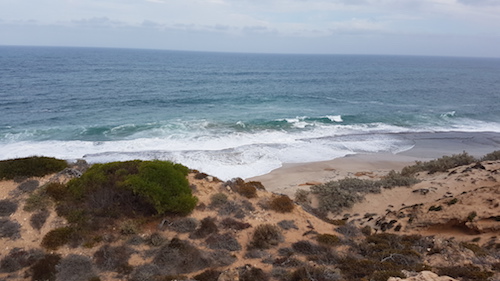
The first diversion off the track was Tiddies Hole – an access point to the beach.
-
- On the way to Tiddies Hole.
-
- Tiddies Hole
On the way back out to the track north the F250 got a puncture. While Matt changed the wheel those at the front of the convoy took the opportunity to collect wood – it being a safe bet that there would be no wood at our beachside camp.
-

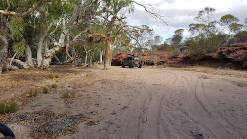
- Heading north.
-

- Joe dragging firewood.
-
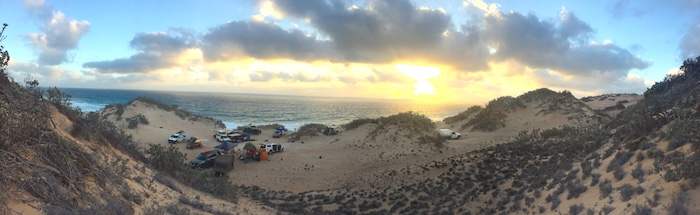
- Beach at the overnight stop.
About 12.45 p.m. we found a campsite behind the dunes, out of the wind. The sea was only marginally safe for swimming and, as the wind picked up, the chance of fishing receded. With fishing not being an option there was time to set up a comfortable camp. It was interesting to see all the various shower set ups.
-
- Storm clouds over the camp.
Our protected position allowed a campfire.
-
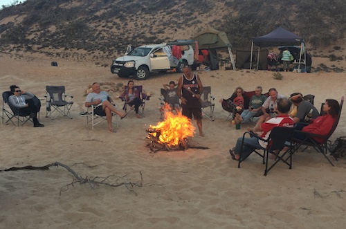
- Campfire behind the dunes.
Most were in bed early. It was windy all night.
Beach Camp to Wilgamia Pool (Saturday)
Trip Leader for the day was Matt Hall.
Our Route showed a turnoff to the south that would be tricky to find but the bulldozer had been through and turned it into a gentle, easy to locate sweep down into a claypan and goat trap. The exit was also easy to spot.
-

- Goat trap
-
- Escape chute
We worked our way south towards Gie Gee Camp. Matt caught a kid and after photographs he released it back into the nursery.
-
- Claypan near Gie Gee Outcamp.
-

- Hut at Gie Gee Outcamp.
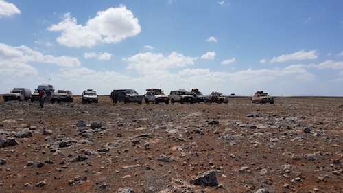
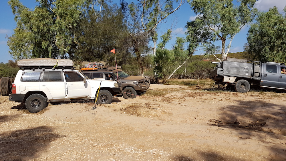
-
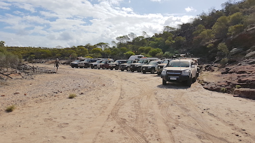
- Vehicle lineup at Gie Gee Outcamp.
Heading south from Gie Gee we detoured into Culcurdoo.
-

- Culcurdoo
-

- Culcurdoo goat trap.
Further south our Route turned onto a track to the north-east I thought would be difficult but it had been upgraded 18 months ago and was now a high speed but very dusty track.
After our coffee break we turned into Hidden Valley.
-

- Heading toward Hidden Valley.
-
- Entrance to Hidden Valley.
-
- Driving into Hidden Valley.
Matt led the way cross country up a bluff until we were stopped by boulders. From there we walked to the edge of the escarpment. Magnificent views.
-
- In Hidden Valley.
-
- Stopped short of the bluff.
-

- Walking to bluff.
-

- The Valley
-

- At Hidden Valley.
We found our way back down the bluff, out of the valley and onto the main track.
-

- Descending hill out of Hidden Valley.
-

- Kim exiting Hidden Valley.
The track into our planned overnight stop at a cave was narrow and overgrown. We were way ahead of time so this became the lunch stop instead of the overnight stop.
-
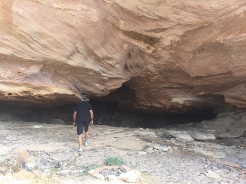
- Joe walking up to the cave.
-

- Cave
-

- Matt and Grace inside the cave.
-
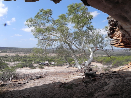
- View to the east from the cave.
-
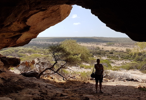
- View from the cave.
-
- Kim’s Rodeo at cave.
-

- Breakaway formation at cave.
Because we were so far ahead of schedule Matt adjusted the planned Route to make the overnight stop at Wilgamia Pool.
Our convoy departed the cave, turned right and headed toward the river. Once we hit the river track we decided to get closer to a pool we could see in the middle of the river bed. This part of the Murchison River is a ‘braided stream’ with numerous pools, a totally uneven stream bed and a multitude of magnificent red river gums across the full width of the river.
Matt led the way. Our trips wouldn’t be what they are without an episode of what then ensued. Five tonne of Ford’s Finest hit a bog hole and went straight down.
-
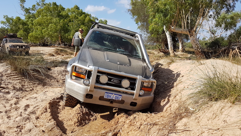
- Seriously bogged.
-

- Matt got the F250 stuck.
-
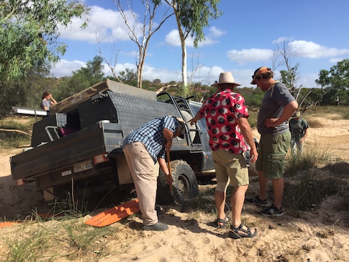
- Kim and Matt supervising Steve.
-
- Joe working on getting the MaxTrax under the rear wheel.
-
- Two vehicles were required to extricate the F250.
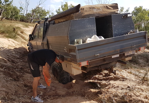
-
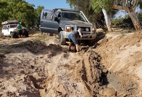
- Andrew working on retrieving a MaxTrax.
The Effy was retrieved and we pushed on to Wilgamia.
-

- Wilgamia Pool on the Murchison River – our campsite for Saturday night.
-

- In Wilgamia Pool.
-

- Kim and Penny on bank.
-

- Relaxing in river.
-

- Brad and Jane and Matt and Tania selected a memorable site for their overnight stay at Wilgamia Pool.
Wilgamia Pool to Army Camp (Sunday)
-

- Great spot for a campsite.
-
- Brad breakfasting at Wilgamia Pool.
-

- Wilgamia Pool
Joe was Trip Leader today.
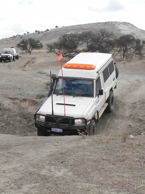
Even a cursory inspection made it clear that we were unable to drive to Mt Curious on the planned Route so we had to back track north. Joe found a shortcut through an overgrown track to the main Mt Curious track.
-

- Through a dry creek.
-

- Andrew’s GQ
-

- John and Sue took another way out of the creek.
-

- Brad and Jane took the same way.
-

- Steve drives his camper out of the creek.
-
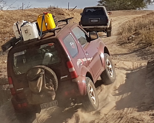
- Adi drives his Jimny out of the creek.
Surveyor/explorer Augustus Gregory (after whom Mount Augustus is named) noted Mt Curious as ‘’a very remarkable sandstone hill’ when he bivouacked to the north of the feature in 1848 but it wasn’t until 1883 that Surveyor H.S. Carey showed in on a local map.
-

- Mt Curious from the shortcut track.
-
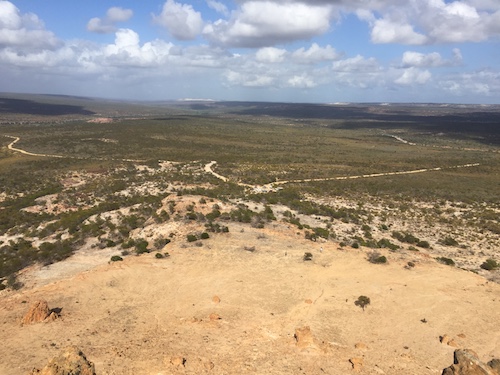
- View of car park from Mt Curious.
-

- View from Mt Curious.
Leaving Mt Curious we headed north to the Pipeline Track.
The first obstacle soon presented itself.
-

- Brad and Jane in their Troopy.
-
- Brad and Jane in the Troopy.
-
- Eugene and Tracy in the Surf.
-

- Eugene and Tracy in the Surf.
-
- Eugene and Tracy in the Surf.
-
- Matt and Tania in F250.
-
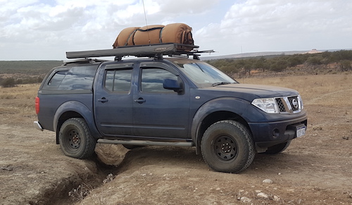
- Paul and Lauren in Navara.
-

- Steve, Eugene and Tracy, and Brad and Jane on the Pipeline Track.
-

- Southern edge of Hidden Valley as seen from the Pipeline Track.
-
- Pipeline Track
-

- Greg and Margot, and Adi on the Pipeline Track.
-

- Matt helped Steve inflate his tyres.
This track is flat and hard but along the way throws in a few obstacles.
-
- Steve drives his camper through.
-
- Andrew in his GQ.
-

- Adi takes his Jimny out of the gutter.
-

- Paul and Lauren in his Navara.
-
- John drives his TD42 out of the gutter.
-

- Greg bounced his trailer through the obstacle.
-
- Brad drives his Troopy through the gutter.
Joe spied a piglet and fleetfooted Grace chased it down. What an effort! I cornered it and Matt caught it. An interesting interlude not experienced since the Darling Descent ’82.
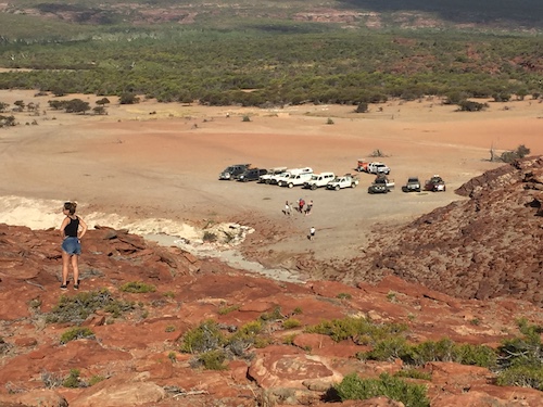
While looking for the track to the Lookout we found another goat trap. Eventually we located the track leading into the Lookout. Lunch.
-

- Joe at Lookout.
-
- At Lookout
-

- Lookout
After lunch we continued south-west on the Pipeline Track
-
- Joe and Penny in the Y62.
-

- Joe and Penny through a creek in the Y62.
-

- Kim takes his Rodeo through a gutter.
-
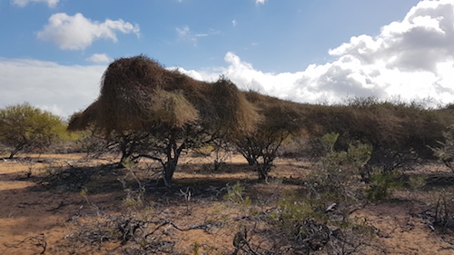
- This is the dodder creeper from the Cassytha genus. There are several species, fairly widespread across southern WA.
-
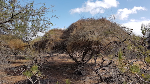
- They are a parasite and can virtually smother their host plants.
Continuing along the Pipeline Track we caught up with the Western Patrol Club. They had stopped at a point where a tree branch blocked the track. They moved off the track, allowing us to pass, and returned the way they had come. Joe and I removed the branch and our convoy drove on and dropped down into a remarkable gully.
-
- Joe wielding axe to remove tree. Note PPE.
The creek bed was part of our planned Route but I was concerned that it would drop off steeply as it got closer to the river and become impassable. The only way to find out was to drive it.
-

- Grace on her way to the top of the cliff.
-
- Just before starting our trip down the creek.
-
- Lineup before the start of the drive along the creek.
-

- Great example of a sandstone wall.
What a fantastic drive. Twisting, turning and interesting.
-
- Joe’s Y62 in the creek.
-
- In the creek.
-

- This flat ‘road’ is actually the bed of a creek.
-
- Joe had to leave the creek bed to get around this obstacle.
We exited the creek and turned onto the river track and then turned right again into the plesiosaur site. There was a paucity of plesiosaur fossils.
-
- Tracy at Fossil Site.
-

- Plesiosaur site
-

- From top at hill at fossil site.
We were again ahead of schedule and decided to relocate to a site on the river known as Army Camp, quite close to the MHS homestead.
Jon found a felled tree, attached it to his Patrol with a snatch strap, and towed it to camp. What transpired was an hilarious event when the Patrol went one side of a tree and the towed log went the other. Jon’s vehicle came to sudden stop as the rear of the vehicle went skyward. No damage.
-

- Mechanisation of firewood collection.
-

- Jon dragging firewood.
Joe constructed a spit from star pickets. A fire was lighted. The piglet caught earlier was prepared. Dinner was started.
-

- Penny and Joe dressing piglet.
-
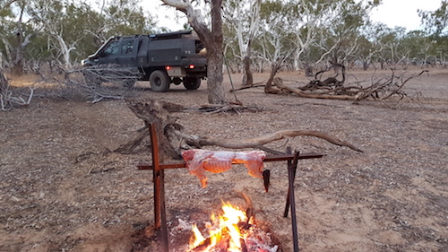
- Piglet on spit.
-

- Joe and Paul turning piglet.
The ‘official’ trip finished at Murchison House Station and participants made their own way home.
The reports of the various trips, tours and travels on the Adventures website have a lot of information about place names – their naming and features – toponymy. More information.
© Kim Epton 2017-2024
1784 words, 104 photographs.
Photographs
Kim Epton
Eugene Opie
Jane O’Neil
Feel free to use any part of this document but please do the right thing and give attribution to adventures.net.au. It will enhance the SEO of your website/blog and Adventures.
See Terms of Use.