
Contrary to first impressions there is much to see just a short distance from the bitumen on the section of Great Eastern Highway from Yellowdine to Woolgangie. This moment in time is 2019.
Morlining
-

- Morlinning Well
Karalee
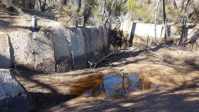
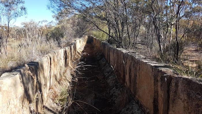
The National Heritage-listed Karalee Rock and Dam is always worth a visit. The turnoff is signposted although it is not a very large sign. The track into Karalee is at 31°16’40.9″S 119°51’3.1″E
-
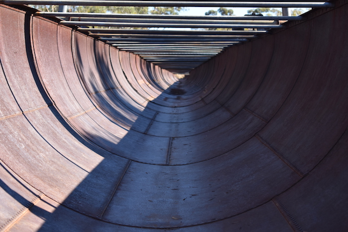
- The flume at Karalee transports water from the rock to the dam.
-

- Well engineered.
-
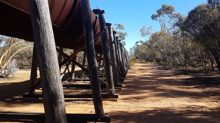
- The flume is supported by substantial wooden uprights.
-

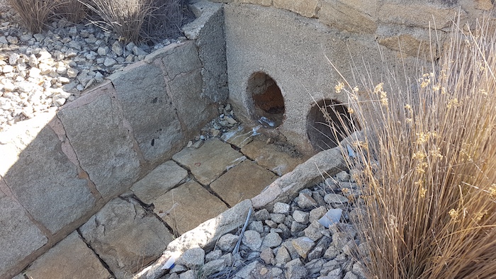
- Sluice gates directed water either to the reservoir or into the bush.
-
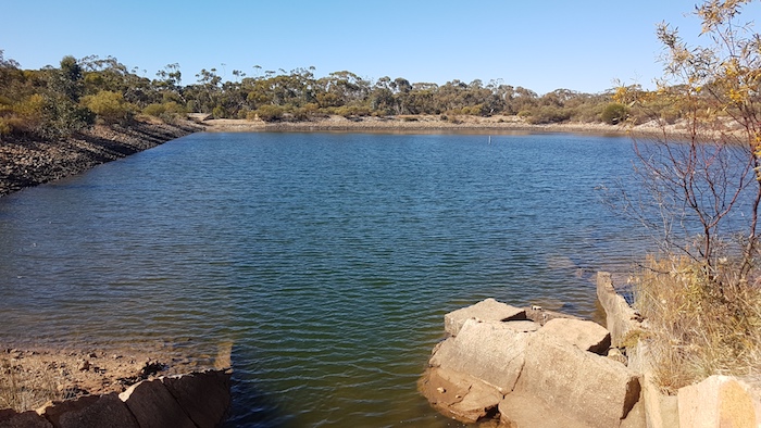
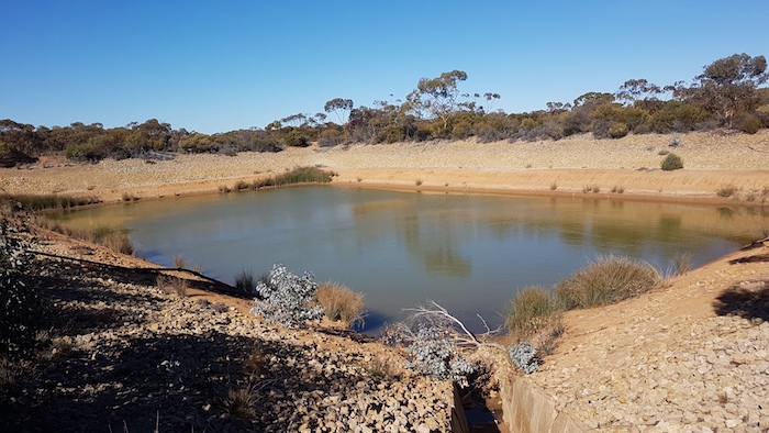
- Karalee Reservoir.
At Karalee a small rock dam has been built across a watercourse. Further up this gully is a rock well similar in construction to Hunt’s wells. It is most likely a PWD construction from the gold rush era.
-
- Hunt style well at Karalee.
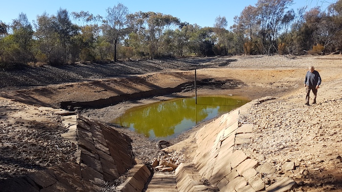
Koorarawalyee
When C.C. Hunt’s team built the well here it was referred to as Quardanoolagin and later as Quardagin. Later work developed a water harvesting system and reservoir.
-

- Flooded Koorarawalyee Well.
-

- Koorarawalyee Tank
-

- A diversion culvert at Koorarawalyee.
Remains of the Southern Cross to Coolgardie Railway
The rails have have been removed and most of the ballast has also gone. In a few places the route of the railway is obvious. Dog spikes litter the ground and fittings from the telegraph line that followed the railway lay along the route.
-
- The bed of the disused Southern Cross to Coolgardie railway.
-
- Artefacts from the disused railway.
-

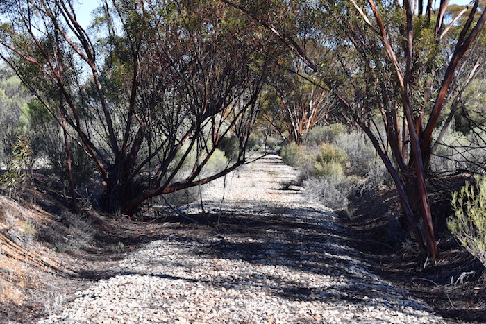
- The route of the Southern Cross to Coolgardie railway near Boorabbin.
Old Well
About 16 kilometres before Boorabbin, on the northern side of the pipeline is the remains of a well from times past. It is now merely an uninteresting depression littered with rusty cans and other artefacts.
-

- The former well is now just a depression.
-

- Relics
The Goldfields Water Supply Scheme Pipeline
-

- A section of Mundaring-Kalgoorlie pipeline.
Hermit’s Hut
Further on is a hermit’s hut tucked away in the bush.
-

- On the track to the hermit’s hut.
-

- Hidden away.
-
- Alfresco living.
-
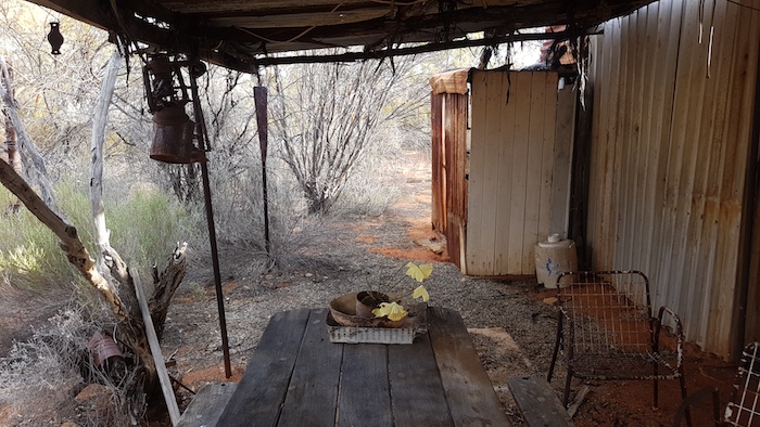
- Everything still in place.
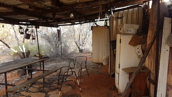
While it is impossible to be certain, the state in which the hut has been left very clearly indicates that no attempt was made to pack up and take items away. One obvious conjecture is that the occupant went off to seek medical attention or enter hospital and never returned. Or perhaps he died a lonely death in the bush and his memorial is a deteriorating bush hut frozen in time.
-

- Reasonably tidy.
-

- Inside is a mess.
-

- The bush is starting to take over.
Two Airstrips
Little is known of this WWII airstrip at Boorabbin. It won’t be too long before the bush obliterates it completely.
-

- Not much left of the WW11 airstrip at Boorabbin.
Modern day Boorabbin Airstrip nearby is a typical, rudimentary bush strip, ostensibly built to fly in Police to control people protesting about the construction of a nuclear waste (low level) facility at Mount Walton, 50 kilometres north.
Boorabbin Rock, Quarry and Dams
Boorabbin Rock and the nearby massive water harvesting system that leads to a huge water storage reservoir was part of the water supply system for the now-forgotten steam railway network to Kalgoorlie and beyond.
Boorabbin was settled in 1895 and flourished for the three months it was the railhead. It boasted a post office, pubs and stores. Within a day of Woolgangie, 24 kilometres to the east, becoming the railhead, Boorabbin was deserted. In December 1895 sheds and shops were dismantled and re-erected at the new railhead. Both Boorabbin and Woolgangie became important stops because of their huge water catchment systems – important for men, horses, camels and trains.
-

- Boorabbin quarry.
-

- On top of the Boorabbin quarry.
-

- Cliff near the water exit point.
-
- Water leaves the rock and is channeled into the dams.
-
- The 160 metre long channel to the first dam.
-
- Cliff at the first dam.
-

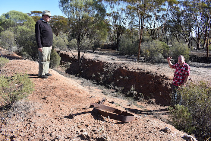
- Greg at the outfall to the first dam.
-
- Outlet to the main dam.
-
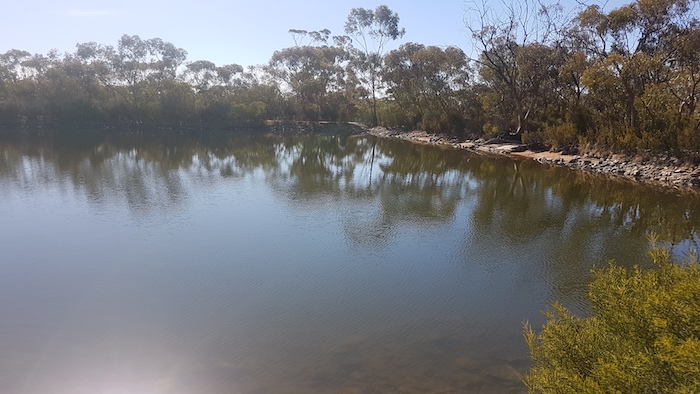
- Main dam at Boorabbin.
-

- Walking up the main channel.
-
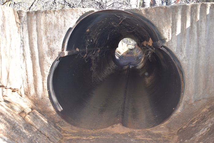
- Pipe under a crossing.
Boondi
Boondi Reservoir was built to supply water for the trains on the Southern Cross-Coogardie Railway.
-

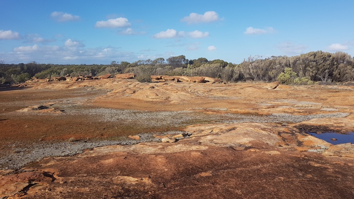
- Diversion channel at Boondi Rock.
-
- Reservoir at Boondi.
Wargangering
C.C. Hunt’s Wargangering is current day Woolgangie. Current day Wargangering is five kilometres to the south-west and does not have a well associated with it. The rock is 100 metres south-west of Great Eastern Highway and a track leads into it at 31°11’8.6″S 120°31’16″E.
-
- Wargangering Rock.
Woolgangie
The water harvesting scheme at Woolgangie is one of the finest on the route of the Hunt Track.
-

- Very long diversion channel at Woolgangie.
-

- Woolgangie Reservoir
© Kim Epton 2019-2024
807 words, 41 photographs.
Feel free to use any part of this document but please do the right thing and give attribution to adventures.net.au. It will enhance the SEO of your website/blog and Adventures.
See Terms of Use.