Lake Boonderoo – 280 kilometres east of Kalgoorlie, extends 10 to 21 kilometres south of the Trans Australia Railway.
- Location of Lake Boonderoo.
It is on Boonderoo Station, part of Kanandah Station on the extreme western edge of the Nullarbor region.
Drought breaking rains in March 2024 brought floods that caused the closure of the Eyre Highway between Norseman and Eucla, and the Trans Australia Railway near Rawlinna.
Though on-the-ground information was unable to be sourced, given the intensity of the rainfall between the Goldfields and the Nullarbor, it was reasonable to posit that at least some water must have got into the lake.
If the lake had filled it would be an amazing sight. This belief was based on the last time it flooded and a subsequent historic power dinghy expedition organised in 1995 to take advantage of such an unusual happening.
- What we were hoping for!. The lake totally flooded in 1995.
This 1995 flooding of the lake was only the second occurrence since settlement; the first being 1975 – confirmed by examination of the rings of trees dead from inundation.
High ground on the east side of the lake about 18 kilometres south of the railway provides a great viewpoint that, when we arrived there, revealed the lake had not filled. However, there was some water – about 10 hectares (25 acres).
- View from our campsite – 2024..
The viewpoint was about 1500 metres from the small body of water and elevated about 20 metres – high enough to get a largely unobstructed view of the lake, both wet and dry.
- View from camp.
Walk In
We walked from the viewpoint to the floor of the lake.
- A forest of dead trees on the lake bed.
- One of the taller trees in the lake.
Lake Boonderoo last flooded in 1995 and the water remained till about 2006. The dead trees – some quite substantial – and variety of bushes at the lowest part of the lake had been under water for ten years and were then exposed to the elements for 18-20 years at the time of our visit.
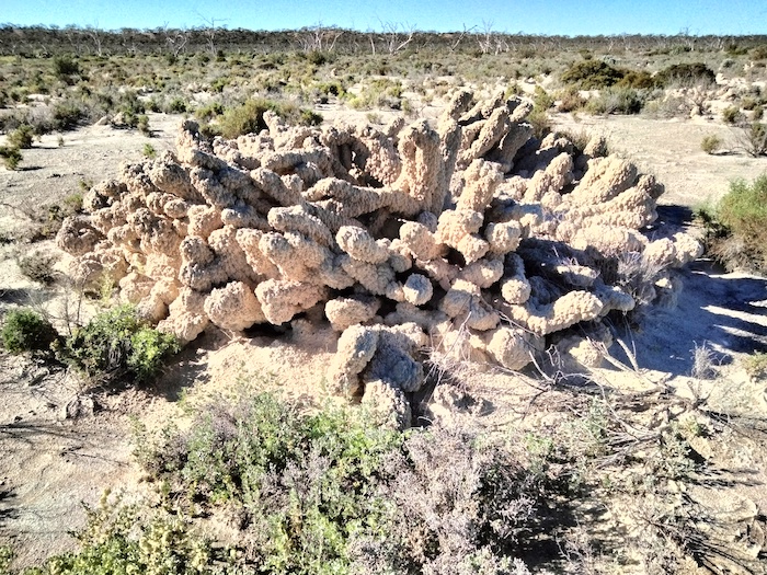
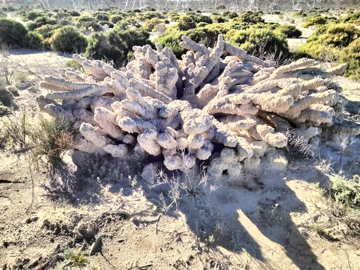
- The underlying framework of this unusual formation is a bush that was inundated when the lake flooded. Calcium carbonate precipitated from the lake’s water forming encrustations that grew quickly.
Tufas
The encrustations are known as tufa – a type of limestone formed when carbonate minerals precipitate out of water in a lake.
Hot springs sometimes produce similar but less porous carbonate deposits, known as travertine. Tufa is sometimes referred to as (meteogene) travertine.
Scott Theorises
With 40 years of bush experience and knowledge, Scott theorised that the large circular ‘coral like’ structures were drowned Saltbush plants that provided a large skeletal framework for the quick formation of the tufas.
In 1995 flood waters rich in organic materials filled the lake, which after having been dry for so long, was really a temperate woodland environment – evidenced by the large dead trees.
These floodwaters brought an influx of minerals from the surrounding gypsum/kopai hills into a relatively recent static geological environment (ie: not subject to regular flooding), creating a formula for the creation of tufa.
Scott further theorised, though not as confidently, that this caused an explosion of cyanobacteria growth and activity over that time – and when combined with the increasing salt levels as the water evaporated it allowed for the deposition of the calcareous carbonates – known as oncoids.
- Thin twig.
Not tuff
Calcerous tufa should not be confused with tuff, a porous volcanic rock, sometimes also called tufa.
- Kim and Scott examining a saltbush tufa.
© Kim Epton 2024
609 words, 20 photographs, one image.
Feel free to use any part of this document but please do the right thing and give attribution to adventures.net.au. It will enhance the SEO of your website/blog and Adventures.
See Terms of Use.


