
-

- ROUTE KARAGULLEN TO MOORINE ROCK
Karagullen
Four vehicles left Karagullen, heading east on the Brookton Highway just after 9.00 a.m. on Wednesday before the upcoming long weekend.
The gravel road from the Westdale turnoff took us to Mount Kokerby.
Yenyenning Lakes and Quajabin Peak
Good winter rains had filled the Yenyenning Lakes. It was a magnificent sight.
What seems like an easy walk up the gentle slope of Quajabin gets harder approaching the top. The effort is rewarded with great views of the green and gold of the wheat and canola.
-

- Quajabin, also known as County Peak, offers magnificent viastas of the surrounding countryside.
-
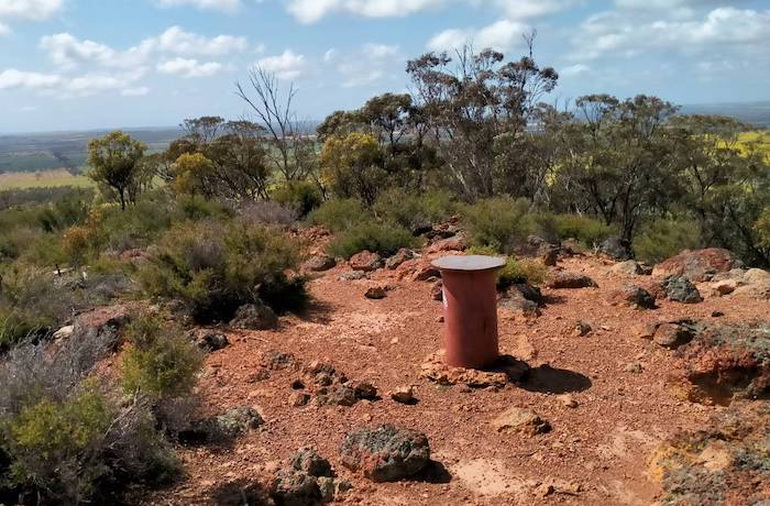
- Cairn at the top of Quajabin Peak.
-

- Track to the summit of Quajabin Peak.
Dangin
Our route took us through Dangin, one of the oldest settled agricultural areas in Western Australia.
Toapin
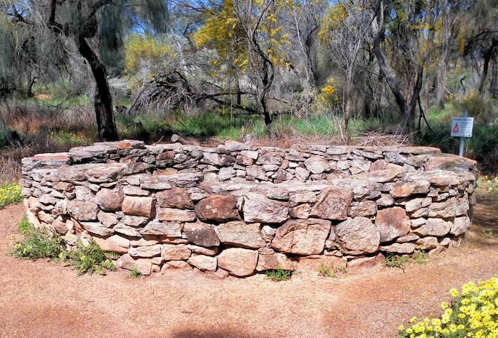
Little known Toapin Rock and its associated water supply engineering was the next stop.
-
- Toapin Weir was built in 1912 and extended in 1935. It was a major part of the water supply for Dangin and Quairading areas.
Kokerbin
Next stop on our Road Trip was Kokerbin Rock, reputed to be Australia’s third largest monolith, after Uluru and Mount Wudinna or perhaps Walga Rock, depending on which sources you accept.

Explorer H.M. Lefroy (1818-1879) used Kokerbin Rock as a navigation point on his journey east to what is now known as Lake Lefroy.
Kokerbin is known for its rock wallabies. A beautiful example of a dry rock well is situated on the north-west side of the Rock. It was built in the early 1900s by pioneering drovers to water their stock.
-
- Kokerbin dry rock, pioneer well.
-

- Kokerbin Well.
After lunch we continued the push eastward and in the Korbel area we got onto a part of Hunt Track. The railway and the telegraph line followed the Track. There is not much of the telegraph line remaining. The railway extends between Bruce Rock and Merredin.
Bogged
Part way along the Track (just short of Robartson Road) Joe’s Discovery got bogged in a short but treacherous mudhole.
-
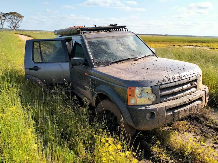
- What seemed an innocuous damp patch trapped the Disco.
-

- Tyres turned to slicks
-

- A gentle tug retrieved the vehicle.
This portion of Hunt Track took us to Merredin, following the railway. There was no reason to stop at Merredin so we continued to our overnight stop at Moorine Rock where we caught up with Greg.
Moorine Rock
-

- Moorine Rock campsite.
There are a limited number of fine campsites about 100 metres past Hunt’s Well at Moorine Rock.
The inline pre filter on my Patrol was blocked and needed replacing. As it was causing the engine to starve for fuel Graham removed it. A replacement was fitted in Kalgoorlie.
-

- Graham removed the blocked, inline pre filter on Kim’s Patrol.
-

- ROUTE OF MOORINE ROCK TO YERDANIE TURNOFF.
Kodjerning Well
Without rushing at all we were away by 0730, taking Moorine Rock Road to Kodjerning Well. We had refurbished this well in 2021 and it was looking in pretty good condition.
Southern Cross
After topping up with fuel at The Cross we were forced to use the bitumen to continue our eastward travel. It is not possible to follow Hunt Track immediately east of Southern Cross. The Track has disappeared and, even if it was able to be located, a well constructed and maintained north-south vermin proof fence presents a formidable barrier.
Yellowdine
Leaving Yellowdine we took the old track that roughly parallels the Highway to Karalee. Along the way we came across a short section of ‘bush kerbing’. While difficult to ascertain when it was made it is a long way from being ‘modern’. Certainly worth preserving.
-

- Graham indicating ‘kerbing’ that, once spotted, is quite noticeable.
Morlining Well
This beautifully made well is six kilometres short of Karalee, about 80 metres south of the track.
-

- Morlining Rocks
-

- At Morlining Rocks.
-
- The well is not signposted
-

- Morlining Well is a masterful construction.
Karalee
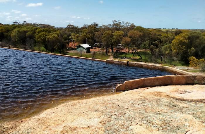
Everyone had previously seen the harvest walls, viaduct, and reservoir at Karalee so we just checked on the plaques we relocated and installed at Hunt’s Dam in July 2021.
-

- The gully, backed up by an earthern dam constructed by Hunt’s team, was quite full.
Wooden Pipeline
While most people in Western Australia know of the engineering marvel that is the Mundaring-Kalgoorlie pipeline, few would be aware the sections of the pipe were once made from wood. The pipeline was located below ground in a trench. Evidence of this can be seen along the disused railway a few metres north of Great Eastern Highway between Yellowdine and Koorarawalyee.
-

- The wooden staves formed the pipe. The wire held the wood in place.
We located the remains of this fascinating piece of our heritage near Koorarawalyee.
-

- Pitch was used to seal the wood.
-

- The pipeline rested on cement plinths.
The current day pipeline is aligned only a few metres distant from the historical pipeline. Many stretches of the steel, concrete-lined, above ground pipeline have been replaced and other sections repaired multiple times.
-

- Offset welding of the seams creates a stronger pipe.
Koorarawalyee
Hunt’s Well at Koorarawalyee is also known as Quardanodiagin Well and sometimes Quardagin Well.
-

- Bicentennial plaque at Koora.
The positioning of the reservoir at Koorarawalyee (built many years after Hunt’s team made its well) causes the original construction to be inundated in times of heavy rain/runoff. Such was the case when we arrived.
-
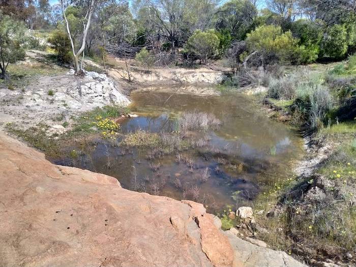
- The inundated vegetation shows the outline of Hunt’s Well.
The harvest walls, channels and portions of Hunt Track were refurbished in 2015.
-

- Harvest wall/channel.
-

- Channel at Koora.
-

- Main channel leading into the reservoir.
-

- Koora Reservoir
We followed Hunt Track on the northern side of the pipeline for eight kilometres to a comms tower and then crossed the pipeline to the Highway.
Boorabbin
The Boorabbin Rock water harvesting development is huge. Not quite as large in extent as Karalee but still impressive in scope and workmanship.
-

- Today, the reservoir at Boorabbin is an important store of water in times of wildfires.
-
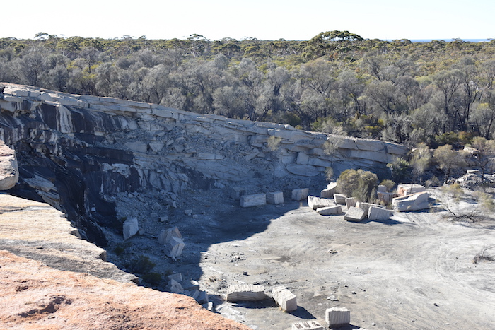
- Boorabbin Quarry
After lunch it was back to the bitumen for the run to the turnoff to Yerdanie Rock – once again following Hunt Track.
-

- YERDANIE TURNOFF TO COOLGARDIE VIA HUNT TRACK
Yerdanie
The turnoff to Yerdanie Rock is difficult to spot. It is at 31°10’16.18″S 120°33’54.78″E. The current day track into the Rock follows the original Hunt Track alignment.
Hunt’s Yerdanie Well had been lost for well over 100 years until relocated in 2020.
-
- Hunt’s Well at Yerdanie after being lost for more than 100 years.
Sometimes referred to as Yerdi Rock, this was an important feature of the original Hunt Track – and also when prospectors and the hopeful headed east in search of their golden fortune. After only a few years use by goldseekers the track was realigned further north.
-

- Survey marker on top of Yerdanie Rock.
Gnarlbine West
Thirty five kilometres of Hunt Track between Yerdanie and Gnarlbine was refurbished in 2018 and 2019 after being lost for many years.
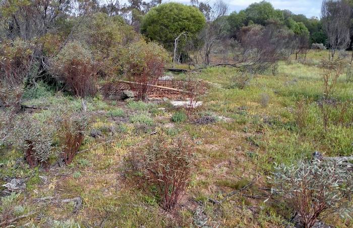
We searched for a pioneer well lost for 50 or more years in dense thickets, without success. We located it in 2021.
-

- The well was hidden by nearly impenetrable thickets.
-
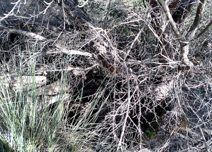
- Pioneer well hidden in dense thickets at Gnarlbine West.
Gnarlbine East
Hunt’s Well at Gnarlbine East is signposted and easy to find.
-

- Gnarlbine Well and Bicentennial Plaque.
A beautifully constructed, dry rock pioneer well 200 metres south is a bit more difficult to locate, however, this information gives the well’s coordinates and links to photographs that show the start of the path to the well.
Coolgardie
Coolgardie styles itself as ‘Mother of the Goldfields’. Coolgardie burst into existence in 1892 after Bayley and Ford found gold at Fly Flat. Less than a year later it was declared a town and by 1898 it had a population of more than 15,000.
It is 555 kilometres east of Perth on the Great Eastern Highway.
There is a lot more to see and do along the route of this Road Trip. Ghooli Pumping Station, Gigai Pumping Station, Cobb & Co Well, Boorabbin Rock and Quarry, WWII Airstrip, Boondi Rock, and Woolgangie are just some of the places to visit. Go here and here.
© Kim Epton 2022-2024
1372 words, 35 photographs, three images.
Feel free to use any part of this document but please do the right thing and give attribution to adventures.net.au. It will enhance the SEO of your website/blog and Adventures.
See Terms of Use.