Songkran
April in Thailand is Songkran, the water festival – the beginning of the New Year. It is hot, very hot. High 30s with the occasional 40 thrown in to remind you that it is hot! And humid.
Songkran Day is 13 April, however, the festivities extend for the best part of a week. Traffic is horrendous as millions return to their home village for the holiday. In 2019, 46 people died on the first day of the holiday break – or, as it becoming to be known, ‘Seven Days of Danger’.
Rural Isaan
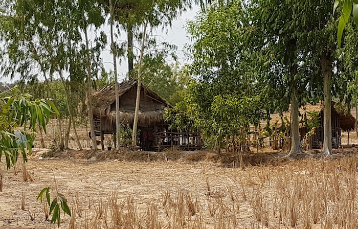
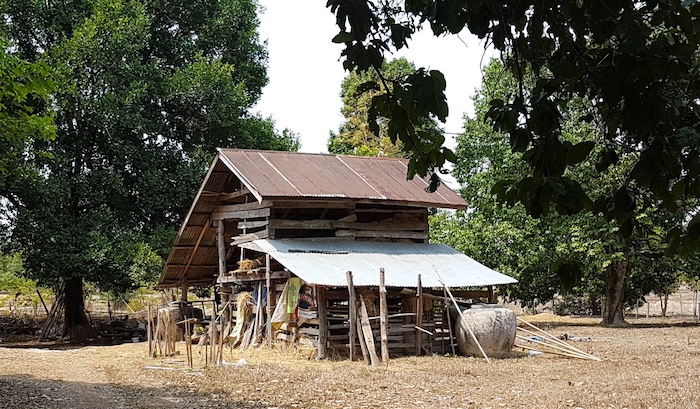
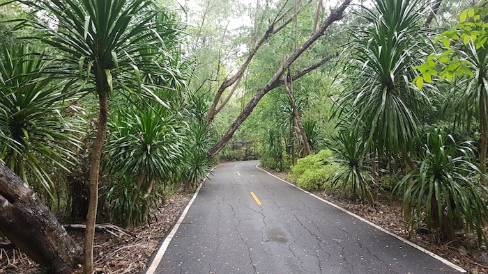
Khamcha-I, where I stayed, is a village in the Khamcha-I District, Mukdahan Province. Asian Highway 16 (Mukdahan to Khon Kaen) runs through the village. It is a very busy, though still very rural, Isaan focal point.
-
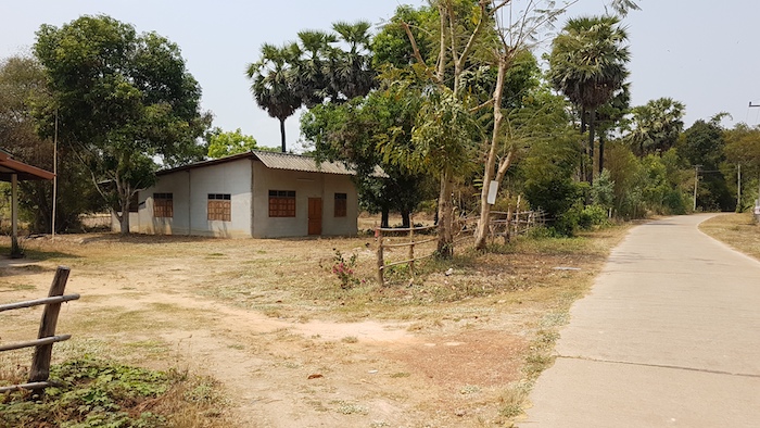
- Near Khamcha-I
-

- Near Khamcha-I
-

- Near Khamcha-I
-

- Near Khamcha-I
-
- Near Khamcha-I
-
- Near Khamcha-I
Nam Phong National Park
Nam Phong National Park, 35 km north-west of Khon Kaen. Cliff top viewpoints, a short walk from the carpark at the summit, offer great views over the huge Ubol Ratana Dam reservoir.
-
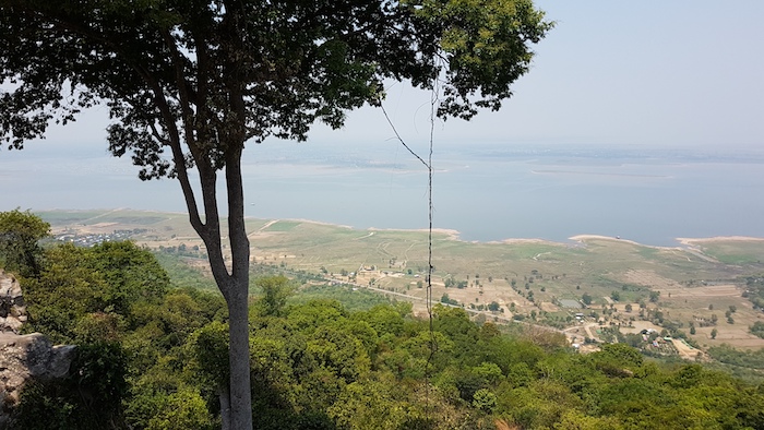
- View over lake from the summit at Nam Phong National Park.
-

- View over lake from the summit at Nam Phong National Park.
-
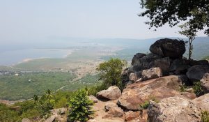
- View over lake from the summit at Nam Phong National Park.
The drive to the summit is even better than Phu Ruea National Park. Some motorcyclists arrived while we there. They didn’t even bother to take in the views. They just enthused about the ride up the mountain, jumped on their bikes and headed down the hill for another thrill ride.
There are series of 20 or so Interesting rocks 200-500 metres north-east of the carpark.
-

- At Nam Phong National Park.
-

- The ‘Unseen’ Rock.
-

- Interesting shaped rocks at Nam Phong National Park.
-

- Interesting shaped rocks at Nam Phong National Park.
-

- Interesting shaped rocks at Nam Phong National Park.
-

- Interesting shaped rocks at Nam Phong National Park.
The park is named for the Nam Phong River, impounded by the dam.
-

- Eating out at a riverside restaurant in Mukdahan before heading south.
South towards Korat then Aranyaprathet
We forewent Khon Kaen’s Songkran celebrations in lieu of an early start for our adventure in the south.
As we headed south out of Khon Kaen towards Korat there was a solid two lanes of traffic headed the opposite direction as we drove the 180 kilometres to Korat – and the north-bound traffic most likely extended further south of Korat. All heading home for Songkran.
We turned off the highway before Korat, heading to Sa Kaeo. Tassy noticed to directional signs for Lam Chae Dam so we diverted from the highway. As is so often the case in Thailand, after the first bit of signage, the rest is guesswork. It was no different this time but we eventually found our way to the dam.
-

- Lam Chae Dam
I intended to go through the Thap Lan National Park to Sa Kaeo. It was many kilometres shorter and, I reasoned, it would be a much more interesting drive.
The Ranger at the Pay Station told us that the road did not go through to Sa Kaeo. Execute Plan B. I chose to go east around the National Park through backcountry Thailand. This is a cassava growing area.
-

- Cassava stalks near Lam Chae.
Cassava is extensively cultivated as an annual crop in Thailand (and throughout tropical and subtropical regions worldwide). It has an edible starchy, tuberous root that is a major source of carbohydrates. It is one of the most drought-tolerant crops, capable of growing on marginal soils. Thailand is the world’s largest exporter of cassava starch, although not the largest producer (Nigeria is). Cassava starch, called tapioca is used for food, animal feed and industrial purposes.
Temple at Thap Rat
We worked our way south through farming country and after two false starts found the Thap Rap temple. It is undergoing restoration.
-

- The pathway to Prasat Khao Lon, Thap Rat District, Sakeo Province.
-

- Restorations at Prasat Khao Lon slowed down considerably for the summer, however, they are in perpetual state of renovation.
Another very hot day. We decided to ‘reset’ at Aranyaprathet. The Indo-China Hotel has a pool.
-

- Tassy poolside.
-

- Kim in the hotel pool.
-
- Indo China Hotel, Aranyaprathet.
We noticed a few Farangs at the hotel but saw none while out visiting the various attractions. Isaan covers the north-east of Thailand, bordering Laos is the north and Cambodia to the south. It extends to the Petchabun mountains to the west where we explored earlier. And while Isaan covers 30% of the country with a similar share of the population it is very much off the tourist trail. Which makes it attractive for tourists wanting to avoid crowds and see the ‘real’ Thailand.
Sadok Kok Thom
As we got closer to Sadok Kok Thom Historical Park next morning the Army’s presence was very noticeable. Nearby Khok Sung is a border crossing with Cambodia.
-

- Extensive work has been done in and around the wat.
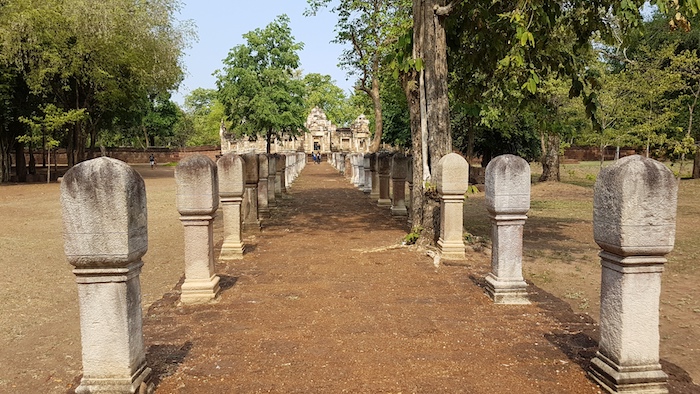
Sadok Kok Thom temple was built midway through the 11th century by the Khmer Empire that ruled much of South East Asia from the end of the 9th century to the 15th century.
The layout and design of Sadok Kok Thom shares many characteristics with other Khmer monuments and temples. Like most Khmer temples, it is oriented towards the East. Sadok Kok Thom is among the smaller of the Khmer temples in Isaan. The processional walkway, flanked by pillars leading to the main building, is impressive. Various sculptures around the temple depict the Naga (mythical serpent).
-

- Sadok Kok Thom is an ancient Khmer temple.
-
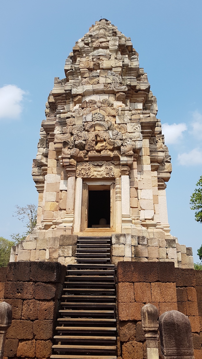
- Main part of Sadok Kok Thom.
-

- Sadok Kok Thom
Originally dedicated to the Hindu God Shiva, it was later converted to a Buddhist temple.
-
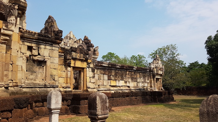
- A side wing of the temple.
-

- Khmer style temple.
-
- The processional pathway to the temple.
Sadok Kok Thom has been extensively restored to the way it is believed to have looked. Original material was used as much as possible but wherever it was not available newly made blocks were used. The colour difference between old and new is quite obvious.
The Khmer Empire extended into modern day Thailand to Phimai, Buri Ram and Sadok and the remains of that hegeomony provide appealing alternatives for a visitor to avoid the hordes of tourists at the more famous Angkor Wat at Siem Riep, Cambodia.
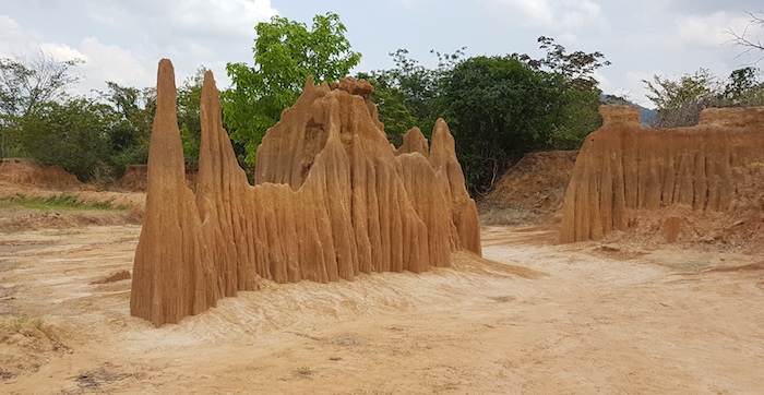
Lalu Sand Pinnacles
I was once at Nambung National Park with an American geophysicist who was commenting ecstatically about Western Australia’s iconic Pinnacles, and the processes that formed therm. I suppose he would be mildly impressed by Lalu, too.
-

- Many hundreds of these.
-

- Tassy at Pinnacles.
-
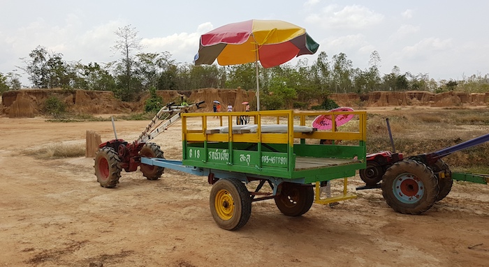
- Our mode of transport.
-
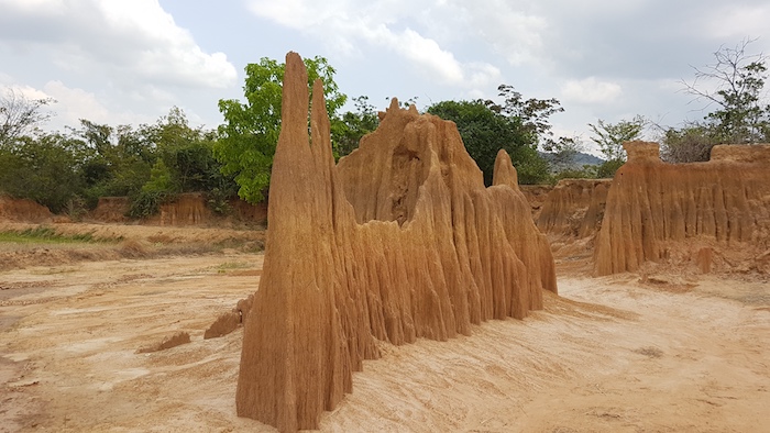
- Very interesting formation.
-
- Sand pinnacles
-

- Sand pinnacles.
-

- Sand pinnacle at Lalu.
-

- My new career.
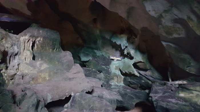
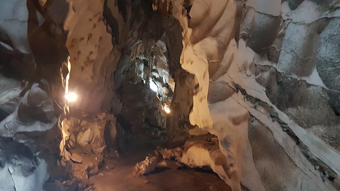
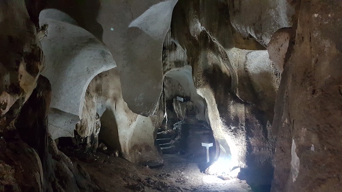
Petch Pho Thong Tham (Cave)
We worked our way south to Petch Pho Thong Tham. Along the way we ran into a local thunderstorm. It was still raining when we arrived.
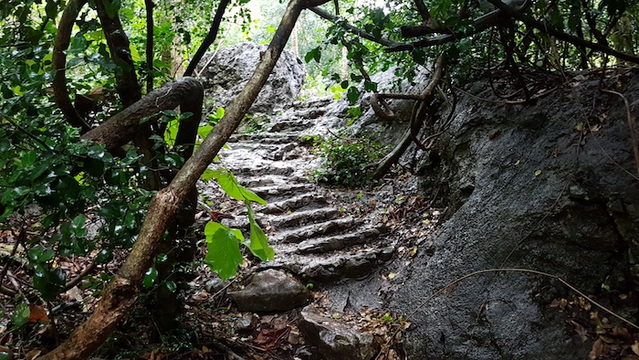
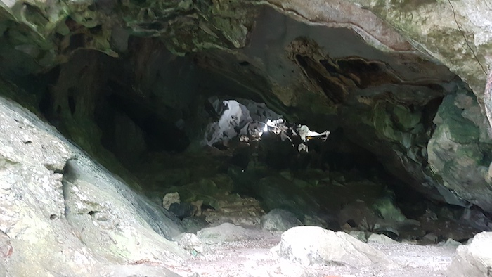
Access to the cave required a 600m walk along a bitumen road and then a 200m walk along a bush track. The entrance to the cave is uncertain and poorly marked but once inside it is magical – just enough lighting to show the way and highlight features.
-
- Road to cave.
-
- Pathway to cave.
-
- Entrance to cave.
-

- Tassy is not sure about entering the cave.
-
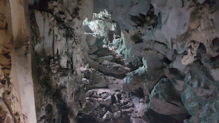
- Once inside it is awe inspiring.
-
- Directional signage deep inside the cave.
-

- A shawl.
-
- Intimidating walkway.
-
- Midway
-

- Tassy is very uncertain by this time but it is just as far back as it is forward.
-

- Another drive.
We left the cave heading north on Highway 317. Google Maps highlighted a 35 minute delay ahead. I took to the backroads, confident that Hema moving map technology would get us around the issue. Tassy, not so much. We were driving on backcountry dirt roads for 30 minutes or more to avoid the congestion.The sight of a policeman directing traffic at a gravel road, backwater intersection confirmed the wisdom of our ‘rat run’ decision.
We discovered a nice place for an overnight stay in Sa Kaeo – Golden House.
Wat Tham Khao Chakan Cave
We passed this ‘must see’ place yesterday while on our ‘rat run’. It was necessary to back track from Sa Kaeo 15 km on Highway 317 to see what the attraction was.
-

- These steps were reasonably easy. The ladder towards the top was a little more difficult.
-

- At the top of the cave. A monk and his dogs inhabit the platform.
-
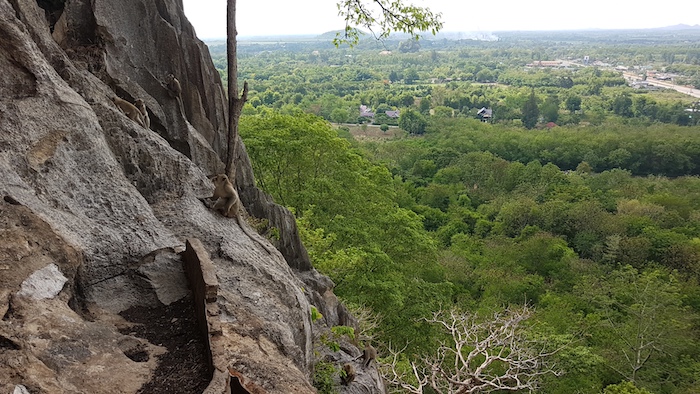
- View from the cave.
We headed north back to Khon Kaen and the traffic congestion we saw at the beginning of our trip was repeated – but in the opposite direction. A 200 kilometre long, slow moving, double lane of cars heading back to Bangkok.
© Kim Epton 2019-2024
1470 words, 57 photographs.
Feel free to use any part of this document but please do the right thing and give attribution to adventures.net.au. It will enhance the SEO of your website/blog and Adventures.
See Terms of Use.