
-

- ROUTE OF 8 DAY, 2000 KILOMETRE CENTRAL THAILAND ROAD TRIP.
A couple of erroneous Motorway off ramp deviations upset the forward momentum in getting out of Bangkok (a convoluted way of saying that we got lost) but we managed to eventually get on the right route. We stayed overnight at Chai Nat, central Thailand.
Dinner at the Riverside Restaurant on the bank of the Chao Praya River – the same river that flows through Bangkok 300 kilometres downstream – was relaxing, tasty and enjoyable.
Chai Nat to Tak via Sukothai Historical Park
Sukhothai was declared a World Heritage City in 2005. It is home to a vast number of historical sites and temple ruins. As the first capital of Siam, the Sukhothai Kingdom (1238 – 1438) was the cradle of Thai civilisation – the birthplace of Thai art, architecture and language. The Sukothai Historical Park is a must see.
Frans Betgem has written an excellent treatise on Sukhothai Historical Park that is a must read for every amateur archeologist with an interest in the ancient ruins of Thailand.
Wat Mahathat


-

- Artist’s impression of a reconstructed Mahathat Temple.
-

- Wat Mahathat


Wat Mai
-
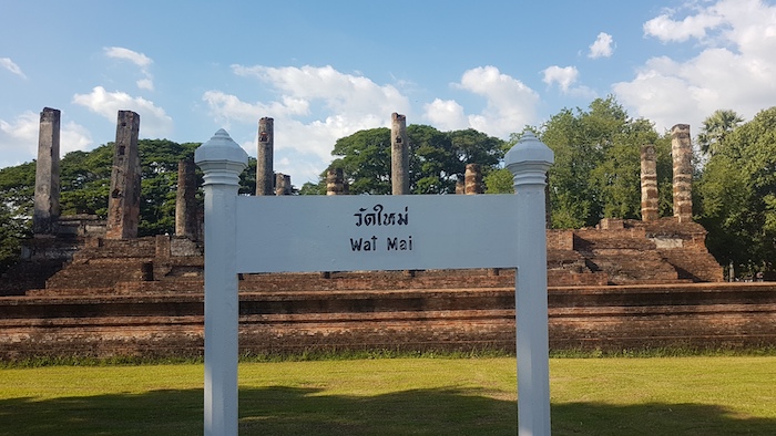
- Remains of the Mai Temple.
-
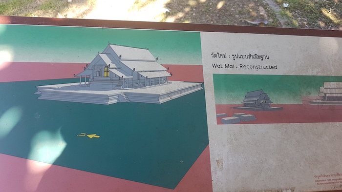
- Artist’s impression of the reconstructed temple.
-

- Only the base of the temple remains.
-

- Base of the ruined temple.
-
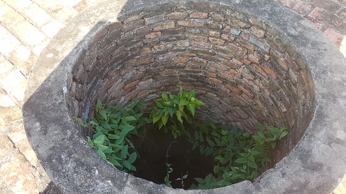
- The well at Wat Mai is 1000 years old.
Sukhothai to Tak
The Andaman Resort in Tak, where we stayed, takes its name from the cooling breeze that comes in daily from the Andaman Sea to the west.
-
- Entry to the Andaman Resort grounds.
-

- Entry to hotel.
Tak to Mae Sot
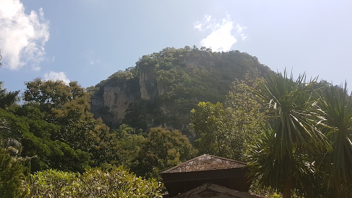
The drive along Route 12/Highway 105 through the Tenasserim Hills/Dawna Range was one of the highlights of the trip. The transit through the mountains is known as the Gateway to South Asia. It is a magnificent exemplar of road engineering in a difficult environment. In the 60 kilometres through the mountains there are more than 200 bends in the road, some extremely tight.
-

- The ‘Gateway to South Asia’ sweeps through the Tenasserim Hills/Dawna Range.
-
- Route 12 is carved through the Dawna Range.
-

- The highway is carved out of the mountains.
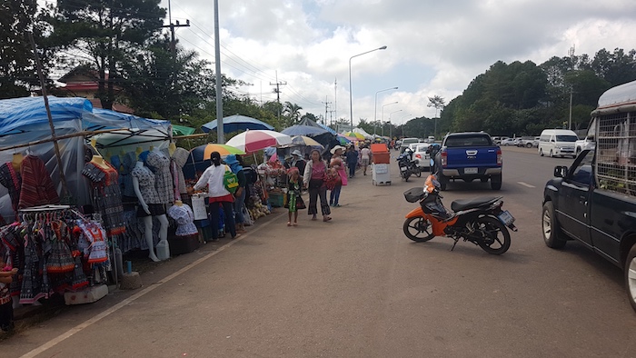
Along the way we stopped at the Mu Soe Hill Tribes Markets – as clean and well-setup as any market I have seen in Thailand – near Doi Mu Soe, the highest point on the trip at an elevation of 870 metres.
-

- Avocados were in abundance.
-

- Dried potato, taro, crispy pork skins and pumpkins.
-

- Crispy pork skins
-

- Clean and well organised.
-

- Some of the produce was imported from China.
Back on Route 12/Highway 105 and it is exhilarating driving. Plenty of twists and turns, sweeping bends and great scenery. We stopped at a lookout over the Taksin Maharat National Park.
-
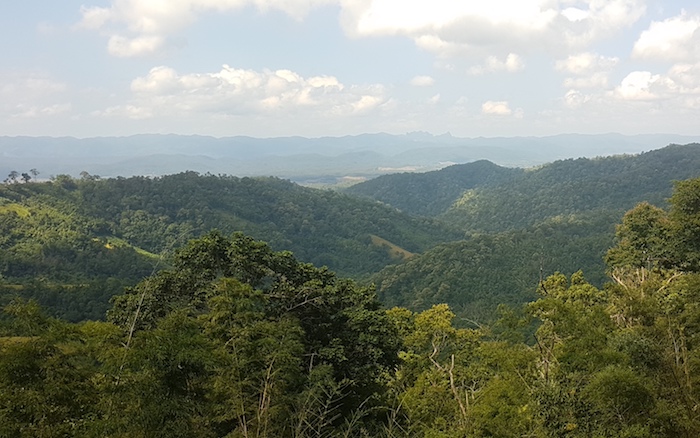
- Looking over the Taksin Maharat National Park along the highway to Mae Sot.
Before going in to Mae Sot we drove through Mae Kasa, a small rural village north of the city, to a waterfall and, further on, a hot spring.
-

- Mae Kasa Waterfall
-

- Mae Kasa Hot Spring
At Mae Sot we drove out to the markets at the Friendship Bridge, had lunch and then headed back along Route 12/Highway 105 for another go at the twists and turns of that great drive through the mountains.
-
- The highway is cut through the mountains.
-

- One of more than 200 sweeping bends between Mae Sot and Tak.
Mae Sot to Lom Sak
-

- Just when you think you have seen it all in Thailand. This pig was feeding in the vacant block next to our hotel.
I had a great drive through the Phu Hin Rong Kla National Park although the experience was tarnished somewhat by the outrageous, rip off entry fee of ฿500 for Foreigners (฿40 for Thais).
-

- Lan Hin Teak
-
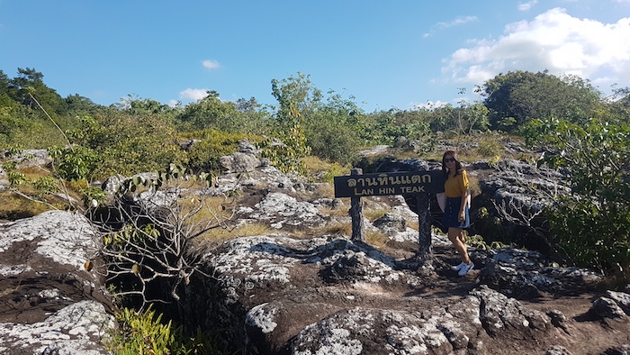
- Tassy at Lan Hin Teak.
We intended to stay at Phu Thap Boek but they wanted ฿2000 for a hovel – plus no restaurants, plus crowded, plus crazy/dangerous layout. The drive down the mountain to Lom Sak bordered on manic, dodging tuk tuks, roadmaking machinery, potholes, dogs, trucks and other cars.
-

- Route of the convoluted descent from Phu Thap Boek.
-
- Good view below Phu Thap Boek.
Lom Sak to Chaiyaphum
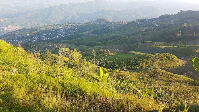
Another great drive through hills to Khao Kho.
-

- Khao Kho Roadside Markets
-
- Khao Kho Roadside Markets
-
- Khao Kho view.
-

- Khao Kho view.
On the drive to Petchabun a road bully in a black Ford Ranger with Bangkok rego plates was tailgating us. We had nowhere to go being right behind another vehicle. Eventually the Ranger went to the inside lane, maintained position at our window and threatened us with a pistol.
Chaiyaphum to Khao Yai
It was an easy drive from Chaiyapum to Khao Yai and we arrived in the early afternoon. Finding somewhere to stay was a challenge. Then finding somewhere to eat was a further challenge.
Khao Yai to Wang Nam Khiao
-

- Khao Yai Bluff
-

- Local swimming hole at Khao Yai.
-

- Rubber plantation at the swimming hole.
-

- Popular swimming and picnic spot.
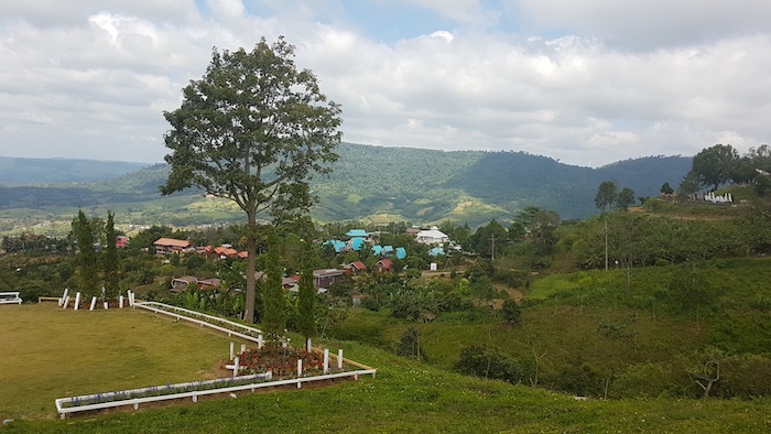
We took rural roads through hilly country from Khao Yai to Wang Nam Khiao, arriving in time for lunch.
-

- View from our lunchtime restaurant at Wang Nam Khiao.
After checking out many guest houses, we favoured Favaree for our overnight stay. The drive to the lookout at Pha Keb Tawan turned out to be a waste of time – the heat haze destroyed the view.
Wang Nam Khiao to Bangkok
Before heading to Bangkok we re-visited Pha Keb Tawan.
-

- At Pha Keb Tawan Lookout.
-
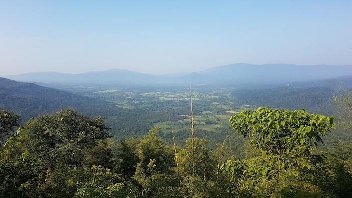
- View from the Pha Keb Tawan Lookout.
The easy drive to Bangkok became more stressful as we got closer to the city. We eventually made it Sukhumvit 101 without incident.
© Kim Epton 2019-2024
957 words, 4 photographs, 2 images.
Feel free to use any part of this document but please do the right thing and give attribution to adventures.net.au. It will enhance the SEO of your website/blog and Adventures.
See Terms of Use.