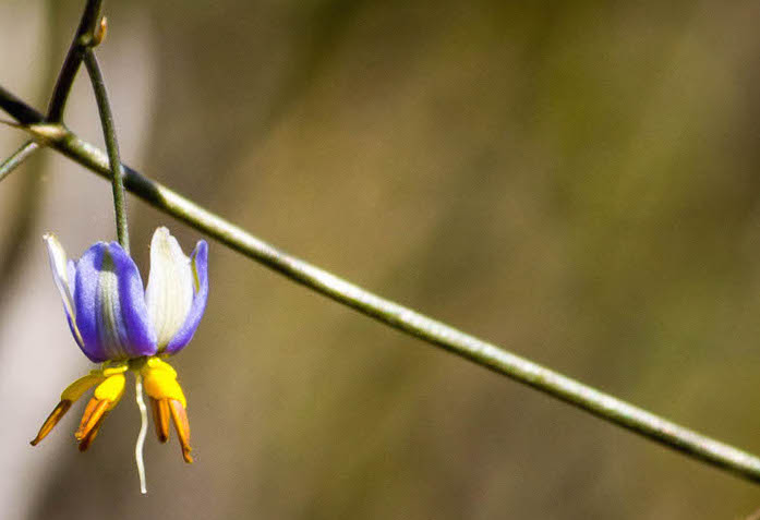
The Wheatbelt Wildflower Tour was planned for the September long weekend, centred on the north-eastern wheatbelt town of Mukinbudin. The date was considered to be fairly late in the wildflower season, however, heavy rains in late July prolonged the flowering.
FRIDAY
The Auria Project
I met up with Scott and Helen in their Jimny and we travelled to Dowerin where we met Rex and Di. Just north of Dowerin we stopped at the Auria project. A local water dowser has taken a different approach to reclaiming salt laden land. The mainstream agriculturists have ignored him but the evidence is plain to see. ‘Auria’ is ‘Australia’ without the ‘salt’.
-
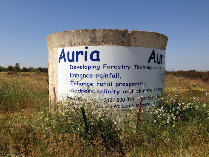
- Australia with ‘salt’ removed.
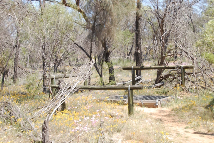
Cullumbin Nature Reserve
Lunch was at Cullimbin Nature Reserve.

-

- Cullimbin

-
- Nature Reserve

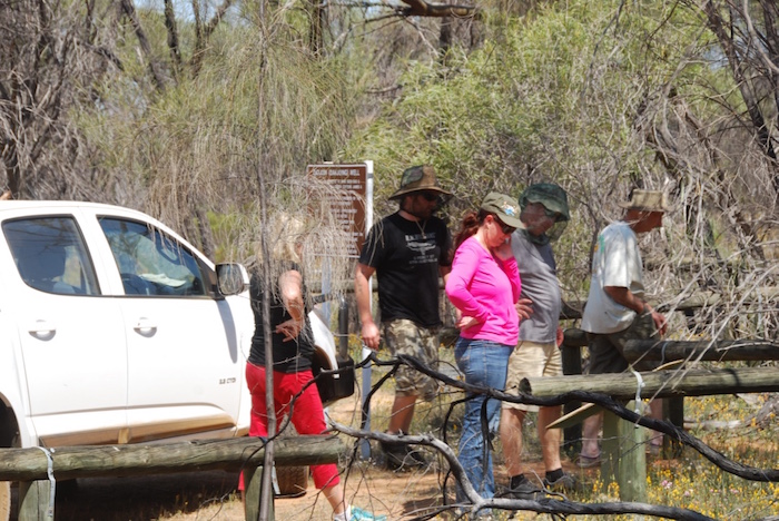
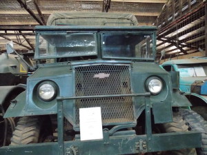
We then headed north to Koorda, Mollerin Rock and Beacon. There is a thriving ‘Men’s Shed’ at Beacon with some fine examples of restored tractors and other farm machinery.
-

- Rex and Scott.
Overnight at Tampu Well
Shortly after arriving at the overnight stop, Tampu Well, Greg and Margot arrived in their recently purchased Colorado. Matt and Tania, Jeff and Micaela, and Paul and Lauren arrived a few hours later.
By the time Mike and Sue, Harrison and Torri, Rusty, Maree and Teagan, and Pete and Lin joined us throughout the next morning there would be eight separate ‘meet ups’ to get the whole Tour together.
SATURDAY
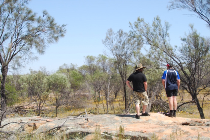
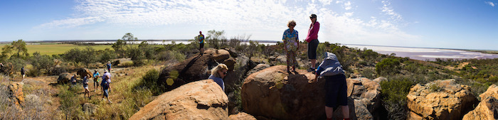
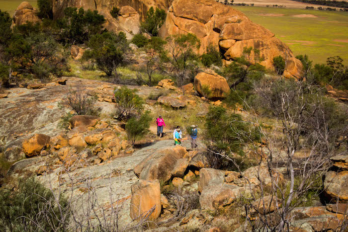
First up Saturday morning was a visit to Beagleys Breakaway and then Billiburning Rock. Surveyor H.S. King used Billiburning as a trig point in 1889.
-
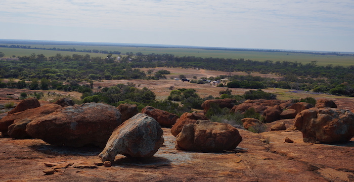
- Billiburning Rock. Photo by Paul Naylor.
-
- View from the top. Photo by Paul Nayler.
-
- Wildflowers at the Rock. Photo by Paul Nayler.
-

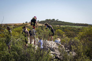
- Walking to the top of the rock. Photo by Kim Epton.
-
- Billiburning Rock. Photo by Paul Marriner.
-

- Everlastings at Billiburning. Photo by Paul Marriner.
Datjoin Well
Leaving Billiburning we turned south to Beacon to refuel before heading to Datjoin Well and Rock. The well was dug by sandalwood cutters in the early 1900s.
This place is notable as the hideout where a fugitive from justice, Lionel Arthur ‘Barney’ Brockman, evaded the police from May to September 1970. He camped with his wife and 12 children in caves around the base of Datjoin Rock. He had various stashes of food around the area, stolen from local stores. He also stole vehicles in the Beacon area. In September one of his camps was discovered near the vermin proof fence. When Brockman made his way back to Datjoin, police and helpers surrounded the rock. Police moved in to capture him but found only his wife and 10 younger children there. Brockman and his two older sons were eventually arrested in Perenjori, some months later.
-
- Kim’s Rodeo and Rusty’s Patrol.
-
- Datjoin Well.
-

- Paul’s Navara.
-
- Datjoin Well.
-
- Paul and Matt.
-

- Datjoin Rock.
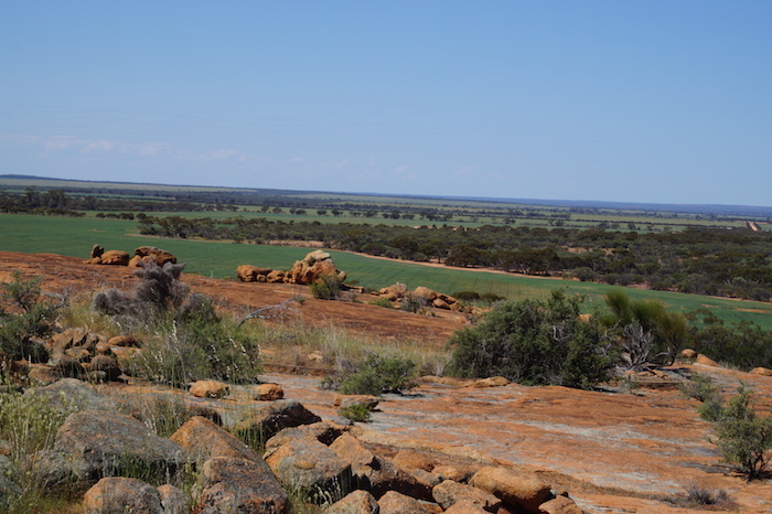
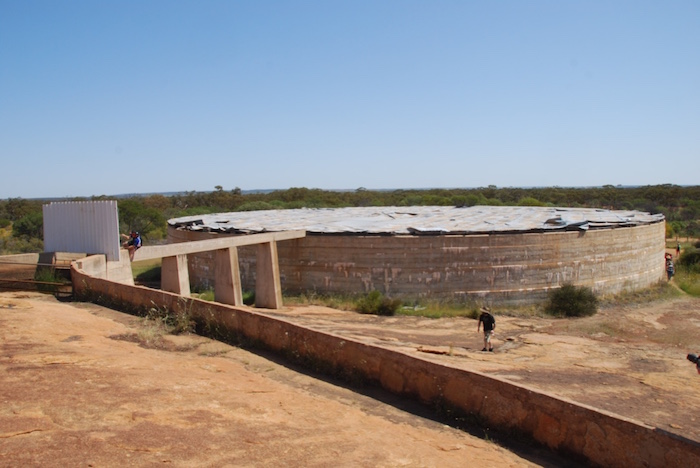
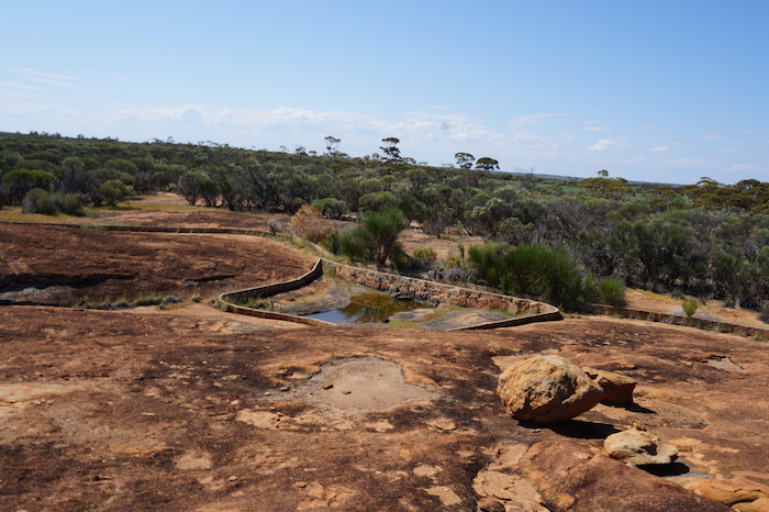
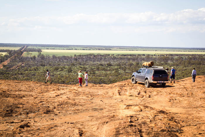
Beringbooding Rock
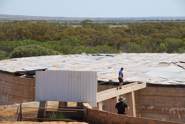
Beringbooding Rock was the next stop. This is a massive monadnock 50 kilometres north-east of Mukinbudin. Settlers in the early 20th century harvested water from the huge expanse of granite and in 1937 Australia’s largest rock water catchment tank was built by ‘sustenance labour’. Holding more than 10,250,000 litres, it was built at a cost of £10,000 ($865,000 in 2015).
Pete and Lin Murdoch caught up with us at Beringbooding.
-

- Lin at Beringbooding Rock.
-

- Pete at Beringbooding Rock.
-

- Cairn at Beringbooding. Photo by Paul Nayler
-

- The beginning of a wave at Beringbooding Rock.
-
- 10 million plus litre tank.
-
- Matt needed a closer inspection. Photo by Kim Epton.
-

- Margot, Helen, Di, Matt Kim. Photo by Paul Nayler.
-
- Paul checks out some native hand prints. Photo by Kim Epton.
-

- Large quantity of water at Beringbooding.
-

- At Beringbooding.
-
- Holoclasty at Beringbooding.
-

- An example of holocasty at Beringbooding.
-
- Water harvesting wall.
-

- Paul, Matt, Tania, Paul and Teagan. Photo by Kim Epton.
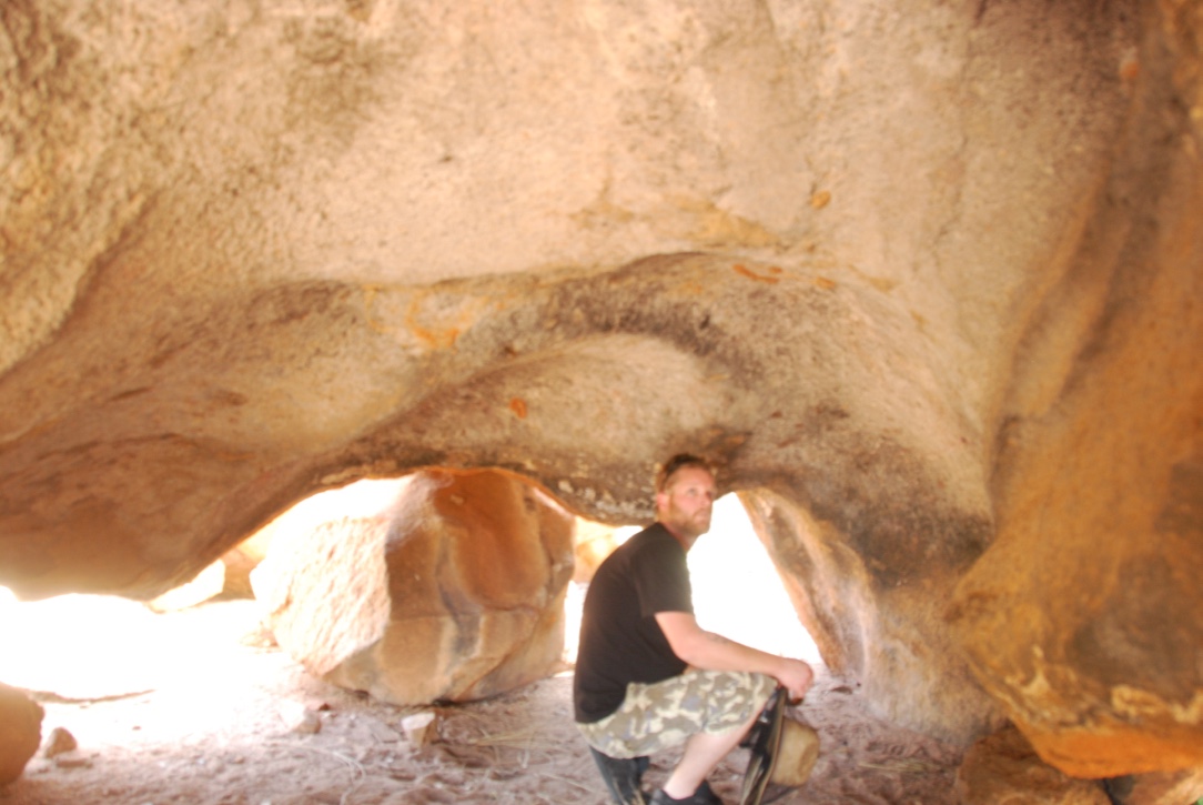
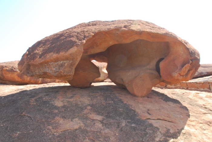
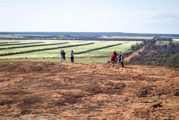
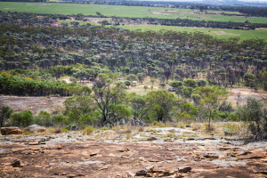
Elachbutting Rock
After lunch we headed to Elachbutting Rock – often claimed by those who know the wheatbelt well to be the most interesting of the hundreds of granite outcrops that occur in the region. Elachbutting is a popular camping and picnicking spot that has also been the setting for numerous weddings. Surveyor H.S. King first recorded the name in 1889. It is thought to mean ‘that thing standing’.
-
- Into Monty’s Pass. Photo by Paul Nayler.
-

- Balancing boulder. Photo by Paul Nayler.
-

- Elachbutting Rock. Photo by Kim Epton.
-

- Elachbutting Wave. Photo by Paul Nayler.
-

- Jeff surfs Elachbutting break. Photo by Pete Murdoch.
-

- Entrance to Montys Pass. Photo by Pete Murdoch.
-
- Rusty, Teagan and Maree.
-

- End of Monty’s Pass. Photo by Kim Epton.
-

- Elachbutting Well 2015.
-

- Elachbutting. Photo by Kim Epton.
-
- Top of Elachbutting. Photo by Pete Murdoch.
-
- Alley farming. Photo by Kim Epton.
SUNDAY
Loud Shirt Day
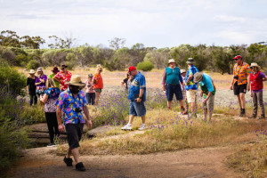
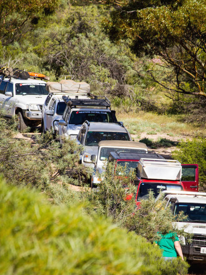
It was intended to split the group into two for the Sunday tour but the dust wasn’t too bad (certainly not at the front) so we had a 11 car convoy.
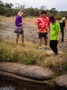
Today was declared ‘loud shirt day’!
-
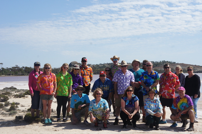
- Loud shirt day. Photo by Scott Overstone.
Eaglestone Hill
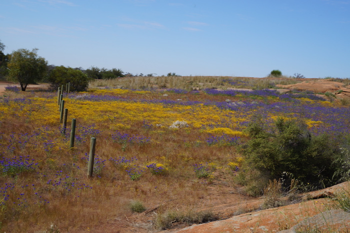
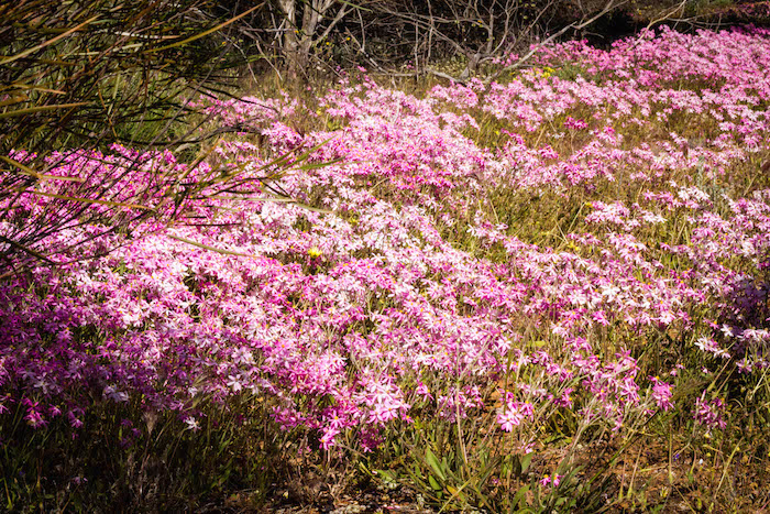
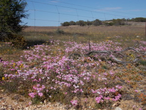
Eaglestone Hill was an unexpected gem. Green paddocks in the distance, a silvery white lake in the background and carpets of pink everlastings caused one to question why it is not part of the ‘Wheatbelt Way’.
-

- Rusty and his ‘white weapon’. Photo by Pete Murdoch.
-
- Eons of erosion. Photo by Kim Epton.
-
- At the top of Eaglestone Hill. Photo by Pete Murdoch.
-

- View of Lake Brown. Photo by Kim Epton.
-

- Greg on Eaglestone Hill. Photo by Kim Epton.
-

- Everlastings. Photo by Kim Epton.
-

- Eaglestone Hill. Photo by Kim Epton.
-

- Lake Brown from the top of Eaglestone. Photo by Kim Epton.
-
- Ascending Eaglrestone. Photo by Pete Murdoch.
Eaglestone Hill, Lake Brown, Mt Moore and numerous other features in the area were named by J.S. Roe, Western Australia’s first Surveyor General, during his major ‘Wongan Hills Expedition’ in 1836.
Lake Brown
Leaving Eaglestone I decided to explore the track along the margin of Lake Brown. After a kilometre or two it was clear that it would eventually meet with the Chandler-Nungarin Road that we were going to use later in the day.
-

- Lake Brown. Photo by Paul Nayler.
-

- Lake Brown. Photo by Paul Marriner.
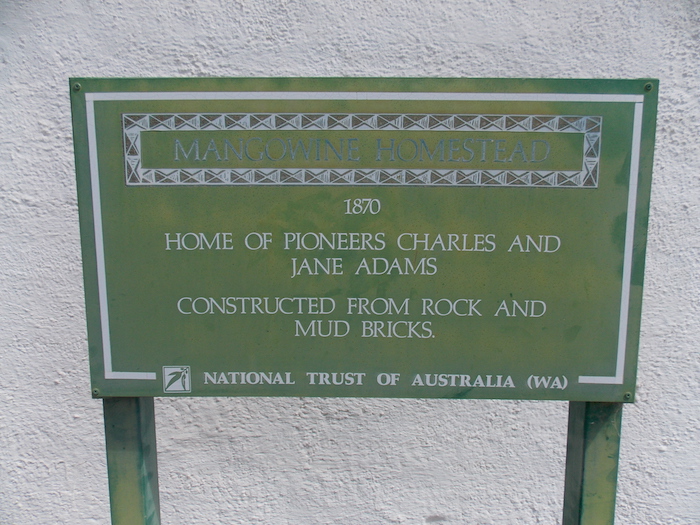
Mangowine
This unscheduled excursion was eating into our program so I found an appropriate turn around point and headed back to Eaglestone Rock and then on towards Mangowine Homestead, an historic homestead north of Nungarin. It was built by Charles and Jane Adams around 1876. The adjacent wayside inn was constructed in 1889.
-
- At Mangowine Homestead. Photo by Paul Marriner.
-

- More information signs like these are needed at heritage sites. Photo by Paul Marriner.
-
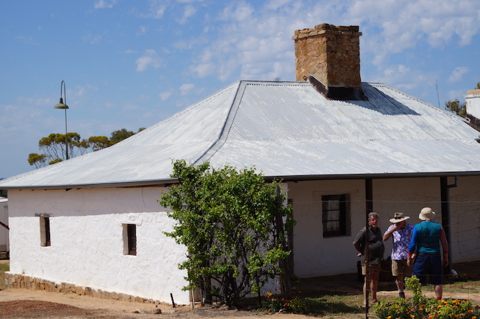
- The Mangowine Homestead. Photo by Paul Nayler.
-
- Old and new. Photo by Scott Overstone.
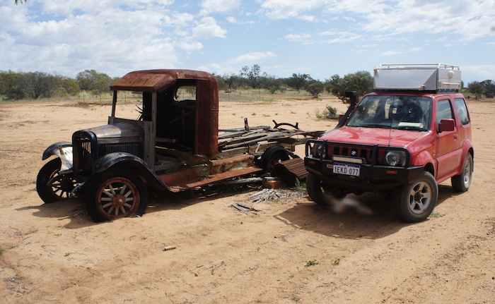
The ‘junkyard’ at Mangowine includes a number of examples of old farm machinery and some Furphy Farm Water Carts.
-
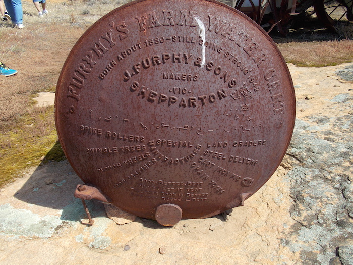
- Remains of a Furphy Farm Water Cart.
The origin of the word ‘furphy’
The mobile water carrier known as the Furphy Farm Water Cart was first made in the 1880s. J. Furphy & Sons in Shepparton, Victoria established a foundry with a furnace to cast the components rather than manufacturing them by the time-consuming method of forging.
The presence of the Furphy Water Cart in Australian military camps during the First World War led to the name of Furphy becoming an indelible part of our language. Known as a ‘Furphy’, water carts were used extensively in Europe and the Middle East to carry water to the troops. The drivers of the carts were notorious sources of information and gossip for the men as they moved from camp to camp. Not all their news was reliable and so it was that the word ‘Furphy’ rapidly became a synonym for suspect information or rumour.
-
- All photos by Pete Murdoch.
-
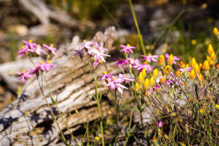
- Pink Fairies (Caledenia latifola)


-
- Everlastings


Nungarin Museum
Lunch was at the Nungarin Heritage Machinery and Army Museum, a massive WWII military workshop that includes a rare Dingo scout car, a fascinating 10th Light Horse display and extensive heritage memorabilia.
-

- Photos by Paul Marriner.
-

- Old bowser.
-
- Blitz truck.
-

- Awaiting restoration.
Mount Moore
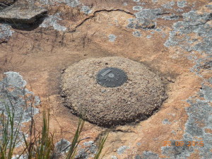
From Nungarin we headed east to Mt Moore, a rock named by Surveyor General J.S. Roe in 1836 after his good friend, fellow explorer and Advocate General of Western Australia at the time, G.F Moore. It is used today as a navigation point by pilots flying out of RAAF Pearce.
-

- Lake Brown in the distance. Photo by Paul Nayler.
-
- Bench Mark. Photo by Paul Nayler.
-
- Mt Moore. Photo by Pete Murdoch.
-

- Flies were bad. Photo by Paul Nayler.
Leaving Mt Moore heading for Weira Nature Reserve, the Chandler-Nungarin Road causeway took us across Lake Brown.
-
- Paul crossing Lake Brown. Photo by Pete Murdoch.
Lake Campion
Along the way I saw directional signs pointing to Lake Campion so a diversion was in order. On initial approach to the lake it was clear that it was once the site of an industrial process. Perhaps lime kilns. Later research showed it to be a potash works/gypsum operations that operated for from 1942 to 1952. Read more.
-

- Potash works and town.
-

- Stockpile.
-

- Lake Campion at Chandler.
-

- Chandler Potash Works.
Regardless of its heritage the lake was clearly a challenge for the local (failed) rev heads.
-

- Bogged cars on lake. Photo by Pete Murdoch.
-

- Micaela.
-
- Maree.
-
- Tania.
-
- Teagan.
Paterson’s Curse (Echium plantagineum) is common throughout the wheatbelt. It is considered a weed and an invasive plant species in the wheatbelt and most places in Australia.
However, it does have its positive uses — it is the source for a particularly fine grade of honey and in South Australia it is known as Salvation Jane because it is a source of food for grazing animals when the less drought tolerant grazing pastures die off.
-

- Wattles near Mukinbudin.
-
- Patersons Curse near Muka.
Weira Nature Reserve
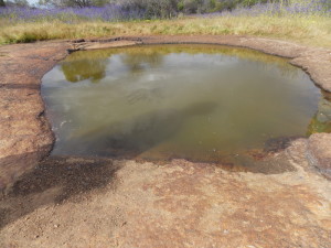
Road realignments brought up the Weira Nature Reserve quicker than expected. Close to Weira Gnamma is another waterhole, a soak of sorts.
-

- Heading into Weira Nature Reserve. Photo by Paul Marriner.
-

- Patersons Curse shows the way to the gnamma. Photo by Paul Marriner.
-
- Everlastings at Wiera Nature Reserve. Photo by Paul Marriner.
-

- Scott checks the depth of Weira Rockhole. Photo by Paul Marriner.
-
- Weira Rockhole. Photo by Paul Marriner.
-
- At Weira Nature Reserve. Photo by Pete Murdoch.
-

- Weira Soak. Photo by Paul Marriner.
-
- Harrison, Mike, Torri and Sue at Weira Rockhole. Photo by Pete Murdoch.
Mukinbudin Caravan Park
The Mukinbudin Caravan Park is great value. Fantastic camp kitchen, excellent community area, cabins that have been retrieved from the Railways, and showers/toilets that would rate with any caravan park in Australia.
-

- Ex Railways cabins. Photo by Pete Murdoch.
-

- Paul and Kim late afternoon. Photo by Pete Murdoch.
-
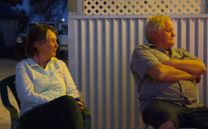
- Di and Rex at Muka Caravan Park. Photo by Pete Murdoch.
-

- Paul at Mukinbudin Caravan Park. Photo by Pete Murdoch.
-

- At the Mukinbudin Caravan Park. Photo by Pete Murdoch.
-

- Margot and Lauren. Photo by Pete Murdoch.
MONDAY
White Man Rock
The Tour would today progress towards Perth via Moujakine, Trayning, Wyalkatchem, Minnivale and Goomalling.
First stop was White Man Rock at Moujakine, 11 kilometres north-east of Trayning. There are a number of directional signs to White Man Rock but none that mark the actual entry to the rock. The rock and adjacent well are on private property (an area of bushland on a farm)..
While surveying in the Moujakine area in 1889, Surveyor H.S. King located an unusual quartz pillar on a ridge of quartz in the NW corner of Charles Glass’s property that he termed ‘the White Man’.
-

- White Man Rock. Photo by Kim Epton.
-
- At Moukaine Well. Photo by Pete Murdoch.
When Alex Glass and his mother found a small nugget of gold while they were cleaning out a well at Moujakine early in 1887, the Newcastle and Northam Settlers Association commissioned a prospector named Colreavy to examine the area.
This historic well is very close to White Man Rock (in the same vehicle park). The well has been fenced and is reasonable condition, if a little overgrown.
This gold find in the well and subsequent examination of the area led to the discovery of the Golden Valley goldfield by Greaves, Payne and Anstey which sparked off the Yilgarn gold rushes.
-
- The quartz outcrop at White Man Rock. Photo by Pete Murdoch.
-
- White Man Rock Well at Moujakine – 2015.
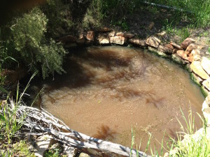
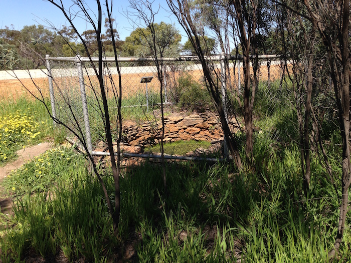
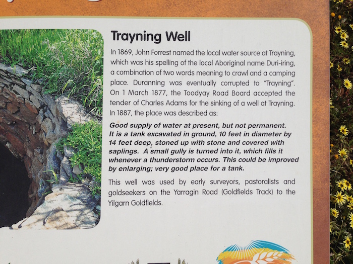
Trayning Well
Trayning Well was the next stop.
-

- Trayning Well plaque. Photo by Kim Epton.
-
- Trayning Well. Photo by Kim Epton.
-
- Trayning Well sign. Photo by Kim Epton.
-

- Wyalkatchem Well/Tank 2015..
-

- Plaque.
A visit to the Wyalkatchem Museum was a unscheduled stop. Some fine farm machinery and wartime memorabilia was on display.
-

- Scout car. Photo by Paul Marriner.
-

- BSA motorcycle. Photo by Paul Marriner.
Minnivale
At Minnivale we stopped at the former CBH wheat silos to view the new tourist rail project. Unfortunately no key was available to provide access to the shed and in consequence Rex was able to give only a summary of the Project.
-

- Oven at the Minnivale Bakery. Photo by Pete Murdoch.
-

- Remains of the Minnivale Bakery. Photo by Pete Murdoch.
-
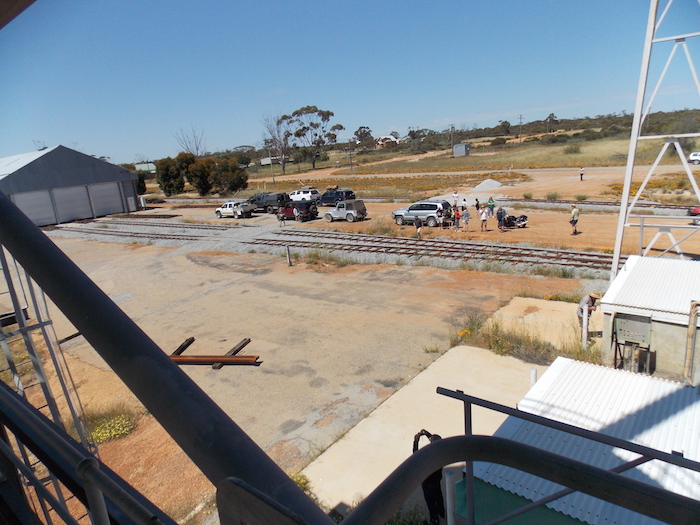
- Ex CBH grain silo used for the Minnivale tourist railway project. Photo by Paul Marriner.
Rusty, Maree and Teagan, and Pete and Lin headed back to Perth after Minnivale. The people in the remaining nine vehicles headed to Uberin Rock for lunch.
Railway Track
I then selected a zig zag course to get to Kalguddering from where we followed the railway into Goomalling.
-

- Greg in his Colorado.
-

- Paul in his Navara.
The Road Trip ended at Goomalling.
The Wheatbelt Wildflower Tour took place in 2015.
© Kim Epton 2015-2024
2291 words, 125 photographs.
Text and layout by:
Kim Epton
Photographs by:
Kim Epton
Paul Marriner
Pete Murdoch
Paul Naylor
Scott Overstone
Feel free to use any part of this document but please do the right thing and give attribution to adventures.net.au. It will enhance the SEO of your website/blog and Adventures.
See Terms of Use.
