
Dam to Dam
This Southern Forest Road Trip started at North Dandalup Dam on Boxing Day 2018.
-

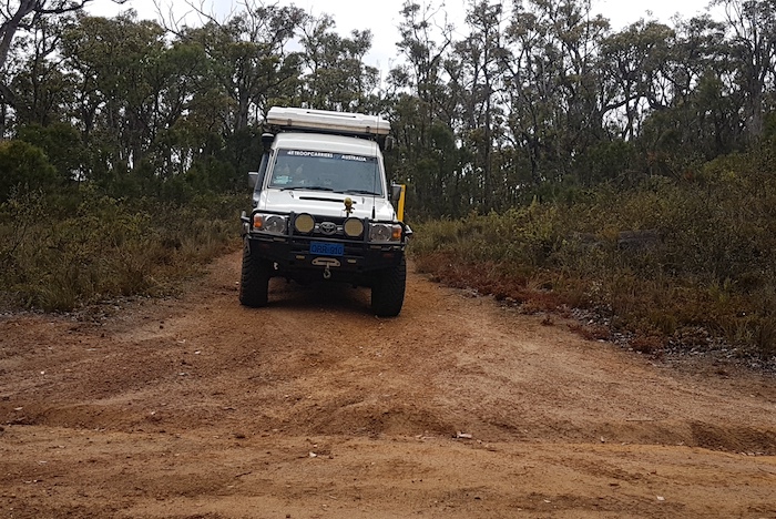
- North Dandalup Dam
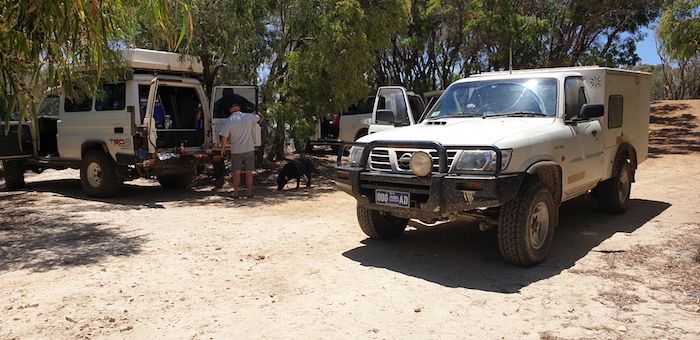
-
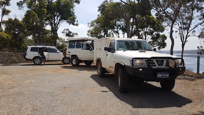
- Pajero, Troopy and Patrol at North Dandalup Dam Lookout.
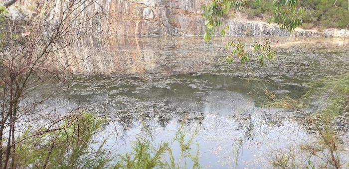
South Dandalup Dam was the next stop.
-
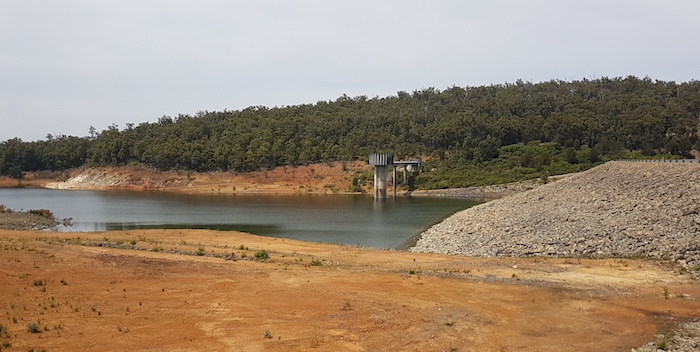
- Lake Banksiadale water level is low at South Dandalup Dam.
-

- South Dandalup Dam Spillway.
Marrinup Prisoner of War Camp
The road south led to the Marrinup No.16 Prisoner of War Camp.
-
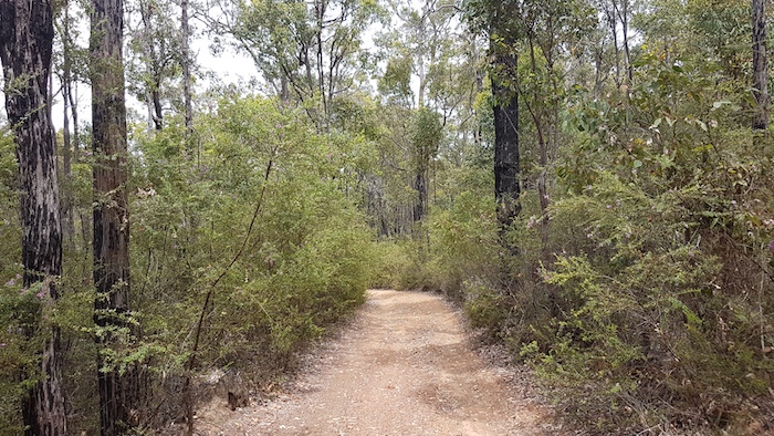
- On Marrinup Road approaching Marrinup Falls. Close to the intersection with Grey Road the track is steep, washed out and rough.
-
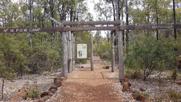
- Entrance to what remains of the PoW Camp.
More than 300 German PoWs were held at Marrinup from 1943-46 where they worked under guard as wood cutters. The timber they cut was used as firewood in Perth. 2500 tonnes of firewood were cut each week. Over the same period 2500 Italian prisoners passed through the camp, most of them working on local farms.
-
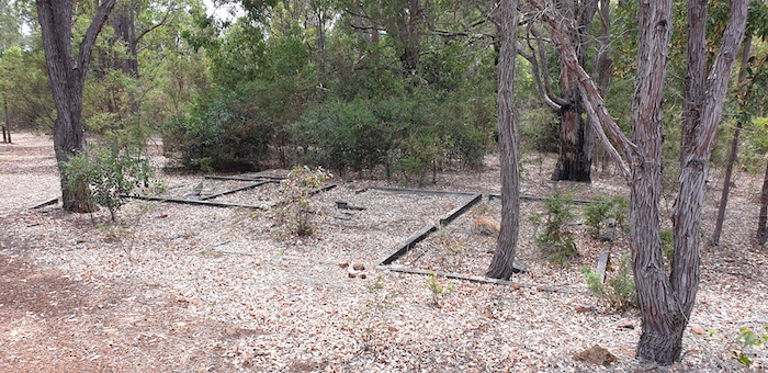
- Ruins at the PoW Camp.
-
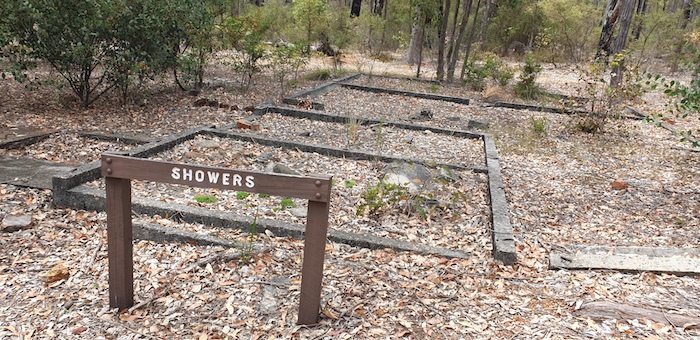
- Ruins of shower block at PoW Camp.
When the last of the PoWs left the camp the buildings and equipment were auctioned off or returned to army bases and the forest reclaimed much of the camp. It is now a heritage site of significant recent history.
-
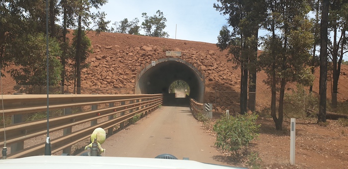
- This tunnel on Nanga Road separates Willowdale mine traffic from traffic on Nanga Road.
Leaving Marrinup we stopped briefly at Dwellingup and then continued south on Nanga Road. Lunch was at Hoffmans Mill – surprisingly deserted.
-
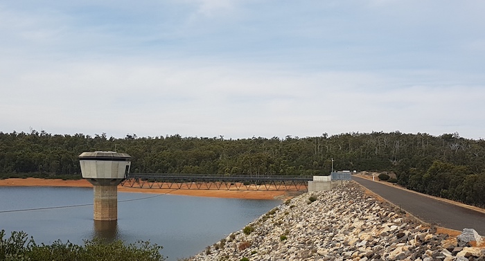
- Harris River Dam
-
- The overflow pool at Harris River Dam.
We refuelled at Collie before continuing south to Glen Mervyn Dam – popular with skiers during the holiday break.
-
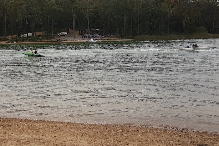
- Ski boats at Glen Mervyn Dam.
-
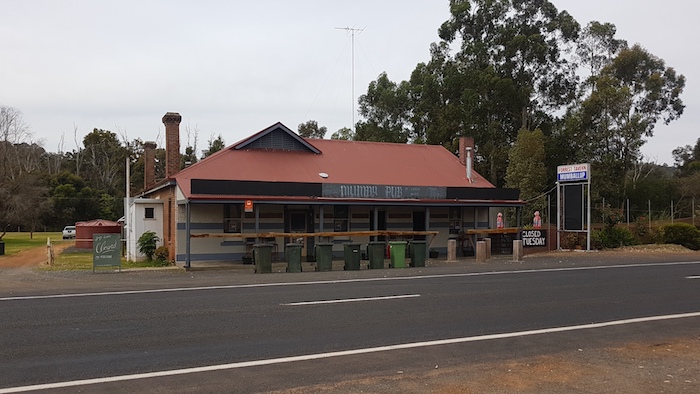
- The Mumby Tavern has gained iconic status as a bush watering hole.
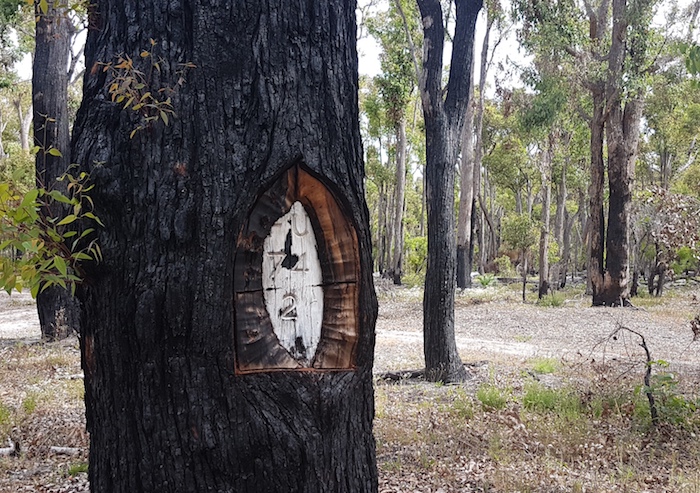
Wilga – forgotten forest dot on the map
Twenty kilometres south is Wilga, an interesting, former timber town nestled in the jarrah forest, now just a shadow of its vibrant past.
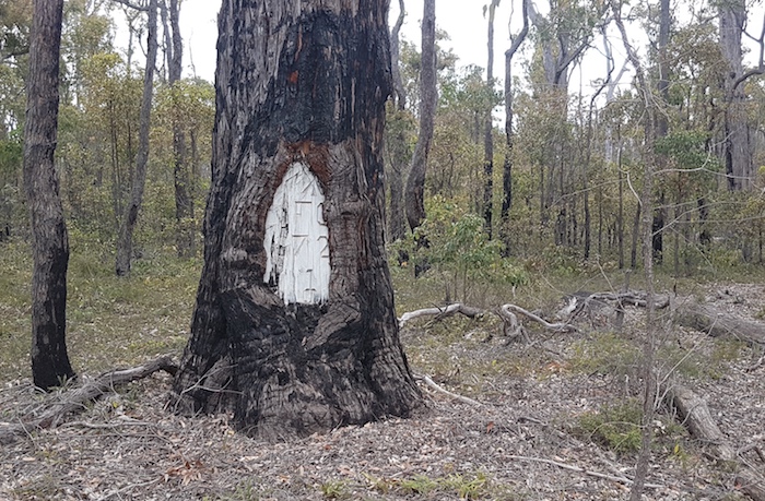
-
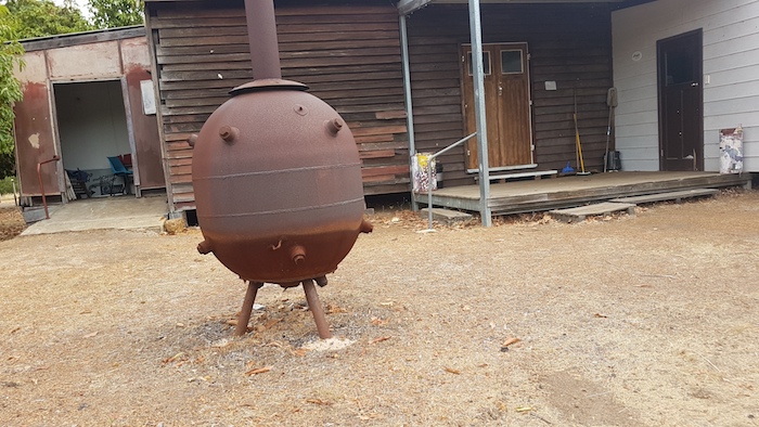
- A WWII vintage mine doing service as an incinerator at Wilga Hall.
-
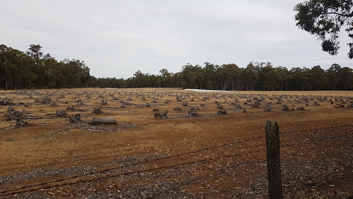
- This paddock of stumps near Wilga is going to present some hard work for someone.
-

- Xanthorrhoeas in infloresence south of Wilga.
-
- A survey tree near Wilga. With the advent of GPS these trees are no longer required.
-
- Another anachronistic blazed survey tree.
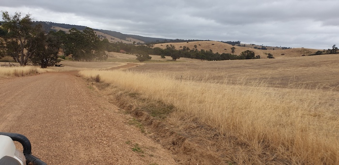
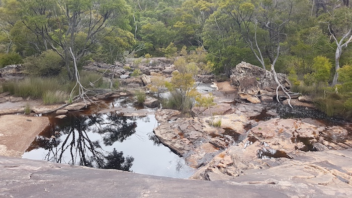
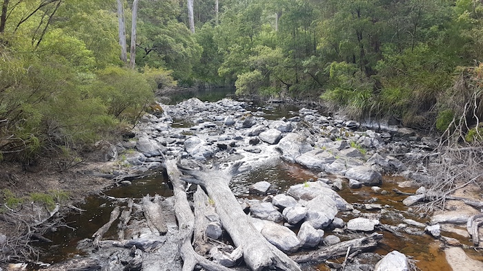
The Blackwood River was just trickling through Winnejup Falls, our overnight stop.
Continue South
Leaving Winnejup we had to select a new path as the planned Route dead-ended in a farmer’s paddock. A regular occurrence. Public roads often seem to be subsumed by private property. The principle of ‘adverse possession’ (12 years in WA) in action.
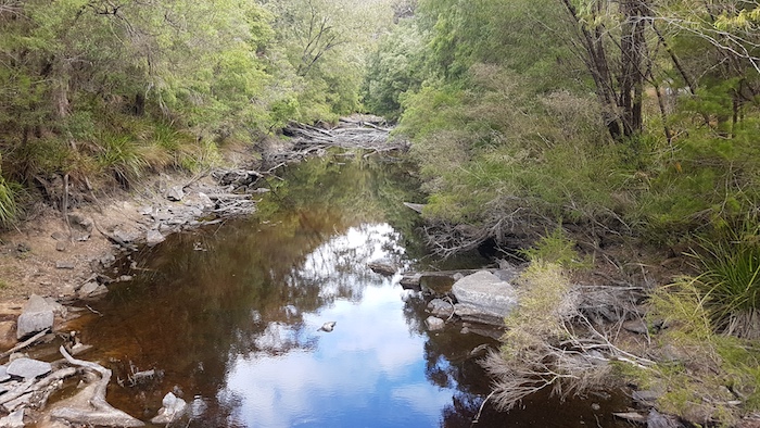
-
- Blackwood River valley, Winnejup.
Attempting to head further south again, through forest country, presented a few challenges as time and again we came up against closed roads. We had to zig zag our way through and around the Greater Kingston National Park.
-

- This fancy signpost near Perup would require a lot of dedicated attention.
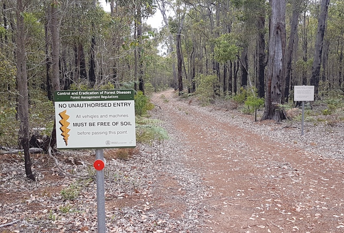
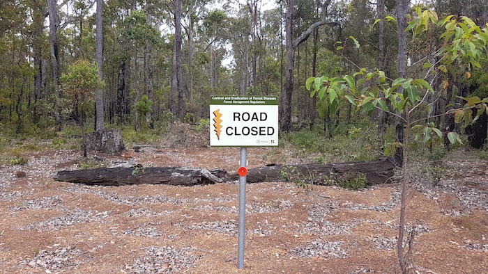
Bureaucracy in the Bush
Logging and Disease Control are causing increasing restrictions to travel in the northern and southern forests. ‘Nanny State’ and CYA actions also contribute to ‘Bureaucracy in the Bush’.
-
- Attempting to control dieback – while logging – one of the greatest proliferators of dieback.
-

- More ‘bureaucracy in the bush’.
-

- Cameras are cheap these days so they are probably not bluffing.
-
- More and more of these signs are being erected.
Dieback (Phytophthora Cinnamomi) is a fungal pathogen that affects a significant proportion of Australian native plants and 40 per cent of native plants in Western Australia. Road/track closure is an easy and cheap method of containment. The first rule of risk reduction is exclusion!
-
- More ‘Nanny State’ BS.
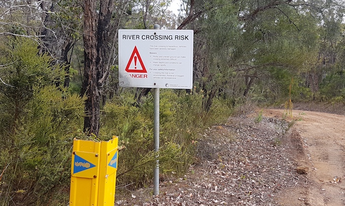
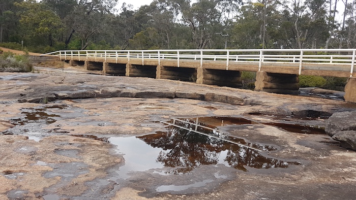
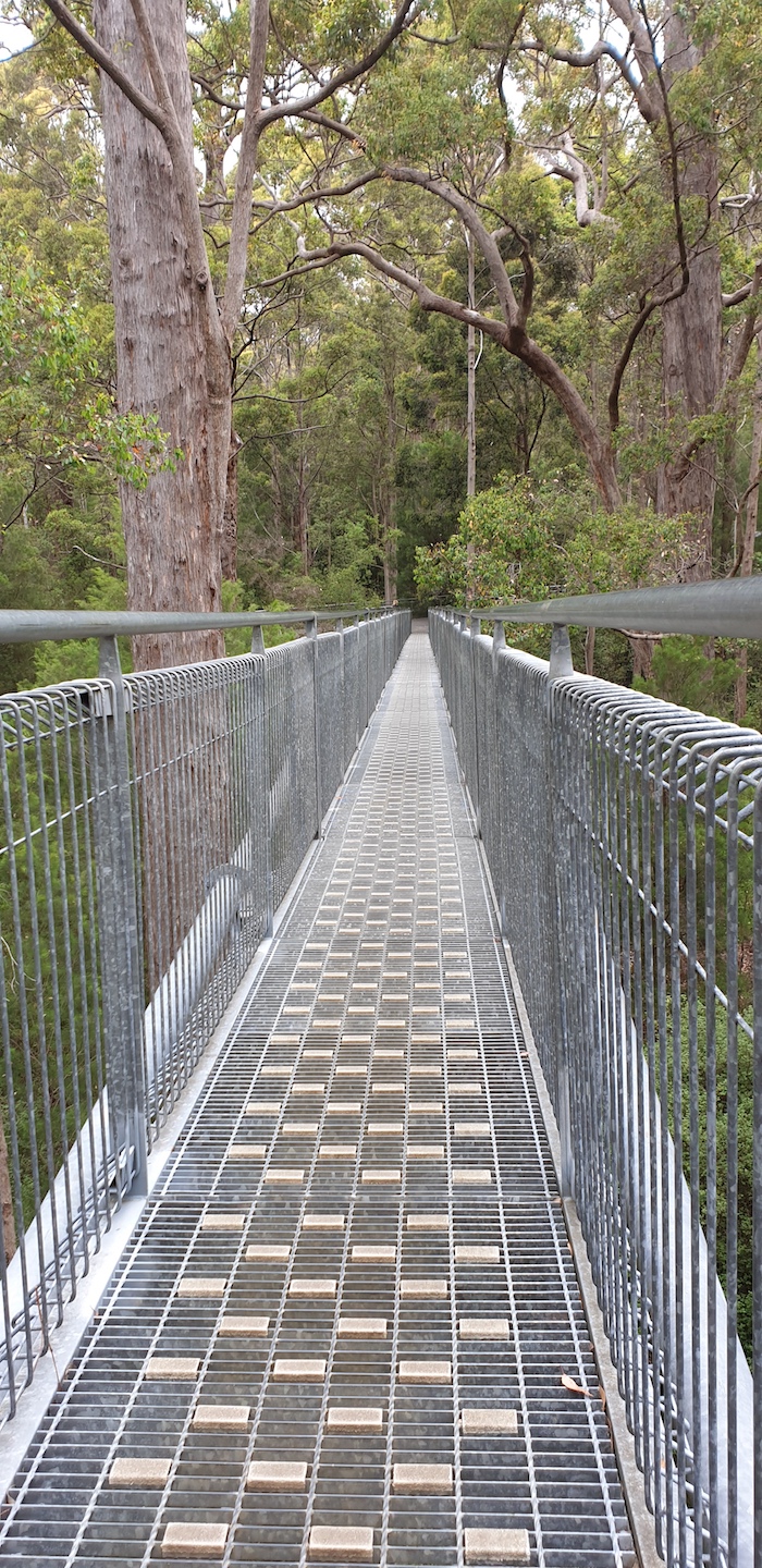
Concomitant with developing the Munda Biddi bike trail is the responsibility of managing it safely and ensuring that it is always open and ‘doable’. Where Break Road crosses the Kent River would sometimes be impassable so an alternative means of getting across the river is available 260 metres downriver. Extravagant, perhaps?
-
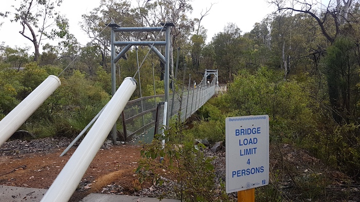
- Suspension bridge below the Falls of Forth to allow cyclists on the Munda Biddi track to get across the Kent River.
Into the Karri Forests
Our journey south took us to Muirs Highway, the first sealed road road we had been on for some time. Nine kilometres later we turned on to the delightful Deeside Coast Road – an extremely picturesque drive through karri forest to the South Coastal Highway.
-
- Bridge over the Warren River. Deeside Coast Road.
Great Forest Trees Drive
The Great Forest Trees Drive is a 26 kilometre loop through magnificent old growth forest that starts and finishes opposite the site of the old Shannon Mill – now a Parks and Wildlife Service Campground.
-
- Shannon Dam was built in 1949 to ensure water supply for the town of Shannon and the timber mill. The Lake is about 1.4 kilometres from the start of the Great Forest Trees Drive.
The entire catchment system of the Shannon River is protected within the Shannon National Park and the adjoining D’Entrecasteaux National Park.
-
- Curtin Tank, about halfway along the Great Forest Trees Drive.
South-west of the South Coastal Highway is a disconnected part of the Great Forest Trees Drive, where one can find the quiet and contemplative Snake Gully, the underwhelming Big Tree Grove, and Inferno Hill.
Fernhook Falls
When the Deep River is flowing well and water cascades over the Falls it is spectacular sight – and one that is easily accessed. It was just a trickle in December.
-
- The bridge is built on top of the falls.
-

- Not much flow at Fernhook Falls.
-
- Looking down the Falls.
The Campground nestled among the forest adjacent to Rowells Pool is managed by the Parks and Wildlife Service and has eight tent sites, two camp huts and a camp kitchen.
-
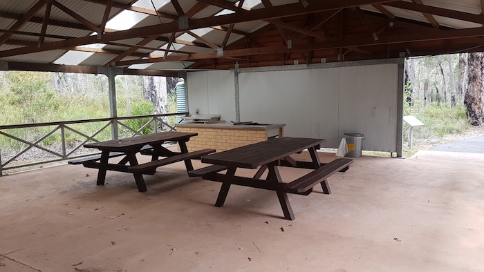
- The camp kitchen at Fernhook Falls.
Access is off Beardmore Road. This road leads to Mt Frankland, our next stop.
Walpole Wilderness
The extent of the Walpole Wilderness was created in 2004 and features a vast, natural and wild landscape that embraces the very essence of Western Australia’s southern forests and coast. Majestic old jarrah, tingle and karri forests surround imposing granite peaks, peaceful rivers, wetlands and tranquil inlets. On the coast there are sandy beaches, sheer cliffs and the relentless, ever-rough Southern Ocean. The Walpole Wilderness encompasses seven National Parks and 360,000 hectares.
-

- The view north from the Little Mount Frankland Lookout over the Walpole Wilderness.
‘Wilderness’ describes an area that is substantially unchanged by technological intervention, is sufficiently large and remote to ensure protection of the biodiversity and natural systems, and where ecological processes remain essentially intact.
The south-west of WA is acknowledged as an internationally significant biodiversity ‘hot spot’.
Mount Frankland
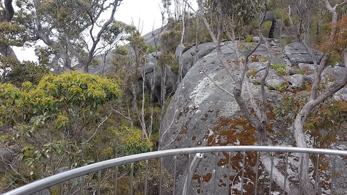
Mount Frankland is a significant landmark within the Walpole Wilderness.
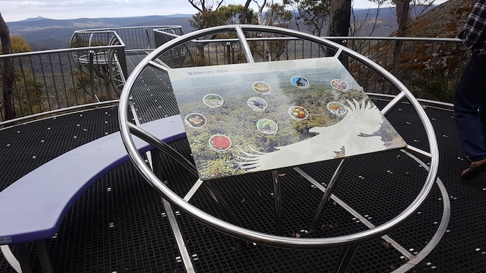
At the Arrival Shelter turn left to visit the Wilderness Lookout.
The impressive Lookout and Walkway, built on the side of Little Mount Frankland, provides great views across the Walpole Wilderness. It winds through the tree tops and, while not as long as the Tree Top Walk in the Valley of the Giants, it is free of cost – and generally free of people.
-

- The Lookout provides amazing views of the Walpole Wilderness.
-
- The walkway hugs the edge of Little Mt Frankland.
-
- A fantastic creation by the Parks and Wildlife Service,
-

- Through the tree tops.
It was time to return to the Arrival Shelter and contemplate the climb to the summit.
There is a wooden hut before the climb to the summit. It is from here that the towerman climbs several times a day to look for fires and check the weather.
The climb to the top of the 411 metre high Mt Frankland is strenuous and includes more than 300 steep, concrete steps. Plus a short climb up a ladder, so a reasonable level of fitness is required. The reward is fantastic 360° views of the Walpole Wilderness, karri forests, wetlands, heathlands, the Frankland River and (maybe) the southern coastline.
Dr T.B. Wilson named Mt Frankland in 1829. More information.
Tingle Drive
Leaving Mt Frankland we continued the push south through forests and farms to Walpole. We then headed north-east on Cemetery Road to where it intersects with Hilltop Road, at which point it is known as Creek Rd. We followed this to Tingle Drive and turned right. Tingle Drive is a beautiful track through magnificent forest alongside the Frankland River. Very tight and steep and one of the highlights of the Road Trip.
-
- Frankland River crossing on Tingle Drive.
-
- Frankland River as seen from Tingle Drive.
Towards the end of Tingle Drive is a easy-to-miss, short track leading to the Frankland River that opens to a small clearing at Monastery Landing.
-
- Monastery Landing picnic area.
-
- Monastery Landing on the Frankland River.
Emerging from Tingle Drive we passed through Walpole on the way to the Tree Top Walk and Ancient Empire at the Valley of the Giants.
Valley of the Giants
-
- The Tree Top Walk
-
- The 600 metre long walkway is 40 metres above the ground and really puts you in the tree tops.
We left the Valley of the Giants headed for Millers Basin, our planned overnight stop, but not confident we would reach it before dark.
Nearly stuck
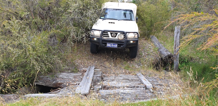
When we got to Pascoe Road (off Ebbett Road), it was non-existent. The gazetted road corridor between two paddocks was overgrown, however, after a bit of checking we discerned a barely visible, overgrown track. It was leading in the right direction so we pushed through. The country was becoming swampy and we were becoming apprehensive. Seven hundred metres in we came across an old wooden bridge over a creek.
It didn’t look too sturdy.
-

- Mushy drives his Troopy over the wooden bridge.
-
- Kim takes his Patrol over the wooden bridge.
-
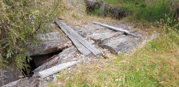
- Old and hazardous.
Daylight was fading and we were stuck in swampy country, unable to go back over the bridge. We eventually found a way back to Ebbett Road, headed west for half a click and turned onto Vermeulen Road. This took us to Valley of the Giants Road and then Middle Road. Clearly, we were not going to make Millers Basin before dark so we turned into the Falls of Forth and found a campsite right on the Kent River.
To Mt Lindesay National Park
Next morning it rained heavily for 10 minutes or so while we were breaking camp.
-
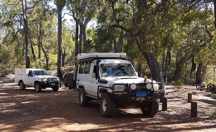
- Mushy and Vicky in the Troop Carrier coming out of Falls of Forth.
We headed north-west and then north on Nornalup Road before turning right onto Basin Road. Little known Millers Basin is about five kilometres to the east.
-
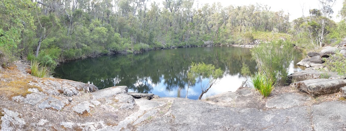
- Millers Basin on the Kent River.
The Millers Basin camping area is big enough for about four vehicles, five at a pinch, and not much of it is very level. Moving east we visited the underwhelming Blue Lake on the way to Possum Trappers Cave.
-
- Blue Lake
Possum Trappers Cave
The track into Possum Trackers Cave is very narrow and slow going. Trees large enough to damage a vehicle line the 6.6 kilometre track to the granite outcrop. An F250 or similar size vehicle would struggle to get through.
-
- A more open portion of the track in to Possum Trappers Hill.
-
- Possum Trappers Hill
-
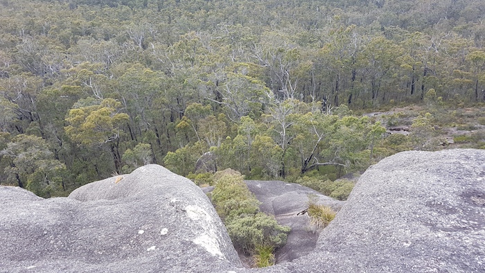
- Looking south on Possum Trappers Hill.
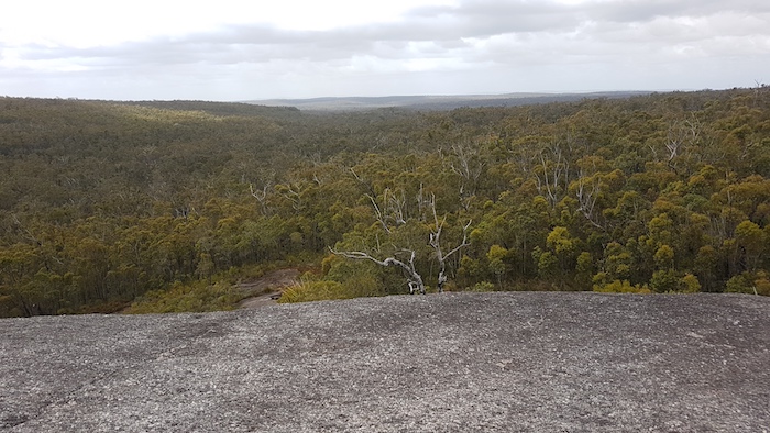
There are at least four sections that would cause concern when wet. Allow 20-25 minutes each way. The reward at the end of the track is great views over the surrounding forest.
-

- Possum Trappers Hill
We made our way south through the Mt Lindesay National Park to the car park at the head of the track to the summit. From this point it is a six kilometre walk to the top of Mount Lindesay. Not something we had time for or were sufficiently motivated to do!
-
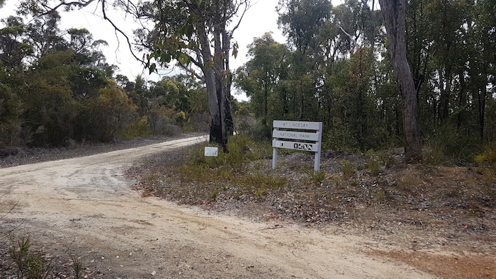
- Mt Lindesay National Park
To Denmark
Between Walpole and Denmark we encountered the Bibbulmun Track numerous times. This iconic track stretches 965 kilometres from Mundaring to Albany and is considered one of the great nature walks of the world.
-
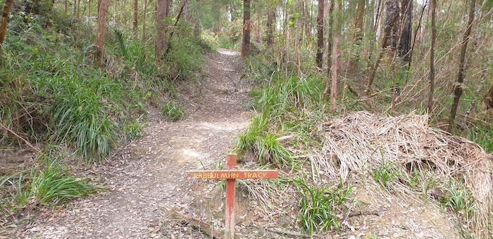
- Bibbulmun Track
Denmark is a premier viticulture area so we had to visit some of the wineries to the north of the town in the Scotsdale area..
-
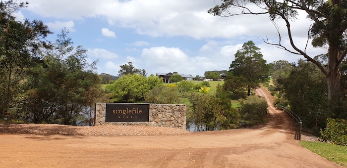
- Award winning Singlefile Winery.
-
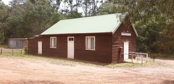
- Scotsdale Hall
After refuelling at Denmark we headed to Cosy Corner and Shelley Beach.
Lower Denmark Road leaves the South Coast Highway near Youngs Siding. It is a beautiful drive. I was looking out for the turnoff to Hortin Road when I saw the turnoff to Lowlands Beach. Having driven past it numerous times but having never turned in, I decided to take a look this time.
-

- Lowlands Beach, west of West Cape Howe National Park.
-

- Lowlands Beach
Shelley Beach
Shelley Beach, in the West Cape National Park, has a small camping area that is popular year round. A freshwater streams runs into the ocean very close to the campground. My observations are that few people realise that this stream is pristine.
-
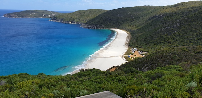
- Shelley Beach, West Cape Howe, from the hang glider launch site.
The bluff above the campsite is an official hang gliding launch site.
-

- Shelley Beach is a registered flying site with the Hang Gliding Federation Australia.
After two nights in the bush a stay in a caravan park was in order. At that busy time of year our expectations of finding a vacancy were low but after many phone calls by Vicky we were able secure a site at King River Palms.
Around Albany
Next morning we drove to Mt Clarence.
-
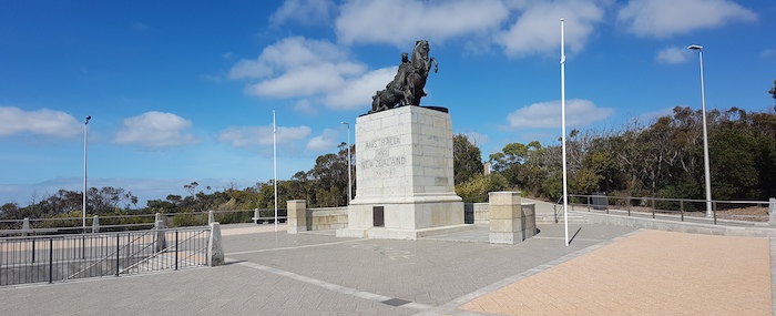
- Memorial to the ANZAC Desert Mounted Corp at Mt Clarence.
We left Mt Clarence, travelling through the historic precinct of Albany and Frenchman Bay Road to Torndirrup National Park.
-

- Lookout at The Gap.
-

- Natural Bridge at Torndirrup National Park.
-

- Coast near the Natural Bridge.
-
- Jimmy Newell Harbour. A fisherman named Jimmy Newell sheltered from a storm here in 1820s.
After a visit to The Blowholes we headed to the Albany Wind Farm.
-

- The Blowholes – not blowing at this time. Very much dependent on swell and the wind.
-
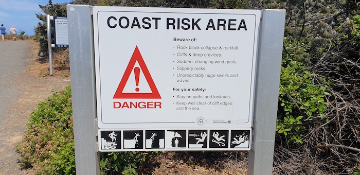
- So many of these type of signs are the ‘nanny state’ in action, however, at the Blowholes the danger is very real.
Albany Wind Farm
The 18 turbines in the wind farm supply Albany with 80% of its energy needs. On average there are just seven days a year when the wind does not blow strong enough to turn the turbines.
-
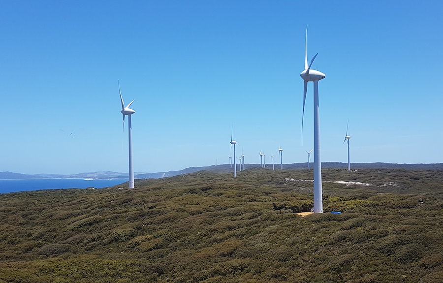
- Albany Wind Farm
The turbines face into the wind and the blades pivot to maximise the energy produced. Winds as low as 7 km/h will turn the blades, however, when the wind speed reaches 120 km/h the turbines shut down to prevent damage.
-
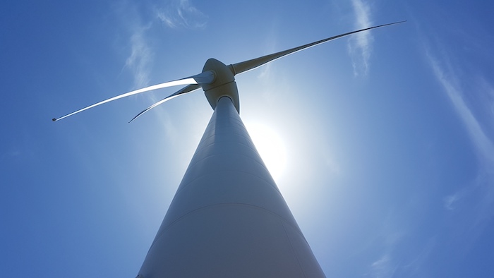
- Wind turbine.
We had lunch at Mutton Bird Beach Lookout before heading down to the sand.
-
- Lunch at Mutton Bird Beach Lookout.
The beach was busy with fishers, swimmers and sunbathers. Wide and not too soft. We exited near Cosy Corner East, through a water crossing, and then out to the bitumen. We had no time to do Torbay Head.
The South Coast Highway took us to Denmark, and then Walpole.
Mt Frankland Road took us to Red Lake, a few kilometres north of Lake Muir, where we camped the night. In the morning we returned to the Bird Observatory at Lake Muir.
-

- The elevated walkway leads to the bird obsevatory.
Lake Muir was listed as a Wetland of International Importance under the Ramsar Convention in 2001. Rare in Australia, the Lake Muir-Unicup Lake system contains peat wetlands.
Difficult to perhaps comprehend in more enlightened 2018, a portion of Lake Muir was used for duck shooting until 1992.
-

- The northern end of Lake Muir (as seen from the Bird Observatory) is known as Cowerup Swamp.
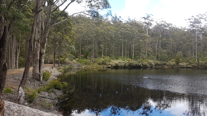
Ten kilometres north of Lake Muir is Lake Unicup, once used for skiing.
-
- Mushy’s Troopy and Kim’s Patrol at Lake Unicup.
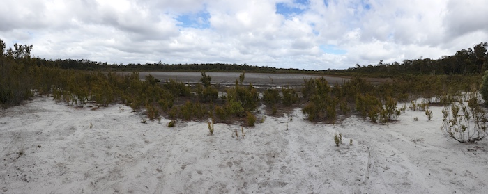
-

- Dry Lake Unicup.
Break at Tonebridge
The Shire of Boyup Brook installed a few gravel bays at this small picnic area just outside the hamlet of Tonebridge, making it available for overnight stays.
-
- The toilet at the Tonebridge campground is hidden by a magnificent bottlebrush tree (Calistemon speciosus).
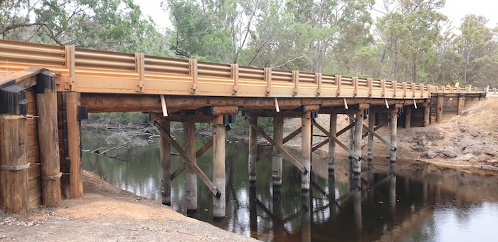
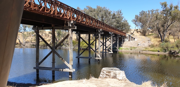
The steel and concrete, two lane bridge at Tonebridge was completed in mid-2018 and replaced a de-rated, 90 year old, single lane, wooden bridge.
-

- Steel and concrete bridge at Tonebridge.
The nearby Perup Nature Reserve is home to six rare or endangered species of mammals – Numbat, Chuditch, Woylie, Southern Brown Bandicoot, Tammar Wallaby, Western Ringtail Possum. It is also the largest reserve of jarrah/wandoo in Western Australia.
Further along the route home we stopped to look at the flood level indicator at Winnejup Bridge and then decided to have a swim.
-
- Winnejup Bridge across the Blackwood River.
Greenbushes
With the rise of the importance of lithium Greenbushes has put itself back on the map.
-
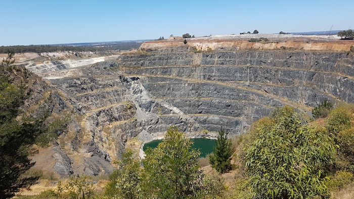
- The disused open cut Cornwall Pit at Greenbushes. The lithium pits are behind this pit.
Tin has been mined at Greenbushes since 1888. Tantalum was mined underground from 1980-83 and recommenced in 2001. Lithium has been mined at Greenbushes since 1983 and since 2006 it has been the key economic mineral.
It was an uneventful drive home on South West Highway.
© Kim Epton 2018-2024
2841 words, 80 photographs.
Photographs
Kim Epton
Michael Orr
Feel free to use any part of this document but please do the right thing and give attribution to adventures.net.au. It will enhance the SEO of your website/blog and Adventures.
See Terms of Use.