
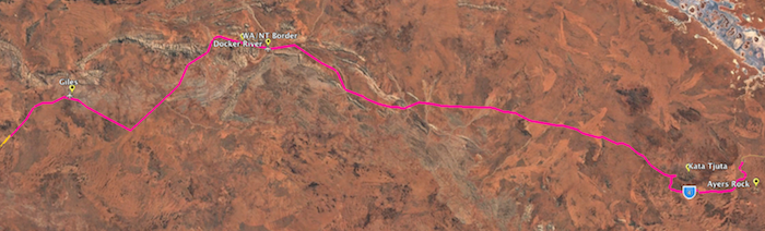
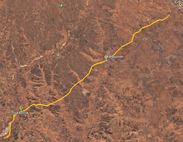
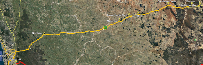
The broad plan was to head out of Perth on the Brookton Highway, and take the Hyden-Norseman Road to Norseman for the start of the trek across Australia on the Eyre Highway. We would travel east, visiting interesting places and highlights along the way to Ceduna.

At this point we planned to take Googs Track to the Trans Australian Railway access track, head to Coober Pedy and then onto Oodnadatta. From this iconic outback town we would make our way to Hamilton, Charlotte Waters, New Crown and Finke (Apatula) before heading onto Alice Springs, capital of inland Australia.
After a break in The Alice to watch the Finke Desert Race we intended to head out on Namatjira Drive to Glen Helen, and then along the Mereenie Loop to Kings Canyon, Yulara/Uluru and Kata Tjuta.
We planned to drive home along the western portion of The Outback Way – Tjukaruru Road and the Great Central Road to Laverton, and then Kalgoorlie to Perth.
As broad plans go, we achieved about 90% of what we planned.
-

- Day 1 Kelmscott to Norseman
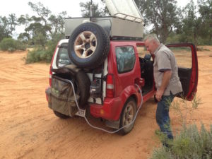
Everyone met at Kelmscott for an on-time start – except Kerry . He had a last minute, urgent job on, and said he would catch us up. The details of how and where were sketchy. I said ok, Alice Springs is a big town.
We stopped at Stumpy’s Roadhouse in Brookton to check vehicles and trailers. Wise to find any problems while close to Perth. All good!
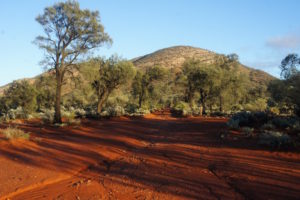
If heading to Norseman and points further east why go any other way than the Hyden-Norseman Road? Big, wide, open, comfortable dirt road after Hyden with little traffic compared to Great Eastern Highway with trucks, road trains and a lots of cars! And the trip through Hyden is quite a few kilometres less.
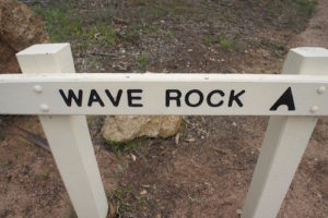
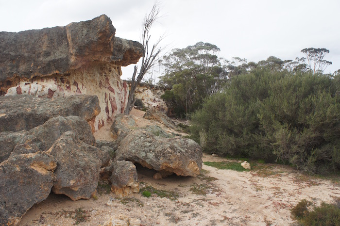
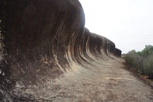
Wave Rock and Hippos Yawn at Hyden are a convenient stop for lunch on the way to Norseman. Hippos Yawn is a wonderfully graphic example of what is known, geologically, as a tafone.
-

- Hippos Yawn
-

- Wave Rock
-

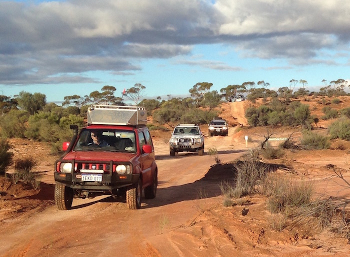
- Dan’s Prado, John’s Patrol and Kim’s Rodeo at Hippos Yawn
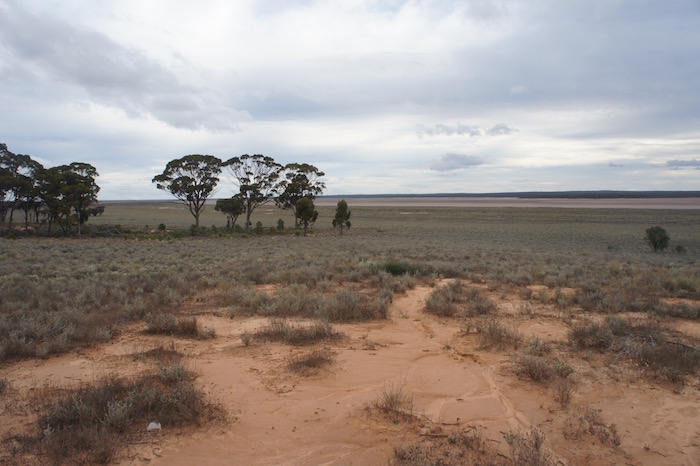
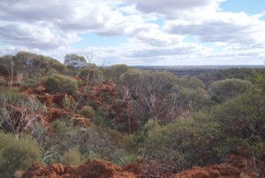
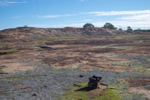
East of Hyden is the Great Western Woodland, a region about the size of England. It stretches from the edge of the Wheatbelt to the Eastern Goldfields and pastoral rangelands to the north, the inland deserts to the north-east and the Nullarbor Plain to the east.
The State Barrier Fence is a clear distinction between productive agricultural land and ‘the bush’. We stopped for the obligatory photograph.
The Breakaways are a great stop along the Hyden Norseman Road (HNR). Ignorant people were camped on the internal track, blocking the way in and around. Clearly the Universe revolves around them.
-

- Breakaways
-
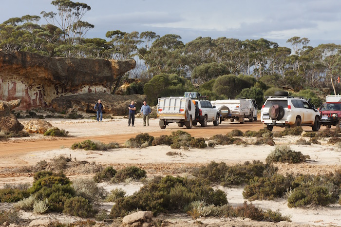
- Our vehicles at The Breakaways.
-
- Breakaways
Onward eastward.
We pulled in to the McDermid Rock carpark and, surprise, surprise, more ignorant people thinking they are the only people that would be visiting McDermid Rock that day. Turnarounds blocked, ignorance personified. And they weren’t aware of their rudeness. Or at least were too embarrassed to acknowledge it.
-
- Waves at McDermid Rock
-

- Disappearing water in a depression at McDermid Rock
While returning from the three ‘waves’ of the Rock towards the carpark we saw a familiar figure up on the rock. It was Kerry. The Tour was finally together.
It was getting late in the day as we continued past Lake Johnston.
-
- Lake Johnston
At our latitude, 94 kilometres of eastward travel equates to four minutes of solar time, meaning that at Norseman, 565 kilometres east of Perth (straight line) the sun sets 24 minutes earlier than in Perth. Coupled with our determination to camp in the bush, rather than Norseman Caravan Park, there was an imperative to find a campsite soon – a bush camp where we could light a fire.
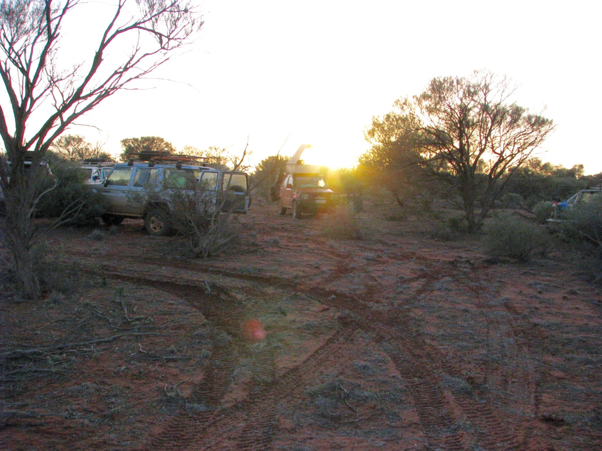
We turned off HNR and headed north towards Theatre Rock. Road realignments defeated our efforts to reach the Rock but we found a very comfortable first night’s campsite adjacent to a large gravel pit.
-
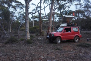
- Scott’s Jimny
-

- Campsite near Theatre Rocks
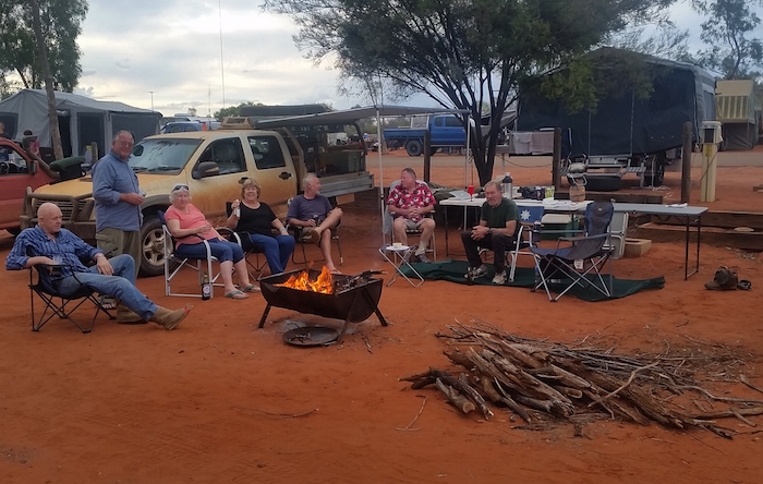
It was a pleasant night around the fire getting to know everyone.
-

- Day 2 Norseman to Moodini
The schedule called for a 8.00 a.m. departure time. We got underway at 7.30 a.m. – very encouraging because it is my experience that people get more and more efficient at packing up and preparing to leave as time goes on. So, early departures could be expected ?!
-

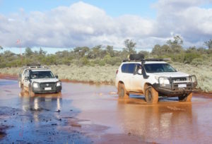
- Crossing Lake Cowan
The early departure from the bush camp allowed us to refuel in Norseman and be heading eastward on the Eyre Highway by 8.25 a.m.
Bypassing Balladonia Roadhouse we turned off the highway into Afghan Rock for a break.
-

- Vehicles at Afghan Rocks
Scott had photographs of himself taken (wearing only jocks and boots) in front of the 90 Mile Straight sign. To protect the sensibilities of the reader, none of these pics are reproduced here!
-

- Dan’s Prado at 90 Mile Straight
The section of Eyre Highway between Balladonia and Caiguna is the longest straight stretch of road in Australia, and possibly the world. The road stretches for 145.6 kilometres (90.5 miles) without a deviation and is signposted as the ’90 Mile Straight’.
The Caiguna Blowhole is just to the west of the Caiguna Roadhouse and well worth a visit.
-

- Caiguna Blowhole Informational Sign
-
- Caiguna Blowhole
We shared our lunch with crows (Australian ravens) and the ‘rats of the sky’, silver gulls, in the picnic area of the Caiguna roadhouse.
Forty kilometres further east the convoy turned off Eyre Highway north into Nuytsland Nature Reserve to find an alternative way to Cocklebiddy Cave. The first deviation was a sinecure – the track turned 90 degrees to the east. With a a fence in front of me there was no option.
-

- Nuytsland Nature Reserve to Cocklebiddy Cave.
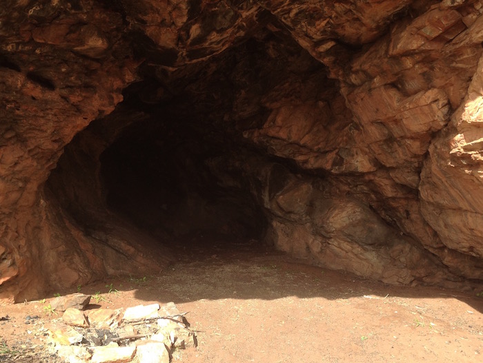
Beyond that, the tracks were extremely ill defined – it was a test of navigation. The track heading south east to the cave was very indistinct. After a minute or so of casting around I located it and we were away again. After only 100 metres or so the track became clearly defined again. On arrival at the cave we were disappointed to find that it had been closed by the Department of Parks and Wildlife.
-

- Cocklebiddy Cave Entrance
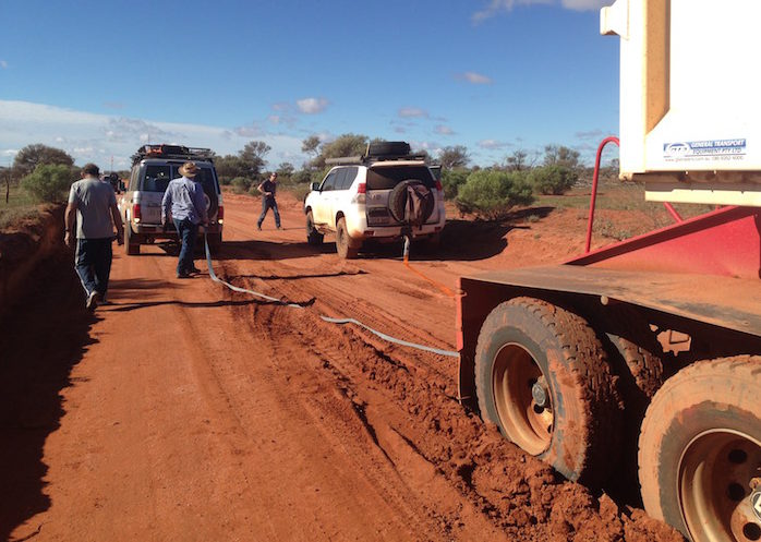
We returned to Eyre Highway and continued east. At the bottom of the Hampton Tablelands at Madura Pass we turned off the highway and headed uphill on the Loonganna Road, intending to take what is erroneously termed ‘the Old Coach Road’ to Moodini Pass but a locked gate across the track prevented access. Weed control was the reason stated on the gate but more than likely it was feral tourist control. Half way down the hill on the return to the highway the sidewall of Scott’s Jimny’s left rear tyre split. Everyone pitched in and it was changed in a few minutes. It was getting dark and overcast, and little bit of rain fell.
-

- Kerry and Scott collected firewood
After 30 minutes of unsuccessful attempts to find a campsite we eventually turned in the Moodini Bluff 24 hr Stopping Place. It was pretty full but eventually we found a space large enough for our group. Scott and Kerry went off in Kerry’s ute and got wood. Another pleasant night around campfire.
-
- Day 3 Moodini to Nundroo
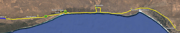
Next morning, after refuelling at Eucla ($1.48/litre), we visited the old Telegraph Station. The inexorable creep of the sand dunes seems to have slowed.
-

- John’s Patrol with Avan camper, Ken’s Colorado with pop top caravan, Dan’s Prado, Kerry’s Navara, Kim’s Rodeo.
-
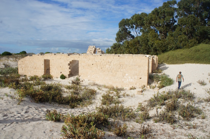
- Telegraph Station ruins.
Coming into Border Village John, Kerry, Scott and I got breath tested. Dan and Ken got drug tested. My information is that Police are selective about who they choose for drug tests!
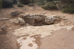
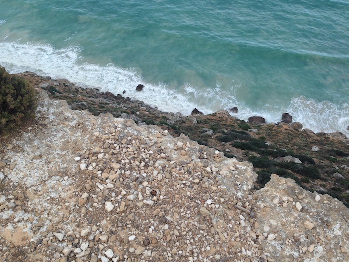
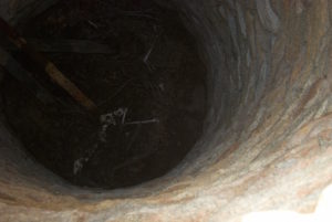
To the north of the quarantine checkpoint is an interesting find, largely unknown. A hole in the limestone karst with an opening just under a metre in diameter has a ledge about 700 mm from the top of the hole. An animal has jumped or fallen into the hole, landed on the ledge and been unable to extricate itself, eventually dying.
-

- Blowhole trap
-

- Remains of animal trapped on ledge in blowhole
From this point Ken and Estela, and John and Leslie continued east along Eyre Highway for 10 kilometres to wait at a parking bay while Kerry, Dan, Scott and I drove to Wilson Bluff.
-

- Wilson Bluff
-

- Kerry at Wilson Bluff
-
- Wilson Bluff
-

- Kerry
-

- Driving back to Eyre Highway
-
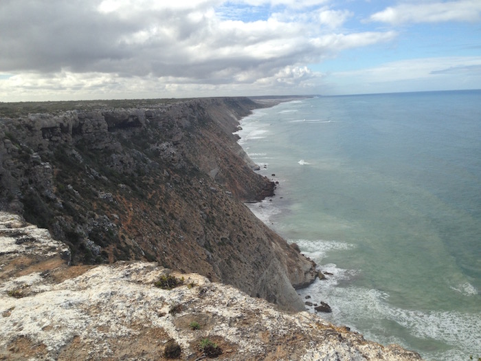
- Looking towards to the Merdayerrah Sandpatch
-

- Cliffs of the Great Australian Bight
Wilson Bluff marks the start of the Bunda Cliffs.
I had been hearing a ‘tinkling’ noise for some time and it was eventually diagnosed as a loose shockie strut, left front. We secured it temporarily with tape and a suitable nut found in Scott’s container of spares.
We headed back to the Eyre Highway, rv’d with John/Leslie and Ken/Estela, and then continued the eastward push. Not long after after we spotted a wrecked van and secured a replacement washer for the strut on the Rodeo. Kerry searched the wreck for a replacement radio antenna. No luck. No luck among the wrecks at Koonalda. Nor in any of the hundreds of wrecks along the Great Central. Kerry was still looking at Laverton.
Scott highly recommended a visit to Koonalda, an abandoned pastoral station homestead 15 kilometres to the north of the Eyre Highway.
Along the way we stopped at a sink hole or doline. Large dolines often have passages leading to caves. Dolines are formed by the collapse of the roof of caves. They can be from a few metres to 200 metres wide, and from a small depression to as deep as 40 metres.
-
- Totally unafraid
We also took time out to greet the local wildlife. While having lunch at Koonalda we wandered around among the old car wrecks, machinery, buildings and artefacts.
-
- Koonalda Homestead
-

- At Koonalda
-

- At Koonalda
On the way back to the bitumen we drove a section of the old Eyre Highway. While taking a break at Nullarbor roadhouse (diesel $1.69/L) Scott organised a replacement tyre to be ready at Ceduna.
-

- Eyre Highway
We pulled into Nundroo Caravan Park just before dark – $4/head and lukewarm showers.
Scott and Kerry had collected wood on the way in and we had a comfortable night around the campfire.
-

- Day 4 Nundroo to Mt Finke
Scott left early to arrange fitting/collection of tyre for his Jimny at Ceduna.
On arrival at Ceduna the group dispersed to refuel, buy food, and get permits for Googs Track. We regrouped at the oyster shop opposite the BP servo.
-

- Ceduna Jetty.
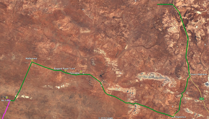
Googs Track crosses more than 300 sand dunes as it traverses 200 kilometres of the Yumbarra Conservation Park and Yellabinna Regional Reserve before it meets the Transcontinental Railway Line access track at Malbooma. It is sometimes compared to a Simpson Desert crossing.
The official advice on trailers on Googs Track was not to take them so John and Ken continued on to Wirulla via the Eyre Highway. From there they would take the track past Lake Gairdner to Kingoonya.
Kerry, Dan, Scott and I returned west, turned right off Eyre Highway onto Kalanbi Road and headed to Googs Track.
There is a gate at the start of the Track, informational signage and a small clearing where one can deflate tyres.
-

- Gate at the start of Googs Track.
Although the recommended direction to traverse the track is from south to north we meet three groups heading south. Advice on sign boards at the start of the track was to use UHF18 and we called continuously – particularly approaching the crest of dunes. Ultimately it was fairly straightforward to locate oncoming traffic and none of the ‘meetings’ presented a hazard.
-

- Kerry’s Navara, Dan’s Prado and Steve’s Landcruiser.
-

- Googs Track.
-

- Through the windscreen of Steve’s ‘Cruiser.
-

- Top of a dune.
-

- Crest of a dune.
-
- Scott’s Jimny.
-

- Steve’s Landcruiser.
-

- Kerry’s Navara.
-
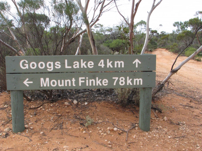
- Googs Lake, four kilometres off the track, has picnic facilities and is well worth the detour.
While heading north I heard the weather forecast. There was a very high possibility that we would get some serious rain. We diverted into Googs Lake for lunch and while there met Steve Sporne from Scone in NSW, travelling by himself in a Toyota Landcruiser V8 Wagon. After I advised him of the impending weather he decided to abandon his idea of camping at the lake and joined our convoy.

-

- Lake Goog.
-

- Lake Goog.
-

- Lunch spot.
-
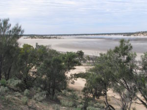
- Lake Goog
-
- Scott refuelling.
The approaching front was evident. The sky greyed over. Light rain started falling.
-

- Lake Goog with water two weeks later
Not long after we got back onto the main track after lunch we stopped and chatted with four blokes from NSW in two vehicles heading south. They had experienced light rain, nothing to worry about. Shortly after that we met Pat Hall from Melville driving a white Toyota Prado and he told us the rain was fairly heavy. I caught up with him after the trip.
-

- Gutter on Googs Track.
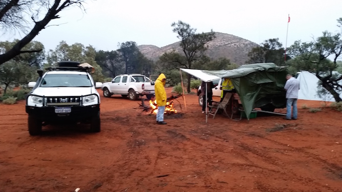
The rain intensified and by the time we turned into Mount Finke to camp for the night it was gloomy and fairly bucketing down.
What could have been a miserable night was sorted ok. I parked my Rodeo at 90 degrees to Dan’s Prado and we extended both awnings. Hoochies were judiciously placed and the final touch was the placement of an umbrella in the V of the two vehicles.
-
- Camp at Mount Finke.
The campsite was picked clean of firewood. Before dark fell we searched as far out as 300 metres for firewood, eventually getting enough for the night – none of it particularly good and all of it sodden. Being good bushmen we used petrol and diesel to start the fire.
-
- MOUNT FINKE TO BULGANNIA
Morning broke with clear skies and we set about ‘recovering’ the situation. There had been a lot of rain overnight and from containers left out we estimated a minimum of 60 mm had fallen but it could easily have been well more than that.
-

- Rain had cleared.
-
- Mount Finke from the campground.
-

- Scott and Steve.
-
- Mount Finke campground.
-

- Mount Finke in the morning.
As a consequence of the previous night’s efforts to keep out the rain it took a little longer to get going in the morning. When we finally got out onto the Track we found that there was water everywhere. Playground for 4WDs.
Mount Finke is an inselberg or monadnock which is an isolated hill or small mountain that rises abruptly from a surrounding plain (literally ‘island mountain’). Presumably Mount Finke’s name is derived from the same as that for the Finke River.
-

- Mount Finke.
Most of the mudholes were fairly innocuous and we drove through them without prior inspection.
-

- Saltpan on Googs Track.
-
- Convoy coming into saltpan.
-

- Steve’s Cruiser at saltpan.
-

- Another puddle.
-

- Scott splashes through.
-

- The Track can get wet.
-

- Kim and Rodeo.
-

- Cruiser on the Track.
-

- Kerry and Kim.
-

- Kerry and his Nissan Navara.
-
- Scott sends up spray.
-
- Through windscreen.
-

- Dan and his Prado spray water everywhere.
-

- Scott and his Jimny.
-

- Common view.
Close to end of the Track we encountered a stretch of water about 120 metres long. I assessed that it was not overly deep, looked similar to all previous stretches of water, and presented no particular challenge. Not quite so. Slippery mud.
-

- Shallow but slippery.
-

- Dan directing operations.
-
- Hooked up.
-

- Snatched out.
Kerry also got stuck at the beginning of the stretch of water. Steve snatched him out.
The appearance of the Trans Australia Railway signalled the end (or beginning) of Googs Track. Much hyped but a bit of a doddle really. If the uneducated could be educated to lower tyre pressures the offset ‘holes/ruts’ (sometimes referred to as moguls) on the approach to sand dunes would be eliminated and one could confidently complete the Track in a 2WD – although that, of course, would exacerbate the problem of holes, ruts and corrugations of which I am complaining. Any halfway competent driver with adequate vision and a vehicle with a 4WD button/stick could drive this track with ease.
-
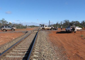
- At the Trans Line.
-

- Crossing the Trans Line.
-

- End of Googs Track.
-

- To Tarcoola.
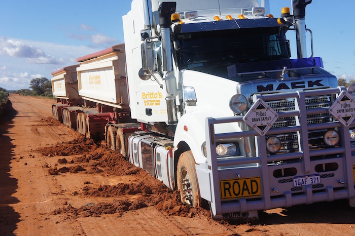
Twenty minutes along the railway access track I saw headlights. Not moving.
A double road train with 47 tonne of railway ballast – to take out two hundred kilometres further west – was going nowhere.
-
- Double road train with 47 tonne of ballast.
After photographs and a bit of discussion Dan and Steve said they would have a go at snatching the truck out backwards.
-
- Bogged.
-

- Double road train going nowhere.
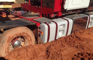
Snatch straps out, handheld radios out, start your engines and engage gears. Out it popped.
-
- Preparing to snatch.
-

- Hooked up to snatch the road train out backwards.
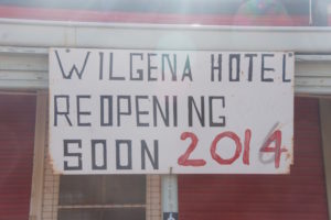
Dan and Steve will be ‘dining out’ on that exploit for years. Our next dining experience was at Tarcoola, a largely-abandoned service town for the Trans Australia Railway. Lunch.
-

- Winch
-
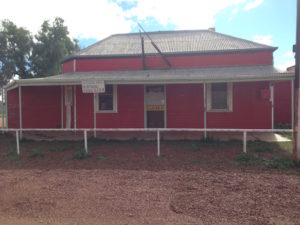
- Wilgena Hotel
-
- Variable opening
-

- Abandoned house
Leaving Tarcoola was problematic. However the side tracks weren’t closed – and were perfectly passable.

The next impediment was that the road we planned to use to shortcut to Stuart Highway required permits – that we didn’t have.

No option but to head to Kingoonya and Glendambo. We were blown into Kingoonya by a near gale force wind that was non-existent at Tarcoola only 75 kilometres to the west-north-west.
-

- Kingoonya pub
Although the track north of Kingoonya towards Coober Pedy goes through the Woomera Prohibited Area, a permit is not required so we checked to ensure we had sufficient fuel and headed out.
-

- Track north from Kingoonya

After a short run north on Stuart Highway we turned off and found a bush camp, partly on the lee of a hill, offering a small amount of protection from the strong winds.
-
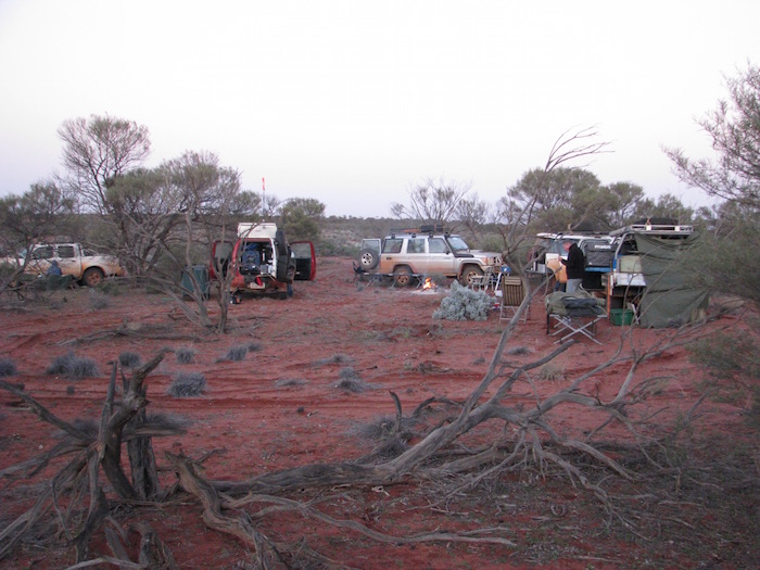
- Bush camp near Bulgannia
-

- Steve, Kerry and Dan around the campfire.
-
- Bush camp near Bulgannia.
-

- Kim at his camp.
-

- Day 6 Bulgannia to Oodnadatta
We threaded our way out of our overnight bush retreat back onto the access track and by 8.00 a.m. were underway north to Coober Pedy.
-

- Leaving camp
The first evidence of the opal fields starts about 55 kilometres south of Coober Pedy. Fences, signs, mullock heaps.
-

- Entry to Coober Pedy
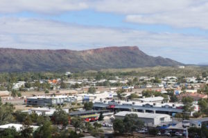
Coober Pedy is raw – the quintessential Australian outback mining town.
On arrival in town the group dispersed – showers, shopping, sightseeing.
-

- Blower
-

- Door to a dugout

-

- Coober Pedy lookout
-

- Too much spare time
-

- Innovative use of tyres
-

- Dugout entrance
-

- Scott and Dan investigate a mobile hopper
-

- Ross’s Rocket
We caught up again with John and Lesley, and Ken and Estela to hear of their adventures when they headed north from Wirrulla
Seven vehicles departed towards Oodnadatta around noon across flat, treeless gibber plains.
-

- Flat, open plains.
-
- Oodnadatta Track.
-

- Gibber plains.
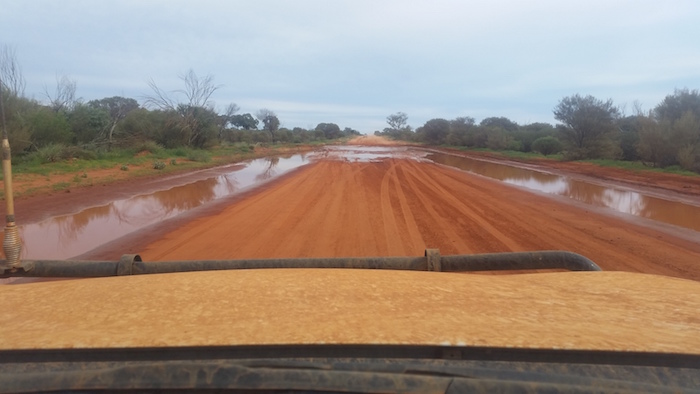
The Track had only just reopened and water was everywhere.
-

- Water laying everywhere
The lunch stop was at Lora Creek, 90 km from Coober Pedy.
-
- Lora Creek
-

- Lunch spot
-

- Lora Creek
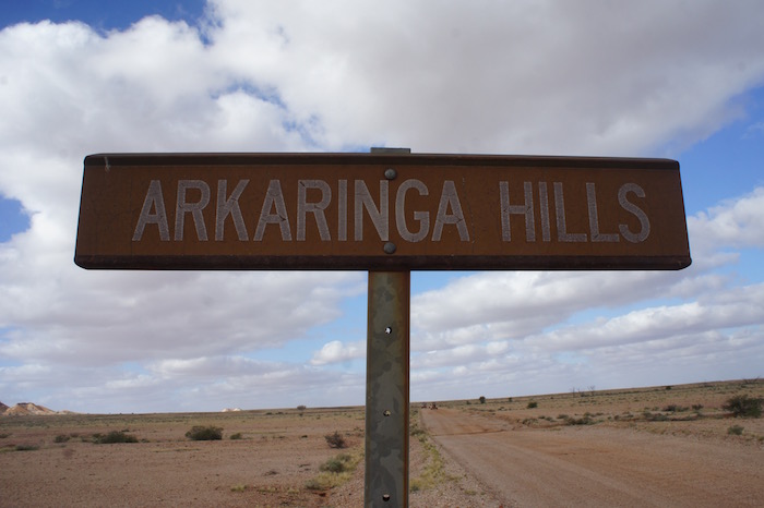
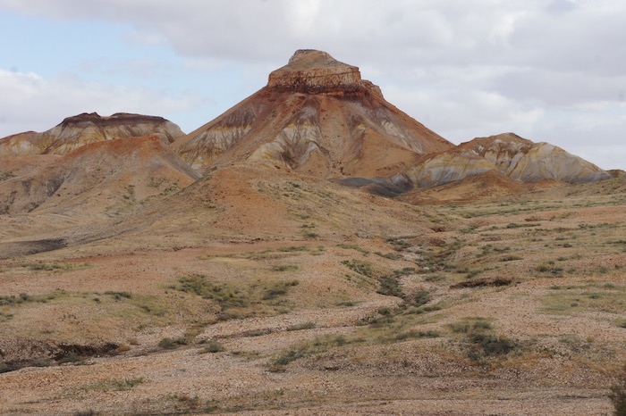
About 20 kilometres after the lunch stop we turned left towards Arckaringa and the Painted Desert. Lots of water on the road.


-

- Painted Desert

-

- Scott and Kerry.
-

- Steve, Dan, Lesley and John.
-
- Mesa.
-

- In the Painted Desert.
Later in the afternoon I started looking for a campsite. I was a fair way ahead of the convoy and spent some time trying to find Hookey Waterhole, eventually locating it. The sign said no vehicle access so we camped on the opposite side of the road at a beautiful campsite on the edge of Stony Creek or one of its tributaries.
We estimated that, between Coober Pedy and Hookey Waterhole, we had driven through a minimum of 60 places where water was across the road.
Scott had been aware of an unusual noise in the right rear wheel of his Jimny for some time and immediately on setting up camp he investigated. The diagnosis was a failed wheel bearing. He emptied weight from the Jimny and distributed it among the other vehicles. There was no option but to re-assemble everything and ‘proceed with caution’.
John had electrical issues. Resolved. Ken had stuff inside his caravan vibrating to bits.
-

- Day 7 Oodnadatta to Alice Springs
-

- Camp Hookey
-

- Hookey Waterhole
Next morning we drove into Oodnadatta and had to wait for the Pink Roadhouse to open at 8.00 a.m.
The operator of the Pink Roadhouse in Oodnadatta is a very pleasant chap. But don’t ever break down there! Even though he tried to help out Scott he had no Alice Springs phone book, couldn’t locate a scrap of paper to scribble on (used a tourist brochure), didn’t know anything about the possibility of buying wheel bearings in Alice (even though he has a quite substantial workshop) and was unable to locate a phone number for Repco, Coventrys, etc in Alice, even though he had done a Google search. How does someone like that operate in such a remote place?
Scott used the public phonebox to organise a new bearing to be available at Alice Springs.
-

- Pink Roadhouse Oodnadatta
At the turnoff to Hamilton we decided instead to take the Oodnadatta Track out to Marla on the Stuart Highway. We said goodbye to Steve who was going to work his way back to NSW via the Simpson Desert.
-

- Oodna Track Junction

-

- Another mudhole.
-

- Another mudhole on the Oodnadatta Track.
-

- Windscreen splash.
After lunch at Marla, Dan and Scott travelled together. Kerry and I rushed to The Alice to collect the bearing and (possibly) a car trailer before close of business the day before the town’s biggest event of the year.
Ken/Estela and John/Leslie proceeded at their own pace.
The bearing in the Jimny eventually gave out at a parking bay just short of Erldunda (the turnoff on Stuart Highway to Uluru).
I got into Alice Springs and collected the bearing with minutes to spare and then organised a workshop where it could be pressed on the next day. Kerry picked up the rental trailer and drove back to pick up Scott’s vehicle.
I booked into the caravan park and related to the manager the convoluted order in which our group would arrive. Ken/Estela and John/Leslie arrived shortly after. The rest of the crew arrived around 11.30 p.m.
The next day (Saturday) we got Scott underway with repairs at Stuart Highway Autos then went to the Alice Springs Desert Park.
-

- Two kites
-

- Kites
-

- Two whistling kites
Scott and Kerry visited the Transport Museum.
-

- Landrover
-

- Old Ghan Train
-

- Eight Wheeler
-

- Three wheel hauler
-

- Trayback tractor
-

- Vestey Bros truck
-

- 4WD
The caravan park had a ‘no fires’ policy. It was bitterly cold for all three nights of our stay in Alice Springs.
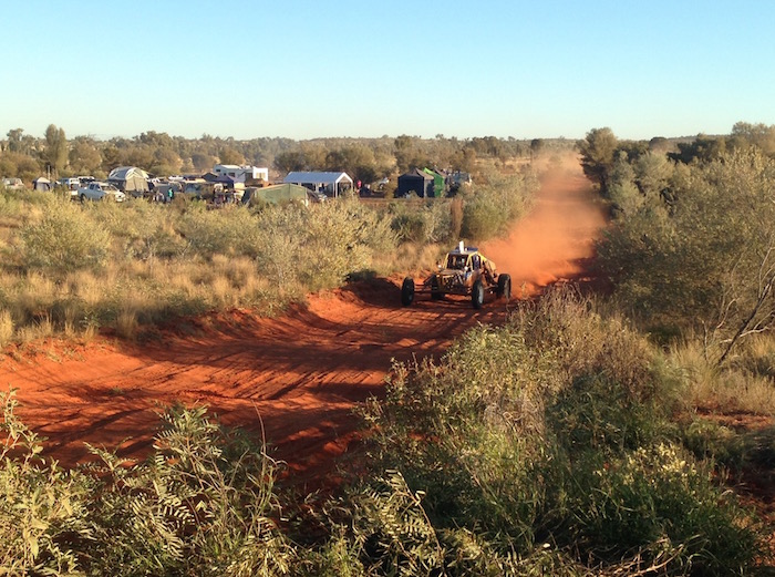
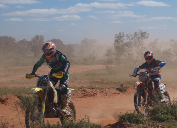
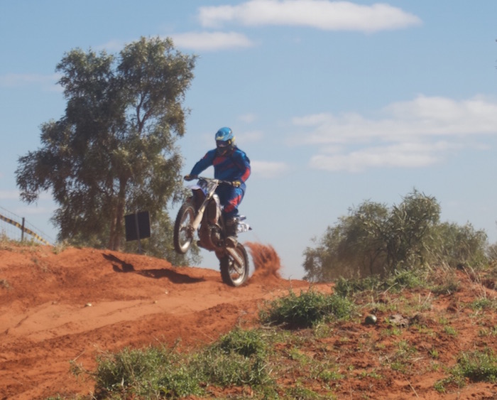
Sunday was the first leg of the Finke Desert Race – from Alice Springs to Finke (Aputula). We drove out along the Maryvale Road and stopped at the hill at the 30 km mark.
-

- Racing to Finke.
-

- Racing to Finke.
-
- Racing to Finke.
-

- Racing to Finke.
-
- Racing to Finke.
-
- Racing to Finke.
-
- Quad racing to Finke.
-

- On the way to Finke.
-
- Hill at the 30 km mark.
-
- Hill at the 30 km mark.
-

- On the way to Finke.
-

- On the way to Finke.
-
- On the way to Finke.
-
- On the way to Finke.
The field was through by early morning and it was then time for breakfast/lunch and a look around town.
-
- The spring after which the town was named. It’s actually a soak.
-
- Alice Springs
-

- from Anzac Hill
To get out the cold we caught a taxi into the Todd Tavern for dinner.
There is an abundance of features named ‘Finke’ in the NT and South Australia as a result of John McDoull Stuart’s explorations. The Finke River was named by Stuart on 3 April 1860 during his fourth attempt to cross the Australian continent from south to north. Stuart named the Finke River “after my sincere friend William Finke, Esq. of Adelaide, South Australia – one of the liberal promoters of the different expeditions I have had the honor to lead.” Other features and events linked to the name are Finke (Aputula), Finke Gorge NP, Finke Desert Race, Mt Finke (SA).
Permits to transit the Mereenie Loop road were $5 at the local tourist office.
-

- Day 10 Alice Springs to Kings Creek Station
Just before departing the caravan park at Alice Springs I phoned Kings Creek Station and booked us in – fortunately. We got the last sites.
The drive west from Alice Springs along Larapinta Drive is a tourist’s dream. So many easily accessible attractions in a relatively short distance.
Just out of town is the memorial to John Flynn, founder of the Royal Flying Doctor Service.
Simpsons Gap is a stunning gorge carved out of the West MacDonnell Ranges by Roe Creek. It has the same derivation as the Simpson Desert – A.A. Simpson, President of the South Australian branch of the Royal Geographical Society. A borefield on Roe Creek fifteen kilometres south of the town is the water source for Alice Springs.
-

- Simpsons Gap
-
- Roe creek, watercourse that created Simpson Gap
-

- Waterhole at Simpsons Gap
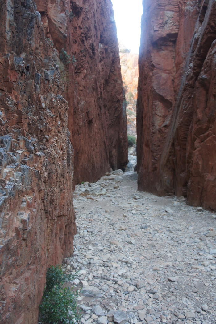
There was a definite chill in the air as we alighted from our vehicles at Standley Chasm. Time for a coffee before we headed for the Chasm. The gorge is said to be named after Mrs. Ida Standley, who came to Alice Springs in 1914 as the first Government school teacher and taught there for fifteen years. She is reputed to have been the first white woman to walk through the Chasm. The walls of the chasm extend to a height of eighty metres.
-
- Standley Chasm
-

- The walk into Standley Chasm
-

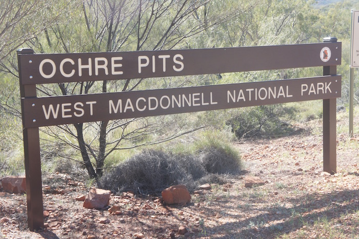
- Yellow and red ochre
-

- Ochre was a tradeable commodity
-

- Ochre Pit
-

- White ochre
Ochre was traditionally used by Indigenous Australians in ceremonies and was traded with neighbouring clans across the continent.
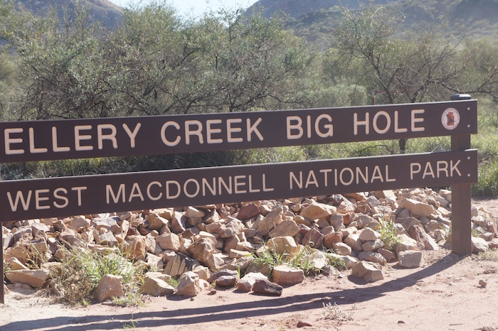
-
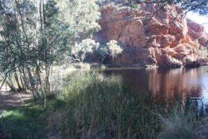
- Ellery Creek Big Hole
-

- Lots of shade
-
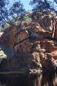
- Ellery Creek Waterhole
-

- Lots of water
-
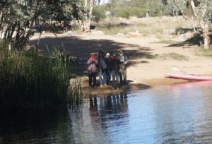
- Estela, Ken, Leslie, Dan and John
-

- Tranquil
Next stop was Ormiston Gorge, probably named by pioneer pastoralist J. Arthur Macartney after his Queensland property.
-

- Ormiston Gorge
-
- Kim and Ken at Ormiston Gorge waterhole
-

- Dan, Ken and Kim
After Glen Helen we passed Mount Zeil, the NT’s highest peak, and continued on Namatjira Drive till its intersection with Larapinta Drive. From here we turned right to do the ‘Mereenie Loop’ (now promoted as the Red Centre Way). This dirt road allows tourists to access Kings Canyon without returning to Alice Springs.
-

- Stand of desert oaks on Namitjira Road
-
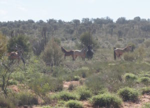
- Wild horses
-

- Wild horses running away
-

- Iconic piece of outback advice. The drum has been replaced numerous times
-
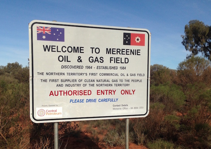
- Mereenie Oil and Gas
While stopped at the turnoff to the Mereenie gas operations a worker from the plant arrived in a 4WD and stopped to chat.
There are two main fields from which oil and gas are produced – the West Mereenie and East Mereenie. Gas is compressed and sent via a 1628 kilometre pipeline to Darwin. Oil and condensate is transported to Alice Springs via a 270 kilometres pipeline. From here it is transported to South Australia where it is on sold.
The plant has been reduced to 15 workers and needs the pipeline to Alice Springs to be upgraded to make it viable. Workers at the gas operation are FIFO, two weeks on, two off. He was heading down the hill to be a lollypop man while a fuel road train drove up the switchback.
-

- Switchback on the Mereenie Loop
-

- Switchback on Mereenie Loop
-

- Carmichael Crag in the George Gill Range – approaching Kings Canyon Resort from the west
Just past Kings Canyon I had a blowout, right rear.
-

- Shattered tyre
We camped at Kings Creek Station. We were initially frustrated at having nowhere to set up camp other than on access roads but one of the older station hands took over from the ‘backpacker’ staff member and allowed us vehicle access on to the lawn. Compared to Alice Springs it was not too cold.
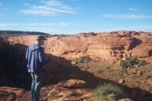
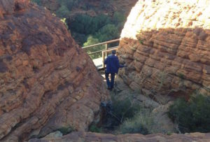
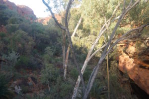
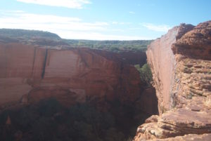
Next morning we drove 30 kilometres back to Kings Canyon. An 8.00 a.m. start to do the Rim Walk is fine in June but later in the year one would need to kick off at first light to avoid the heat. We took 2.5 hours start to finish. Many would take three hours or longer.
-

- Canyon near the start of the Rim Walk
-

- Canyon near start of walk
-
- Dan at canyon near start
-
- Dan
-
- Garden of Eden.
-

- Steps leading to the Garden of Eden
-

- Garden of Eden.
-

- Pool at Garden of Eden.
-

- Garden of Eden.
-

- Garden of Eden.
-

- Garden of Eden
-

- Garden of Eden
-

- Ken in the Garden of Eden
-

- Lookout to Kings Canyon. Difficult to access.
-

- Garden of Eden
-

- A view of Kings Canyon most people rarely see. It is difficult and dangerous to get to this vantage point.
-

- Ken at Pool
-

- Beehives
-

- Beehives
-
- End of beehive section
-
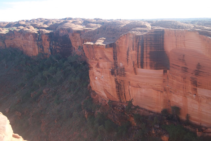
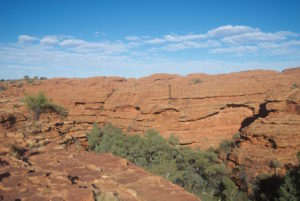
- Kings Canyon
-

- Scott at the rim of the canyon
-
- Kings Canyon
-

- Kings Canyon
-

- Ken, Scott and Dan
Leaving Kings Canyon we took Luritja Highway to the Lasseter Highway and made our way into Yulara.
After a bit of negotiation with Campground staff we secured a fire pit (half a 200L drum) and, once again, had a comfortable camp
At 9.00 a.m. next day we departed for ‘the Rock’.
-

- Uluru
On arrival, access to the Rock was closed and I decided to join the Mala Walk. Just as I was about to set off on the walk I noticed the gate being opened – the ‘climb’ had been reopened.
I climbed Uluru, while everyone else did the Mala Walk. It took me 1.25 hours (last time was 0.75 hours). Halfway down from the top I spoke with a bloke who had just travelled the Tjukaruru Road (section of the Great Central Road from WA/NT border to Yulara ) who told me it was in excellent condition. This was surprising news given my experiences of it on a number of occasions since 1996.
-
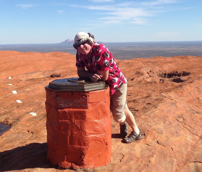
- Kim on top of Uluru.
-

- Top of Uluru.
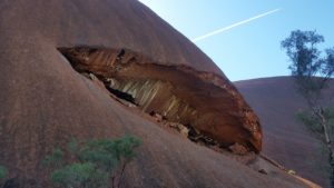
-
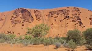
- Uluru tafoni.
-
- Ancient and modern
After lunch at the Interpretative Centre Kerry and I returned to Yulara. Other members of the group returned at various times throughout the afternoon and prepared for the trip home through the desert.
-
- Campfire at Yulara
-
- 13-Yulara to Giles
It rained overnight. We departed at 8.00 a.m. for Kata Tjuta / The Olgas.
-

- Kata Tjuta
-

- Emergency radio point
-
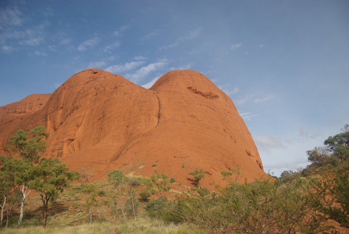
- Kata Tjuta dome
-
- Not something you see every day
-

- Infrequent occurrence
-

- Into the Valley of the Winds
-

- Tafoni at Kata Tjuta
-

- Ken
-

- Dan
We walked to top of the Valley of Winds walk. It was busy. Numerous group were coming and going.
Leaving Kata Tjuta we turned off the bitumen at the start of unsealed section of the Tjukaruru Road. Some deflated tyres slightly for the dirt road.
-
- Tjukaruru Road
The Tjukaruru Road was in good condition although there were numerous mudholes for many kilometres – the bloke I spoke with half way down Uluru wasn’t lying.
-

- Also known as Tjukaruru Road
Stopped for lunch under some desert oaks at Puta Puta, in the Petermann Ranges, near Chirnside Creek.
-

- Lunch at Puta Puta
Next stop was Lasseters Cave at Tjunti, not far from Docker River. It was here that prospector Harold Bell Lasseter sheltered for 25 days in January 1931 after his camels deserted him. He was later found dead by Bob Buck, well-known bush man of central Australia. More information.
-

- Estela at Lasseters Cave (Tjunti)
-

- Hull River at Tjunti
-

- Plaque at Lasseters Cave
-
- Lasseters Cave
-

- Kerry at Tjunti
-

- Hull River at Tjunti
From Tjunti it is only a short run to the NT/WA border.
-

- WA section of the Outback Way
-
- Its a real problem
The convoy had spread out a bit by Warrakurna and it was clear that the pace of the trip was a little too fast for the guys towing.
Giles Weather Station is about a kilometre north of the roadhouse/settlement so we took the opportunity to see one of the Gunbarrel Road Construction Party’s graders. A part of the Blue Streak rocket launched on 5 June 1964 from Woomera found 50 kilometres south-east of Giles in 1980 is on display at the Weather Station.
-
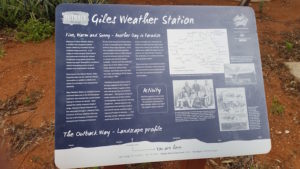
- Giles Weather Station
-

- Remains of Blue Streak rocket
-

- The Gunbarrel Grader
-

- Gunbarrel Road Construction Part grader
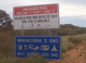
Kerry topped up at Warakurna roadhouse (diesel $2.45/litre). Cheapest fuel in town. We left Warakurna looking for a camp for the night, deciding on Yarla Kutjarra
Minutes after we set up camp we were joined by Sebastian and Marion, a young French couple in Australia for a year travelling in a Mitsubishi Challenger 4WD wagon. They were to stay with us for the rest of the trip.
-

- First campsite on the Great Central Road
-
- Day 14 near Giles to to past Chooka
John and Lesley and Ken and Estela decided to head home at a slower pace. Scott, Kerry, Dan, Seb and Marion, and I departed from our overnight camp spot in a new convoy.
-

- Just before leaving camp
From Warburton to Heather Highway turnoff the Great Central Road (GCR) is bitumenised. I’m sure the locals appreciate it but is somewhat detracts from the ‘Outback Experience’.
While waiting for the service station to open at Warburton (9.00 a.m.) I changed the fuel filter on the Rodeo. This is better done on a hoist rather than lying on one’s back in the gravel forecourt of an outback servo.
-

- Near Tjukayirla
-

- Seb and Marion
-

- Taking a break on the way to Chooka
-

- This desert kurrajong – Brachychiton gregorii – is known as the Kurrajong Sentinel, 17 km east of Tjukayirla.
After refuelling and lunch at Tjukayirla we headed west on the GCR and discussed over the radio whether we should visit Empress Springs. It had long been an interest of mine. Fifteen kilometres west of ‘Chooka’ the David Carnegie Highway leads off to the north – to Breaden Bluff and Empress Springs – before eventually intersecting with the Gunbarrel Highway. The track continues north of the Gunbarrel from where is is known as the Eagle Highway – but often the entire track from the GCR is termed Eagle Highway.
-

- Camels on David Carnegie Track
-
- Breaden Bluff
-

- Breaden Bluff
-

- David Carnegie track
Empress Springs was discovered in 1896 by David Carnegie.
-

- I wonder what was on the missing sign?
-

- At Empress Springs.
-
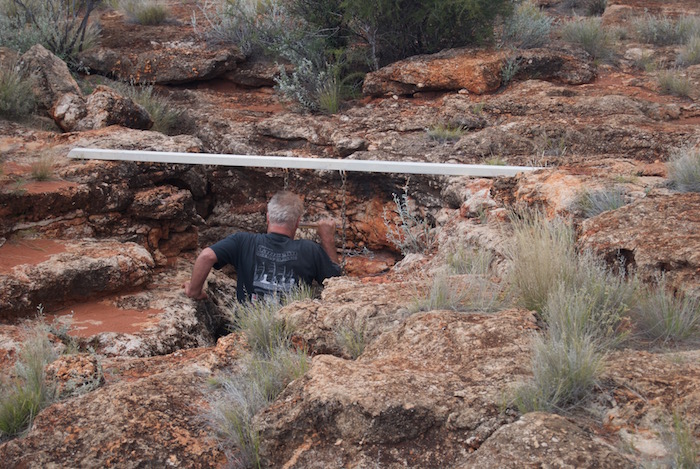
- Scott entering Empress Springs.
-
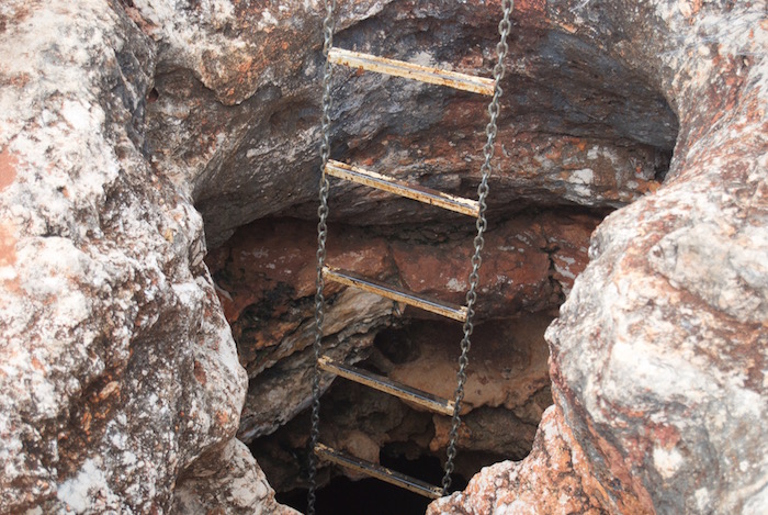
- The chain ladder into Empress Springs is quite robust, however, the mounting of the support beam is a bit sketchy.
-

- Dan descends into Empress Springs.
-
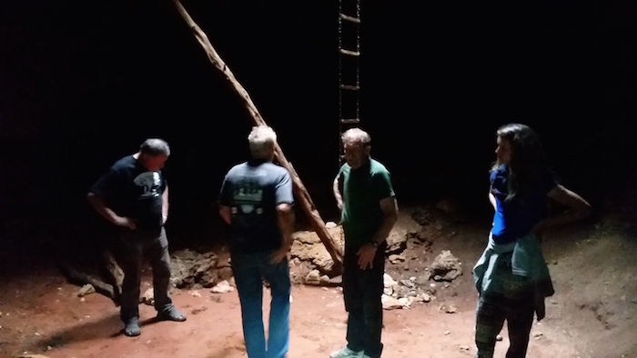
- In Empress Spring.
On the return to the GCR we stopped to collect wood and noticed that Seb’s vehicle was leaking fuel. Scott was carrying some metal sealant that solved the problem.
-

- Last light on the Great Central Road.
The aim was to reach a campsite 95 kilometres to the west but as darkness fell I swung into a earlier parking bay and drove through to the tracks beyond. It opened into a very large gravel pit with masses of wood for our campfire.
The rain blew in horizontally overnight. Not pleasant.
-

- Day 15 near Cosmo Newberry to Koorarawalyee
We planned for an early departure to give us extra time to tour the abandoned mining town of Gwalia. Away by 7.00 a.m.
The clouds cleared at Cosmo Newberry. We refuelled at Laverton ($1.68/litre) and pushed on to Leonora, then Gwalia.
-

- Old Gwalia


-

- How to fix a wheel
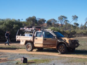
Dan had to meet his dad in Kalgoorlie to swap a fridge and satphone. Kerry and Scott refuelled and went shopping. I took Seb and Marion to the Superpit.
-

- Superpit, Kalgoorlie
It took a bit of coordination but we eventually departed Kalgoorlie at 3.50 p.m., heading for Koorarawalyee. Clearly we were going to arrive after dark. Having refurbished the well and harvest walls at Koorarawalyee over the Anzac Day long weekend in 2016 we knew that it was a good campsite.
-

- Campfire at Koora
DAY 16 – Koorarawalyee to Perth
Rather than return to to the bitumen we took back tracks to Karalee Rocks and Dam. This National Trust site is a fascinating example of railway support engineering.
-

- Karalee aqueduct
-
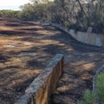
- Harvest walls
-

- Aqueduct at Karalee
-

- Karalee
From Karalee we stayed on a bush track to find Morlining Rock and Well.
-
- Morlining Rocks

After Morlining the track opened out, straightened out and led to an unnamed lake three kilometres to the east of Yellowdine. The track along the margin of the lake intersects with the Yellowdine Marvel Lock Road and within a 100 metres leads to Great Eastern Highway.
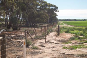
Into Southern Cross to refuel. At Carrabin we turned off the blacktop onto the Goldfields Road and followed it to the site of the historic Rabbit Proof Fence.
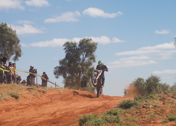
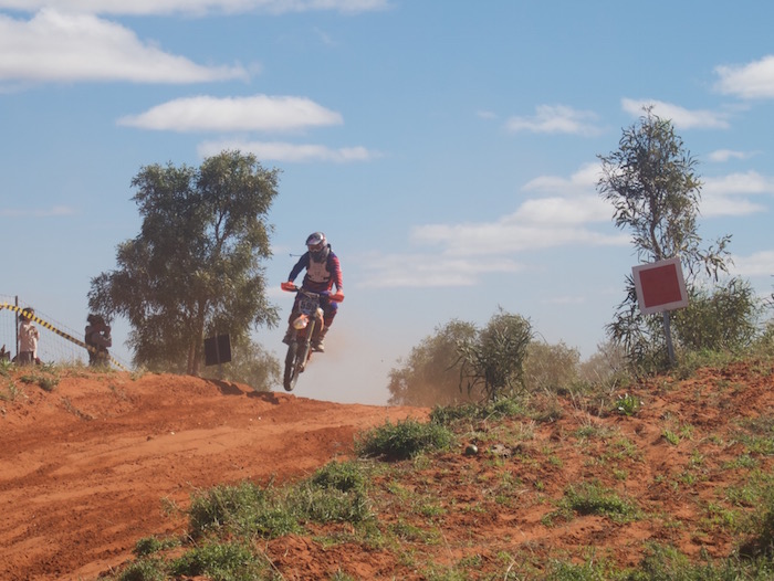
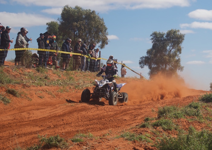
We left the Rabbit Proof Fence, intent on finding Hunt’s Burracoppin Well. This would be the third search for this important historical well. The area near the carpark (signposted ‘Hunts Well 1865’) is a motocross track and after two previous unsuccessful searches we were starting to believe that the well had been destroyed with the construction of the track.


While onsite at the carpark I contacted former champion rally driver and outback explorer, Stuart Kostera, who now has a keen interest in pioneer wells. He told me that he had spent the best part of a day searching for the well and had eventually located it some distance from the signposted location. Following his directions, I was able to quickly find it.
From there it was a straight run home.
Our Red Centre Tour took place in June 2016.
© 2016-2019
Feel free to use any part of this document but please do the right thing and give attribution. It will enhance the SEO of your website/blog and Adventures.
6177 words, 305 photographs/images.
See Terms of Use
Text by Kim Epton
Photographs by:
Scott Overstone
Steve Sporne
Dan Wales
Kim Epton