
It is a long slog up the bitumen to Perenjori via Muchea, Bindoon, Dalwallinu, Wubin.
With no reason to stop in Perenjori we continued north for a few kilometres before turning east, intending to travel to Kadji Breakaways and camp the night there but the access (Kadji Lake Road) is closed (permanently it would seem).
-

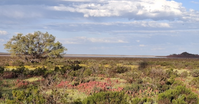
- Lake Nullewa on the way to Kadji Road.
Koolyanooka Springs
We returned to Koolyanooka Springs to camp overnight.
Koolyanooka Springs Campground is a huge area with any amount of wonderful campsites – with easy access for caravans. It has toilets, barbecues and fireplaces.


-

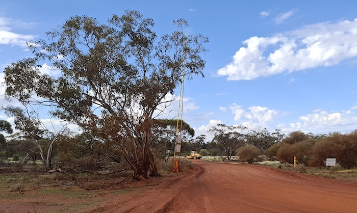
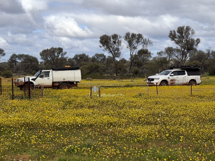
- Koolyanooka Springs is just outside the western boundary of the Park.
Karara Rangeland Park
From Koolyanooka Springs the next morning Mungada Road took us into the Karara Rangeland Park.
-

- Karara Rangeland Park
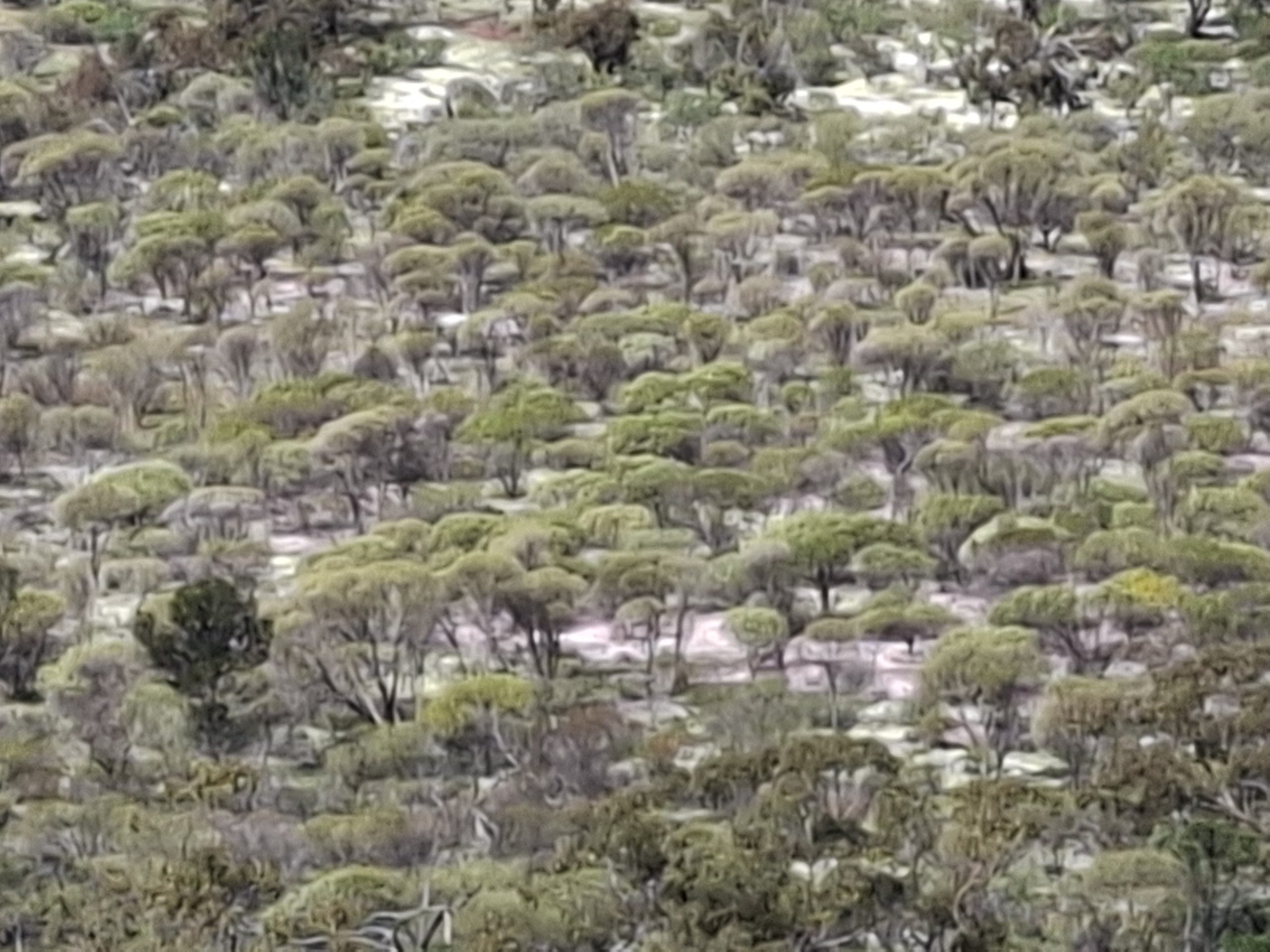
The Park encompasses a variety of distinct landscapes, species and habitats in its 5600 square kilometres. It is larger than 40 of the world’s sovereign countries.
The Department of Parks and Wildlife acquired Karara, Lochada, Kadji, Kadji, Burnerbinmah, Warriedar and Thundelarra pastoral stations, and a number of timber reserves to create the Park. While the land encompassed in the Park is contiguous it is somewhat irregular in shape.
The obvious avoidance of the names of these pastoral stations in any official publications is bureaucratic historical revisionism in action. Disgusting! Shame on DPaW and their woke agenda.
Having been thwarted yesterday by the closure of the Kadji Lake Road we tried to get through to the Kadji Breakaways on the Kadji Mellenbye Road. It was not to be. Long stretches of water/mud made it impassable. We returned to Mungada Road and continued east.
Lochada Track
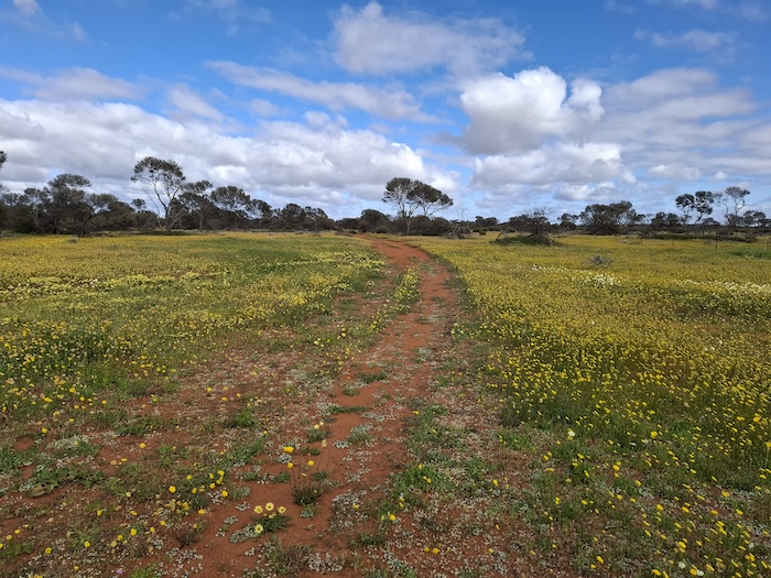
The Lochada Track heads south off Mungada Road. This track runs through what was once Lochada Station before it was incorporated in the overall Karara Rangeland Park. The wildflowers along the Lochada Track were spectacular. They spread into the bush out of sight. Tall, thick and lush.
Karara Homestead
The Lochada Track eventually brought us out on to Karara Road.
-

- On Karara Road at the end of Lochada Track.
-

- Wonderful display of wildflowers near Karara Homestead.
From this intersection we headed up to what I thought was abandoned Karara Homestead. On arrival we met Jürgen. Caretaker keen for a chat.
-

- Jürgen and his dog. Caretaker at Karara Station.
He gave us a guided tour of the place and then provided directions on how to drive directly to John Forrest Lookout. Jürgen is an accomplished amateur photographer, specialising in wildflowers. The first of his two pics has been used as the Featured Image for this article.


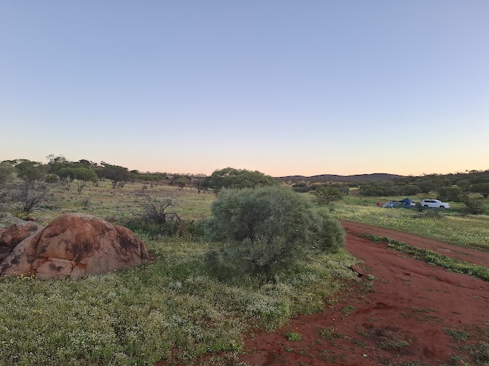
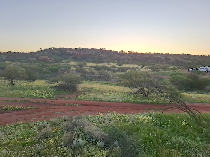
John Forrest Lookout
This lookout is in the Damperwah Hills which John Forrest discovered and named in 1869 during his search for missing German explorer Ludwig Leichhardt.
-

- Cairn at the top of the Lookout.
-

- The lookout provides 360° views of the Rangelands.
-

- Topograph at the top of the Lookout.
There is interesting and informative topograph – a plaque that gives gives distances and directions to features and/or places – on the top of the Lookout.
-

- The rocks in this vicinity are full of iron and are known as BIF – Banded Iron Formation.
-
- The ground between the trees is totally carpetted with wildflowers.
Sadly, the Bicentennial Plaque at the Lookout is in error. Forrest did not visit Cue and Day Dawn on an expedition as a surveyor in 1897. At that time he was (the first) Premier of Western Australia. There are numerous websites that blindly repeat this obviously incorrect information without first checking it. Fact checking official plaques may seem unnecessary but, clearly, it is not. Here’s another egregious example of a plaque that was in error for 33 years until I fixed it i(with the help of numerous others) in 2022.
-
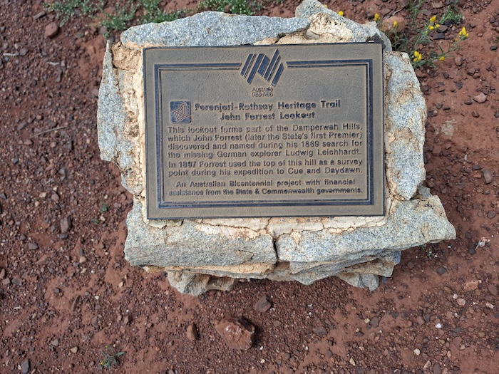
- Bicentennial Plaque
The climb to the Lookout is reasonably easy, even for someone with mild mobility issues, although it is not wheelchair accessible.
There is a large barren area at the bottom of the Lookout designated as a campground. We took the opportunity to have lunch.
Camel Soak
Camel Soak is towards the south-west corner of the Park. This granite water catchment was sunk as a watering hole for men and their camels working on the No. 2 Rabbit Proof Fence between 1903 and 1906.
-

- Bicentennial Plaque at Camel Soak
-

- Camel Soak
-

- Red-tail Black Cockatoos at Camel Soak.
-

- Popular spot for caravanners.
Old Rothsay Road
We took old Perenjori-Rothsay Road to Damperwah State Farm. If seeing not-very-old buildings in ruins is your thing it might worth a visit, otherwise don’t bother.

A long, churned up mudhole presented a challenge. I got stuck about two thirds of the way through. After reversing back a vehicle length and down shifting I got out. The Ranger took a slightly different line and made it through at the first attempt.
-

- Along old Rothsay Road.
-
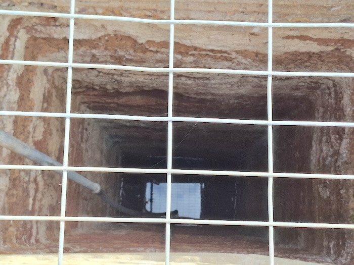
- Entry to Rothsay Gold Mine.
-

- At entry.
The track is good but a little bumpy all the way to Rothsay Mine.
-

- At Rothsay Cemetery.
An aluminium plaque listing the burials in the Rothsay Cemetery was securely attached to a tree by the crew at WA 4WD. These guys get around and have good stuff on their website.
Warriedar/Lake Monger
We visited abandoned Warriedar Homestead where Track Care has done some restoration work and then drove to the Lake Monger camping area.
-

- Our camp on the margon of Lake Monger.
-
- Lake Monger.
-

- Pinyalling Hill.
-

- Recursive island in Lake Monger.
Sunrise at Lake Monger
The aspect to Lake Monger from our campsite was amazing. Why we go bush. Sunrise was special.
-

- Wildflowers by the lake at sunrise.
We left a very picturesque campsite at Lake Monger, headed for Thundelarra.
-

- North-eastern end of Lake Monger.
-

- On the Old Warriedar Road.
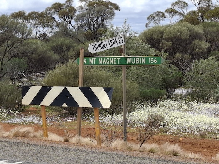
Thundelarra
After a visit to Fields Find Cemetery and an abandoned gold operation we continued to Thundelarra.
-

- Abandoned shaft
-
- Two metre high earthern walls of a leach dam.
-

- Leach dam.
The former Thundelarra pastoral station homestead is the DPaW headquarters of the Karara Rangeland Park. After a chat with the Ranger on duty to advise him of an unattended vehicle at the entrance to Meleye Campsite that I checked out on the way past, we left for 3 Mile Well.
3 Mile Well
-
- The track in to 3 Mile Well.
-
- Parked at well and yards.
-
- Well made well.
After leaving the homestead we deviated to the Monument Well track. The magnificent display of wildflowers continued all the way to 3 Mile Well. Fear of running out of fuel before reaching Paynes Find (the plastic junction of the fuel transfer system had split) necessitated a return to Thundelarra-Paynes Find Road. The vehicle was still at Meleye Campsite, however, there was a sole lady in attendance. She was ok and said she would liaise with the Ranger.
-
- Intersection of the Thundelarra Road with Great Northern Highway.
-

- We knew that, having just driven it.
Paynes to Koorda
The Paynes Find Roadhouse was a busy place. Signs on the bowsers indicate that fuel must be pre-paid. At $2.19/litre it is easy to see the logic in this. However, they have a more sensible approach to this procedure. Rather than try to guess what value of fuel you are going to purchase they just require that you leave an item of value (phone) with them while you fill up. Easy.
The drive south on Maroubra Road was uneventful. The wind and rain hit as we pulled into the Koorda Caravan Park.
Return to Cockburn
Driving, squally rain that created extremely limited visibility accompanied us for much of the three hour drive from Koorda to Cockburn, via Dowerin, Goomalling and Toodyay.
The Karara Rangeland Road Trip was from 2-5 September2024.
Distance 1200 kilometres.
Road Trip 2124-karara-rangelands. Download GPX File.
© Kim Epton 2024
1302 words, 42 photographs, one image.
Feel free to use any part of this document but please do the right thing and give attribution to adventures.net.au. It will enhance the SEO of your website/blog and Adventures.
See Terms of Use.