From Goongarrie
From the now-non-existent town of Goongarrie on the Goldfields Highway to Goongarrie Homestead, a DPaW Conservation Reserve about 14 kilometres west, the track is wide open and good travelling. It deteriorates after the turnoff to Davyhurst. The way we went.

-

- Paul and Andrew in the Pajero.
-

- Brad’s Troopy through the creek.
-

- Mushy and Ray through the creek.
-

- James takes his Jeep through the creek.
We emerged at the boundary of Goongarrie Starion about 30 kilometres further on and the track I wanted to take wasn’t visible. After a bit of consideration we headed west on a good track that we hoped would eventually get us to the abandoned gold mining town of Siberia.
Siberia
We had arranged to meet Scott Wilson, well-known Kalgoorlie prospector and President of the Eastern Goldfields Historical Society, at Siberia. He would join us for a couple of days.
I was hopeful that the track that we were ‘forced’ to take would eventually connect with the Daveyhurst-Ora Banda Road, however, halfway to that expected junction, we arrived at a pipeline and powerline access road. It looked to be a good track and I was reasonably confident it would intersect with the Daveyhurst-Ora Banda Road. It did – seven kilometres south. We continued on to our rendezvous with Scott at Siberia.
-

- Our convoy meets up with Scott at Siberia.
-

- The most impressive thing about current day Siberia is this intersection.
-

- Siberia cemetery
Wangine
Scott gave us a guided tour around Wangine – a place he has been familiar with for most of his life. The breakaways here are spectacular and extensive.
-

- Breakaway at Wangine.
-

- Spectacular Wangine breakaway.
-

- Multi coloured
-

- Short, steep watercourse from the top of the breakaway.
-

- Water erosion over the eons.
-

- Mushy and Steve at mini canyon
-

- Wangine’s version of the Bungle Bungles.
Track West
After lunch we tried to find the Gus Luck Track leading west from Wangine. In the late 1890s, Wangine was an important depot and stopping place. Despite a concerted effort by at least six vehicles the way west remained elusive.
We speculated on the course of the Track entering and leaving Wangine. Clearly the Track from Goongarrie accessed the hotel and other facilities below the breakaway. It would appear that it was on top of the breakaway before continuing on its westward course. Did the Track keep high on the breakaway with a spur to the depot and lodgings below or did it dip below and then make its way back up to the high ground. Difficult to know.
-

- The Gus Luck Track disappears into thick scrub.
As we determined during a follow up Trip in late October, the Track to the west exists but passage for motor vehicles is currently not possible.
Head West
We made the decision to skirt the impassable country by going south to Siberia and then west across former pastoral country (ex Credo). As we were heading west Scott recognised some mining exploration tenements that he held in this area many years ago.
We were not certain that the track would connect with Coolgardie North Road but it did eventually bring us out to our destination on that road. A short drive to the north on this major dirt road brought us to the track to Coonmine.
Although it was getting late in the day I figured we could get a few kilometres along the track towards Coonmine. We eventually found a great campsite a couple of kilometres in.
-

- We camped in a stand of Goldfields Blackbutts.
-

- Our camp near what many people believe to be the start/finish of the Gus Luck Track but what is, in reality, an old station track.
Gus Luck Track
This day we would cover most of the Gus Luck Track.
-

- ROUTE OF THE GUS LUCK TRACK
Coonmine
First stop was Coonmine Rockhole, also known as Frost Soak.
-

- Coonmine Rockhole, also known as Frost Soak.
-

- James, with coffee, at Coonmine Rockhole.
-

- The location of the well/soak at the various rocks is not always obvious and a directional sign is helpful.
-

- Along the Track.
Turturdine
The next soak/rockhole along the Track is Turturdine. The location of the water at this rock is not immediately obvious, however, an arrangement of rocks in the shape of an arrow points to the soak.
-

- From the top of Turturdine.
-

- The arrow points the way to the water.
-

- Well made soak.

-

- Scott Wilson at Turturdine.
-

- Graffiti or history.
Coppicing
Throughout the day we were fortunate enough to have Scott share his knowledge of the geology and history of the area, among a number of other subjects. We stopped a few kilometres before Urdardanging and Scott explained the process of coppicing.
-

- Scott explained ‘coppicing’ to the crew.
Urdardanging
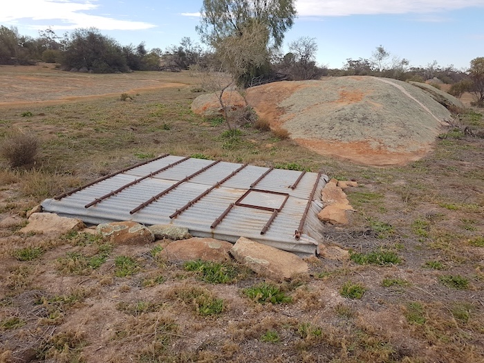
Next stop was Urdardanging Rock where there is a covered soak with plenty of water – and a grave 100 metres distant. This rock and Turturdine were often confused in official records. Urdardanging was also known as Dookie Rock.
-

- Covered soak at Udardanging.
-

- Grave at Udardanging.
-

- A balancing rock on the south-west side of Udardanging/Dookie Rock.
Pilarning Rock is 1.7 kilometres further on. We didn’t stop.
-

- On the track west of Udardanging.
Bush Fire Devastation
A huge fire had devastated the country last season. A seven kilometre swathe of bush was gone.
-

- The beginnings of regrowth after a devastating fire.
Ten kilometres before the Mount Walton Road we lost the Track – without realising it. It was only after a few hundred or so metres that I realised we were not following the planned route. But there was no turnoff or junction. Very deceptive. I radioed to Scott at the rear of the convoy and he was able to pick up the faintest of tracks off to the left – the real Gus Luck Track. We turned around and retraced our route. Clearly most, if not all, travellers would follow the good, open track to the Mt Walton Road turn left, drive south for five kilometres and pick up the Gus Luck Track again. And the situation is little better for those doing the Track in the opposite direction, from Yellowdine. As we discovered on a follow up Trip in October travellers are led away from the real Gus Luck Track to this more open roadway. Very few, if any, travellers are driving the actual Gus Luck Track for the 20 kilometres east of the Mount Walton Road – as evidenced by the lack of tyre marks and the overgrown condition of the real Track.
Washaway
Apart from the navigational challenges in this stretch of the Track, there is a 100 metre washaway that could present a few challenges in the wet.
-

- Washaway
-

- Rodeo in the washaway
-

- Mount Walton haul road
71 Mile Rock
Not far west of the Mount Walton Road is 71 Mile Rock – an important stopping place in times past. Today’s track does not led directly to the rock and well. The narrow, rough, and overgrown offshoot, while not obvious, does lead directly to the base of 71 Mile Rock.
-

- 71 Mile Rock
-

- The well at 71 Mile Rock. It is surrounded by dense thickets and is difficult to find.
-

- 71 Mile Rock
Wallangie
Wallangie is 15 kilometres further on. This was a large and important water point on Juardi Station.
-

- Vehicles parked at Wallangie Dam.
-

- Ives Rock at Wallangie.
-

- Covered water at Ives Rock.
-

- Ives Rock Soak at Wallangie.
-

- Wallangie Dam.
We were approaching the Trans Australian Railway. Since the Mount Walton haul road we had been travelling through what was once Juardi Station, now a DPAW Conservation Reserve.
-

- Disused and unmaintained dam on what was once Juardi Station.
-

- Ullambay Soak
Darrine
At the Trans Line the dirt track parallels the rail track for 200 metres before crossing over and then continues alongside it for a further two kilometres before turning away to the south. Darrine Soak is a couple of kilometres further on. Signatures/graffiti on the lid of the soak roof at Darrine date back to 1939.
-

- It is from this graffiti that we learn Roly Dimer, government dogger out of Kalgoorlie, was here in November 1958. Quite a few preceded him and many others followed.
-

- Brad at Darrine.
-
- The covered rockhole at Darrine.
We came across some potentially boggy parts of the Track after Darrine and took to the (burnt out) bush to get around it. Except for Brad and Scott who were determined to demonstrate Toyota exceptionalism.
-

- Brad didn’t take the detour.
-

- Scott didn’t take the detour, either.
Eva Lake
The afternoon was wearing on and it was time to start looking for a campsite. Though there was sufficient time to reach Weowanie Rock I knew there would be insufficient wood there so I determined to stop just short of that feature.
-

- Burnt out country north of Eva Lake.
Responsibility for campsite selection was with Mushy and he soon found a clearing only 50 metres off the Track large enough for all vehicles and replete with plenty of firewood. In addition it was on high ground – away from the low lying Eva Lake and eastward portions of Lake Seabrook.
-

- Crossing Eva Lake.
-

- We were indeed fortunate that we crossed Eva Lake before it rained.
-

- It does not take much for Eva Lake to make the Track impassable.
Rain, rain, rain
Scott left us at this point and made his way south to the Great Eastern Highway. The weather was starting to look threatening. We were coming into range of broadcast radio stations and the weather forecasts for later in the night and early the next day were dire.
The evening passed as usual and everyone went to bed reasonably early. Some made preparations and packed their camp that night. The rain arrived about 1.00 a.m. It rained and rained and rained.
-

- On the Gus Luck Track.
Difficult Just To Get To Track
Without any urging, everyone was up before first light, packing away a sodden camp. The rain kept coming. There was no time for a cooked breakfast – just grab whatever was available. By 6.00 a.m. everyone was ready to leave.
The 50 metres from our campsite to the Track was looking problematic. Soft, sodden mud although it appeared as if the base was firm. I walked out to the Track. Water was flowing down it eastward towards Eva Lake. At least it was reasonably firm under the rivers of water. Maybe we weren’t going to be stuck here for a week.
-

- Paul had no trouble.
-

- Nor did Steve.
I asked the lightest crews to drive out first and those with diff locks to come out last. As all made it to the Track without too much stress I suppose it was anticlimactic, however, there was still another 13 kilometres of potentially flooded track to get through.
-

- Lined up on the Gus Luck Track and ready to go.
Weowanie
Just over two kilometres along the Track it T junctioned with the Yellowdine Vermin Proof Fence. After some hesitation and discussion over the radio I decided to head to the right. Within 700 metres we arrived at a gate through the Fence, a sign opposite the gate displaying ‘Juardi Station’, and the track clearly continuing on the other side of the gate.
I was pretty confident I knew where I was, having been here once previously – but on the other side of the Fence. We passed through the Fence and within a few kilometres arrived at Weowanie.
-

- Weowanie was wet.
-

- Granite outcrops shed a lot of water.
-

- Andrew took the opportunity for a foot wash,
-

- Weowanie Tank
Yellowdine
Track conditions had improved remarkably but I was still very concerned about the next seven kilometres (particularly a part that traverses a section of Lake Seabrook) before we would get to the all weather Koolyanobbing-Marvel Loch Road. While rough, rutted and torn up in places it was passable and did not present any real issues. We stopped at Duladgin Well.
-

- In poor condition condition and getting worse.
The drive to Yellowdine was sloppy but without worry.
Cheap diesel at the roadhouse was a bonus. Mushy and Ray, Paul and Andrew, and James and Tim decided to head home down Great Eastern Highway. The others continued on to the Mount Palmer Track.
© Kim Epton 2020-2024
2050 words, 63 photographs, 1 image.
Photographs
Kim Epton
Jane Dooley
James Hay
Michael Orr
Ray Dowinton
Feel free to use any part of this document but please do the right thing and give attribution to adventures.net.au. It will enhance the SEO of your website/blog and Adventures.
See Terms of Use.
