
Day 30 Yulara to Marla
I made a donation to the NT consolidated revenue coffers leaving Yulara and headed east on the Lasseter Highway to Erldunda.
-

- The Red Centre Way
-

- The Red Centre Way
At Erldunda we turned onto the Stuart Highway and headed south – 117 kilometres to the iconic Kulgera Pub and Roadhouse.
-

- The Last Hotel in the Territory.
-

- Kulgera
-

- Kulgera Police Station
-
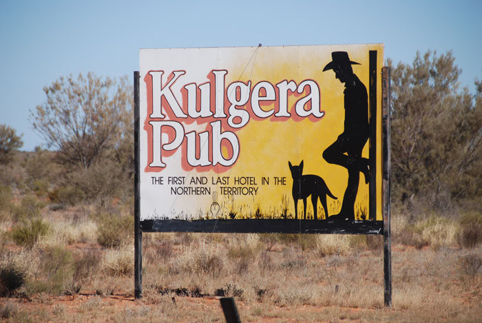
- The famous roadside sign.
Crossing a border anywhere is always an occasion and in Australia there are not many opportunities to partake in the experience. From NT to SA is not that significant and without the signage one wouldn’t be aware of the change in jurisdiction.
-

- Approaching the South Australian border.
-
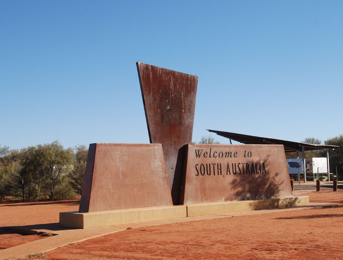
- At the Northern Territory / South Australia border.
-

- Always worth a visit.
-

- Multilingual advice for tourists.
-

- Heading south on the Stuart Highway.
-

- Goods train heading north on the Ghan line.
-
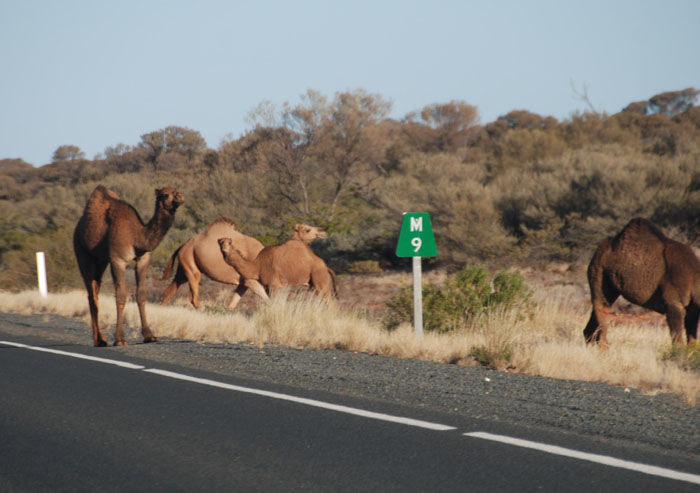
- Feral camels north of Marla.
We found a patch of grass at the Marla Caravan Park where we stayed the night.
Day 31 Marla to Ceduna
Four hundred kilometres into South Australia is the raw, outback opal mining town of Coober Pedy.
-

- On the Stuart Highway entrance to Coober Pedy.
-

- Turnoff to Coober Pedy.
-
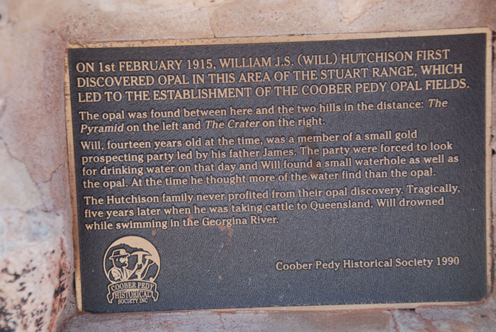
- Discovery of the Opal Fields.
-

- Tom’s working opal mine.
-

- Opal field
-

- The opal fields of Coober Pedy.
-
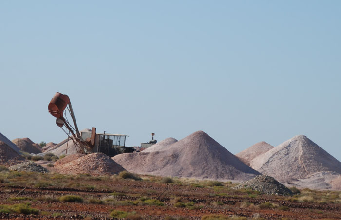
- Mullock heaps
-

- Gem shop in Coober Pedy.
-

- Fayes underground home
-

- Entrance to the Bedrock Hotel.
While travelling south on Stuart Highway before we reached Glendambo we came across a Wedgetail Eagle feasting on roadkill. Tammy was quick to get the camera into action and secured some fantastic shots.
With a wingspan of up to 2.8 metres, the Wedge-tailed Eagle is Australia’s largest bird of prey and one of the largest in the world. They are found all across Australia, mostly in open country.
-

- Wedge-tailed Eagles are an important part of the road cleaning cycle.
-

- The magnificent Wedge-tailed Eagle beautifully captured as it takes off.
-

- Massive wingspan of the Wedge-tailed Eagle.
I intended to take the dirt track past Lake Gairdner through to Ceduna, saving many kilometres against driving all the way south to Port Augusta on the bitumen. While Gosses Road would have been shorter still, I decided to take the more travelled Tarcoola Road out of Glendambo. Longer but safer. We were in a single vehicle and Tammy was unwell.
-

- Welcome to Glendambo.
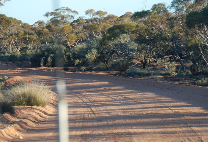
The Tarcoola Road takes one to Kingoonya and then a another dirt road winds its way south through lake country to Ceduna where the Eyre Highway commences. Kingoonya is an important depot on the east-west railway, the sole rail link across the continent from Sydney to Perth.
-

- Good advice.
-

- Roads are quite often closed.
-

- Windmill on the approach to Kingoonya.
-

- Kingoonya pub.
-

- Anything to amuse the tourists.
-

- Hello Backpackers
-

- Fallen splendour of times past.
-

- The East West Railway.
-

- The way south out of Kingoonya.
This track out of Kingoonya is sometimes termed the Gawler Ranges Road. It is generally in good condition and, providing there is no water/bog holes, it could be navigated by a 2WD. There were numerous bog holes when we travelled it, none of which presented any issue.
-

- Sturts Desert Pea (Swainsona formosa).
-

- To Lake Gairdner.
-

- Rain water collector.
-

- The roof is angled to direct (very infrequent) rain water into holding tanks.
-

- Lake Gairdner
-

- Grazing sheep.
-
- On the track.
-

- Along the track.
-

- Seen in the paddock, late afternoon.
We arrived in Ceduna after dark. It was drizzling when we booked into the foreshore motel. The pleasant atmosphere in the dining room overlooking the ocean could not lift the sombre feeling of tenseness.
Still more than 2000 kilometres back to Perth.