
Day 28 Alice Springs to Yulara
A common misconception is that Alice Springs and Ayers Rock are in close proximity. Even by the standards of The Outback the 446 kilometre distance separating them is not ‘close’. With much to see along the way it is a full day’s drive.
-
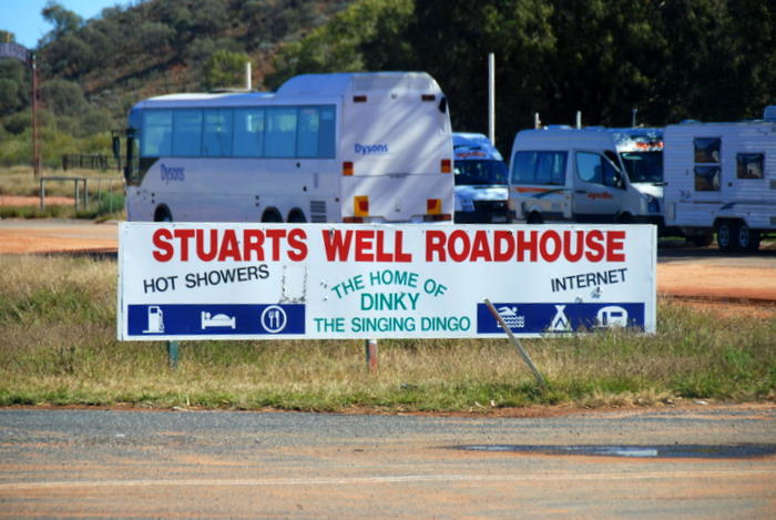
- Stuarts Well Roadhouse
-
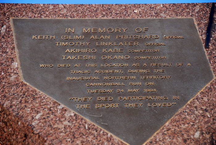
- Plaque commemorating the deaths of four participants in the ill fated Cannonball Run in 1994.
-

- On the road to Yulara.
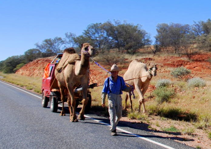
On Outback roads the unusual is not that unusual.
-
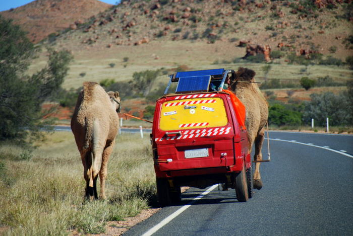
- On Stuart Highway north of Erldunda.
-
- Wanderer on Stuart Highway.
-
- On Stuart Hwy north of Erldunda,
-

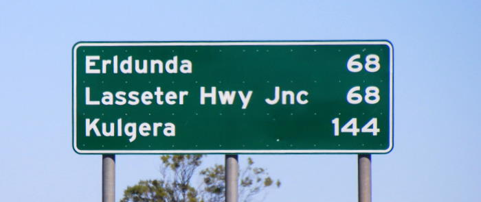
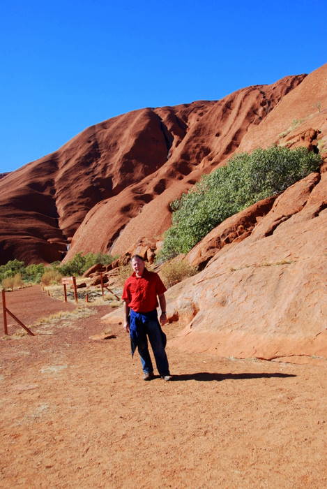
- At Erldunda on the Stuart Highway.
-
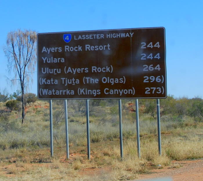
- The Lasseter Highway connects Erldunda and Yulara.
-
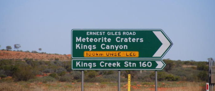
- At the intersection of Lasseter Highway and Ernest Giles Road.
-
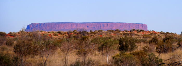
- Mount Conner – often mistaken for Uluru.
-

- Tammy at Mt Conner Lookout.
We arrived at Ayers Rock Campground at Yulara with plenty of daylight left and set up a comfortable camp.
-
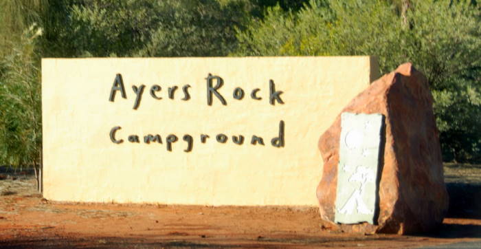
- Entrance to the Ayers Rock Campground.
The sand dunes behind the campground are a good location from which to view the ever changing hues of Uluru as the sun sets.
-

- Uluru at sunset.
-

- On the sand dunes behind the Campground.
-

- Uluru at sunset.
-

- Uluru at sunset.
-

- At Campground.
Day 29 Uluru
Yulara Campground is 21 kilometres from Uluru. The park managers have cleverly routed the road from Yulara to The Rock so that it gives an ever-changing vista. Specially located sites from which to view The Rock at sunset and at sunrise have been set aside and parking/stopping is prohibited in the vicinity of these lookouts so photographers/observers get a pristine view.
-
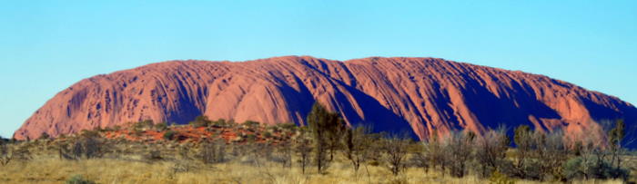
- Uluru
When climbing Uluru it is best to get an early start to beat the heat and the hordes of other tourists. There has been ‘political’ pressure to prohibit people from climbing The Rock for the past 20 years and perhaps longer. Political correctness will one day see it banned. Given that the Anangu used to lead climbing tours of The Rock (the fact of which is now conveniently erased from the record), their campaign to close the climb is hypocritical indeed.
-
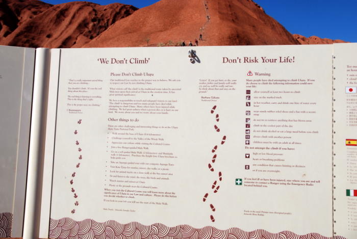
- Information Board at the start of the climb.
-

- Warning
-

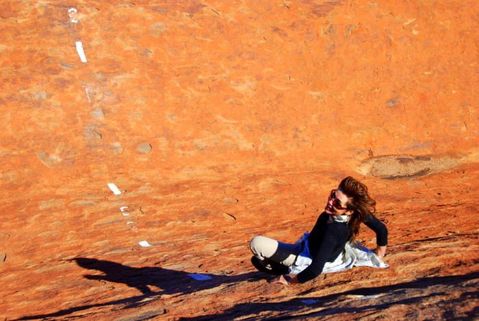
- Tammy on the first section of the climb.
-

- Taking a breather on the first section of the climb.
-
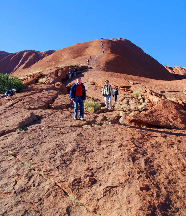
- Short break on the way up.
-
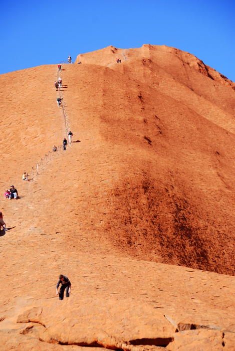
- Lots of people climbing.
-
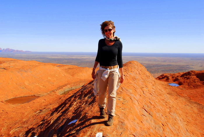
- Tammy on the way to the top.
-
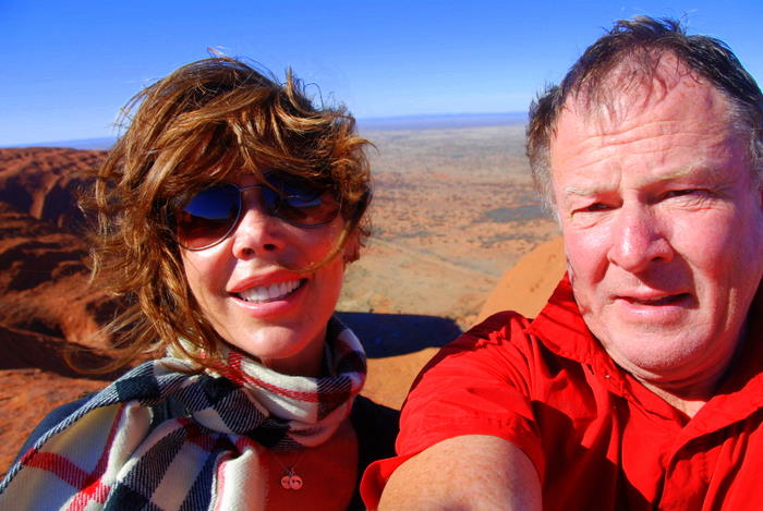
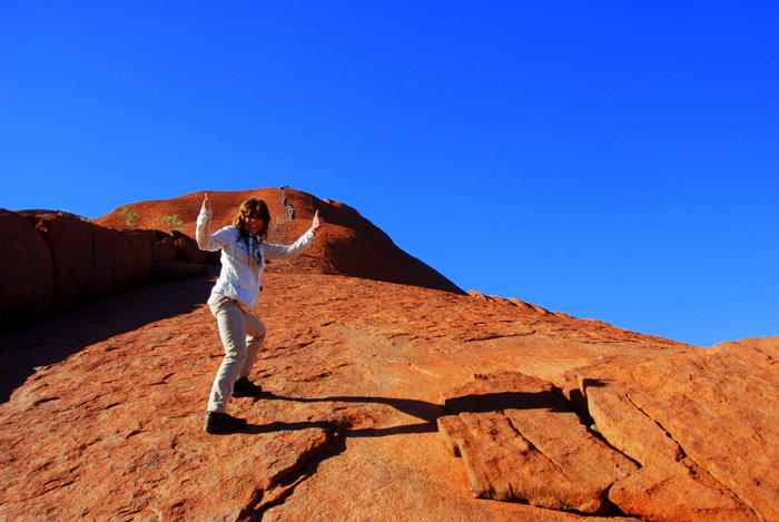
- Tammy and Kim at the top of The Rock.
Uluru is a 348 m high monolith (the world’s largest) with most of its bulk lying underground. It has a circumference of 9.4 kilometres and appears to change colour throughout the day. Sunrise and sunset are particularly spectacular and the park managers have set aside special viewing areas with road access, parking, and seating to give tourists the best views of The Rock at these times.
-

- Kim at the top of The Rock.
-
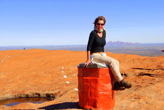
- Tammy at the summit marker.
-
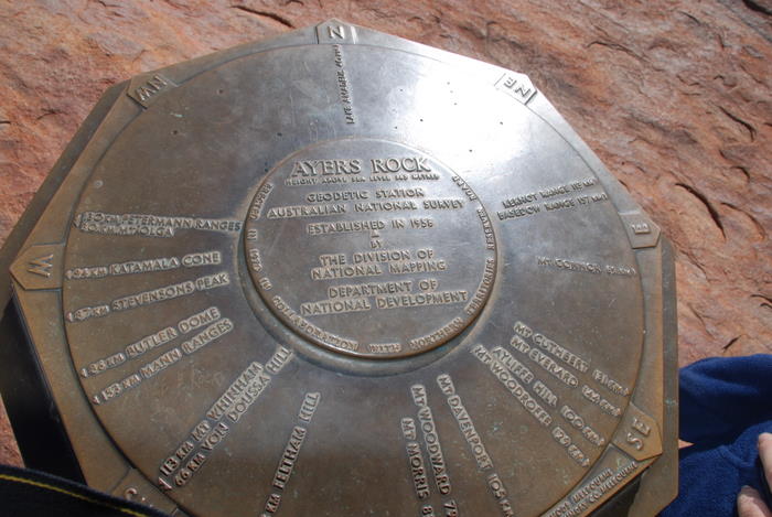
- Marker at the top of Uluru.
-

- Tammy resting at the top of The Rock.
-

- At the top.
-

- Kim and Tammy at the top of Uluru.
-
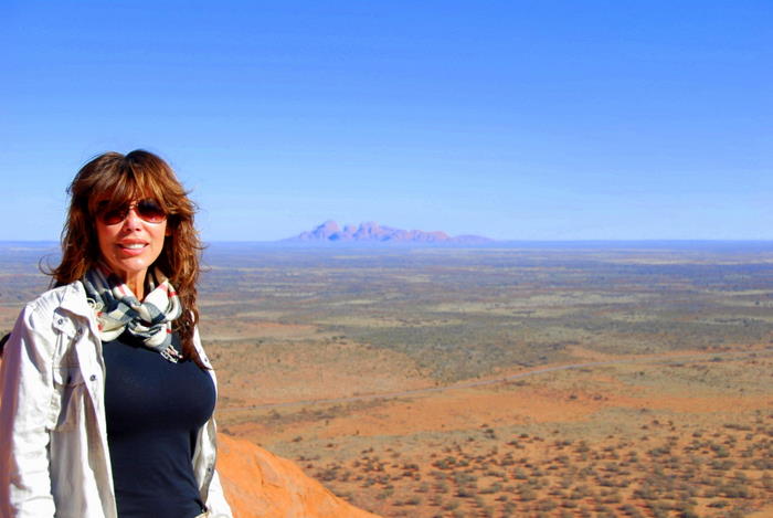
- At the top of Uluru with Kata Tjuta in the background.
Kata Tjuta, formerly known as The Olgas, can be seen to the west behind Tammy. With Mt Conner these three iconic features line up uncannily, both visible from the top of Uluru, causing some to speculate that they emerged at the same time and from the same cause.
This notion is totally unsustainable. While Uluru and Kata Tjuta are of similar composition (granite like) and emerged about 600 million years ago, Mt Conner is a flat top mesa 200-300 million years older.
Once at the top of Uluru I gave Tammy a surprise and phoned her Mum in Washington State. She was a little homesick, to say the least.
-
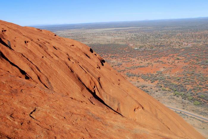
- View from the top of Uluru.
-
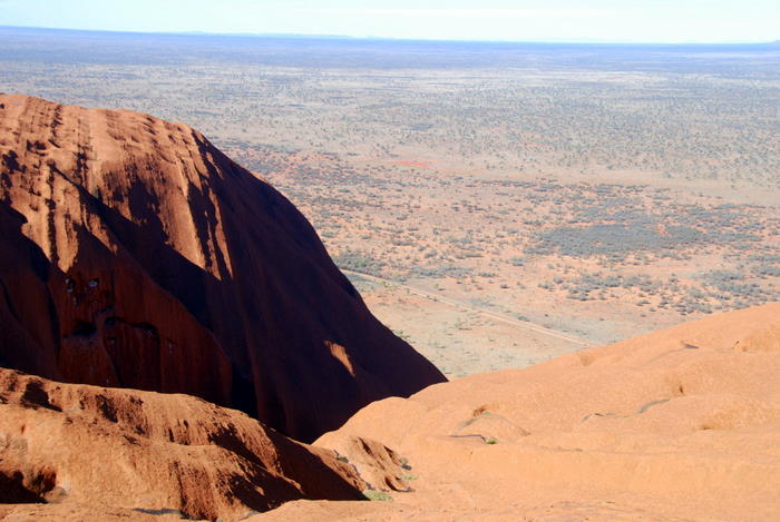
- View from the top.
-
- Descending Uluru
-

- Using the chain to descend at the point known as the chicken chute.
-

- Plaques commemorating those who died on the rock.
The number of people who have died climbing The Rock is not precisely known but it is thought to exceed 36. Most of these were from cardiac arrest.
-
- Kim at the base of The Rock after finishing the climb.
-
- Tammy is excited to have finished the climb.
-

- I did it!
The drive to Kata Tjuta, formerly known as The Olgas, is around 50 kilometres on a good sealed road.
-

- The Olgas
The dual naming convention adopted for The Olgas in 1993 meant that it was known as The Olgas/Kata Tjuta. A 2002 amendment means that it is now known as Kata Tjuta/The Olgas.
It comprises 36 formations that are thought to have been one huge piece of rock (much like Uluru), that has weathered over hundreds of millions of years. The highest point, Mount Olga, rises 546 metres above the ground; 200 metres higher than Uluru.
Mount Olga was named in 1872 by Ernest Giles, in honour of Queen Olga of Württemberg, daughter of Tsar Nicholas I. She and her husband, King Charles I of Württemberg, marked their 25th wedding anniversary the previous year by naming Australian resident geographer and botanist Ferdinand Mueller as a Freiherr (baron), making him Ferdinand von Mueller. Von Mueller was a sponsor of Giles’s expedition and so was able to request this repaying of the Queen’s earlier compliment to him.
The full ‘Valley of the Winds’ walk takes about three hours. We went only to the Viewing Area and then made our way back to our camp at Yulara.
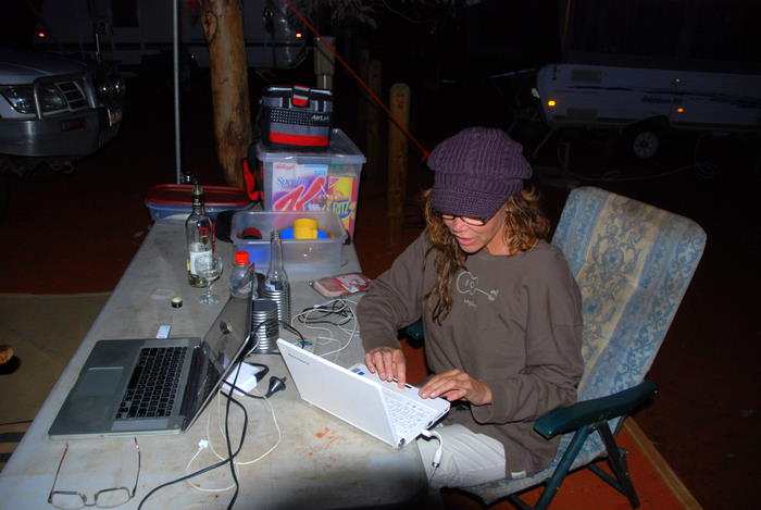
-
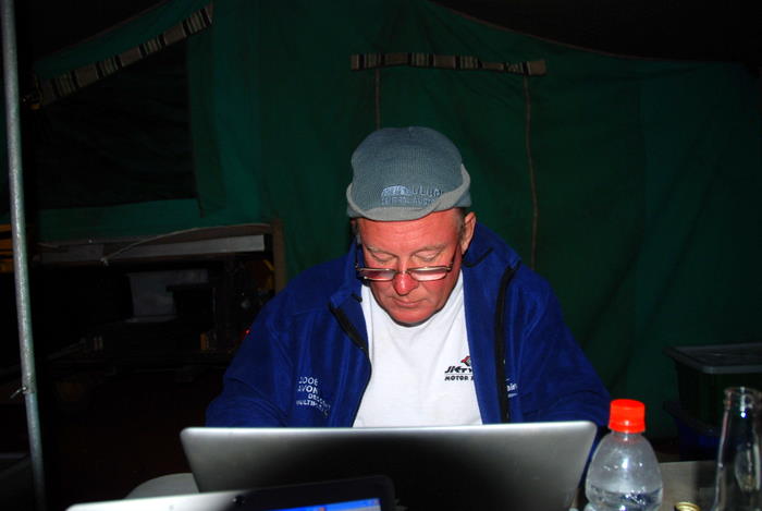
- Writing up diary.
-
- Arranging photos at camp.