
The source of the Jerdacuttup River is 26 kilometres north of Ravensthorpe at current day Hayes Road. It flows generally south-south-east, then south for 115 kilometres and empties into Jerdacuttup Lake on the coast. This lake does not communicate with the Southern Ocean.
The river flows to the north of the Ravensthorpe Range. The Moolyall Creek is a tributary of the Jerdacuttup River and would extend its length by 15 kilometres.
-

- Jerdacuttup River map.
The name for the river was recorded by surveyor C.D. Price in 1875-76. It is an aboriginal (Noongar) word of unknown meaning.
-

- Bridge over the Jerdacuttup River.
The following series of photographs were taken easter 2016 when much of southern Western Australia was flooded. It was a ‘once in a lifetime’ flood for the Jerdacuttup River.
-

- The floodwaters nearly reached the height of the bridge.
-
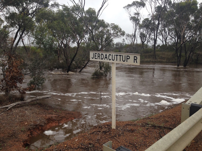
- Jerdacuttup River
-

- River in flood.
-

- The river is normally on a few metres wide when flowing.
Price also recorded alternative versions of this name as ‘Jerdacat’ or ‘Verdicat’ River.
The river normally flows only during winter.
Sources:
C.D. Price, Fieldbook 1A, pp.35-37 and Fieldbook 2, p.18.
Original Plan Plantagenet 60.
Read about other rivers in Western Australia and Australia.
© Kim Epton 2019-2025
232 words, five photographs, one image.
Feel free to use any part of this document but please do the right thing and give attribution to adventures.net.au. It will enhance the SEO of your website/blog and Adventures.
See Terms of Use.