The Fiztroy River rises at Mount Wells in the Durack Ranges.
It was named by Lieutenant (later Commander) John Lort Stokes of the Beagle in 1838. Read more about his discovery and naming of the river.
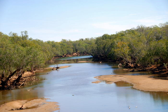
- Fitzroy River at Willare, 2010.
The longest river in the Timor Sea Division, the Fitzroy also carries a huge volume of water. It has an annual flow of 8,225,000,000 cubic metres, measured at Fitzroy Crossing.
The flow during the month of March alone is as great as the total annual useable water resources of the South West of the Western Australia. An instantaneous flow rate of 20,000 cubic metres per second was recorded in February 1993 in what was one of the heaviest ‘wets’. If this flow rate could be maintained it would fill Canning Reservoir in 75 minutes.
| LENGTH 622 kilometres. SOURCE Three kilometres east of Mount Wells in the King Leopold Ranges near the southern extremity of the Durack Range (100 kilometres north-north-west of Halls Creek). A.M.G. (source) 309100 metres East 8071200 metres North. FLOWS INTO King Sound, Indian Ocean. ENDPLACE Fifteen kilometres south-west of Derby. A.M.G. (mouth) 560000 metres East 8073000 metres North. TRIBUTARIES Little Fitzroy River, Hann River, Adcock River, Margaret River, Cunninghame River (anabranch), Minnie River (anabranch), numerous named and un-named creeks. 1:100,000 MAPS Bedford 4363, Tableland 4263, Laptz 4262, Glenroy 4163, Lerida 4162, Hooper 4062, Fitzroy Crossing 4061, Cunningham 3961, Dukes Dome 3960, Kalyeeda 3860, Hardman 3861, Nerrima 3761, Anderson 3661, Yeeda 3662, Derby 3663. 1:250,000 MAPS Lansdowne SE 52-5, Lennard River SE 51-8, Noonkanbah SE 51-12, Mt Anderson SE 51-11, Derby SE 51-7. |
Reference:
Epton, Kim, Rivers of the Kimberley, Hesperian Press, Carlisle, 2000.
Read about other rivers in Western Australia and Australia.
© Kim Epton 2022-2025
290 words, one photograph.
Feel free to use any part of this document but please do the right thing and give attribution to adventures.net.au. It will enhance the SEO of your website/blog and Adventures.
See Terms of Use.

