Khon Kaen to Suphanburi
We departed from Khon Kaen with the sun behind us and when we arrived at Suphanburi it was in our eyes. A full day on the road travelling west.
Our route took us through Chaiyaphum, then Lop Buri, Ang Thong and onto Suphanburi.
As per usual we took Rural Roads rather than Highways and travelled through some very interesting country, particularly between Lop Buri and Ang Thong. Lots of water – rivers, dams, lakes, klongs. This area has a 200 year history of building klongs (canals) and straightening rivers.
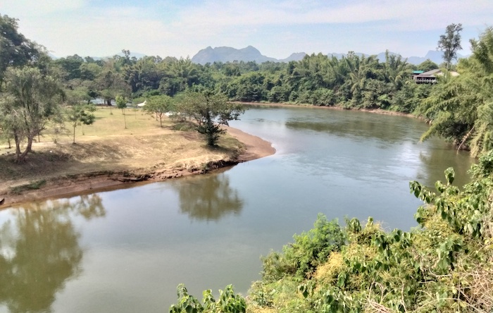
On our route south from the town of Lop Buri we followed the Lop Buri River for 30 kilometres before crossing it at Route 3267. Ten kilometres later we crossed the Chao Phraya River, Thailand’s major watercourse. It rises in far north Nan province, although it is named Chao Phraya only from Nakhon Sawan, and flows generally south 300+ kilometres through Bangkok to the Gulf of Thailand.
Our 450 kilometre drive – six hours behind the wheel and an hour for breaks – was a long day on the road. Any time that one can average in excess of 60 km/h for a full day’s driving in Thailand it is full on. A 450 kilometre to 500 kilometre road trip in country Thailand is the equivalent of around 700 kilometres or more in country Australia.
-

- WESTERN THAILAND XMAS 2023 ROUTE
Suphanburi to Sangklaburi
The morning’s first destination was the Sam Chuk Old Markets 35 kilometres north of town. This Chinese community market is located on the Tha Chin River. Old wooden shop/houses dating from early in the 20th century give the precinct an authentic Thai style feel. Being early, the market was way less crowded than it would be later in the day and made for a pleasant history and shopping experience.
-
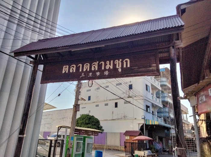
- Entry to old style Sam Chuk Markets.
-
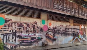
- Mural on wooden building.
-
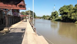
- The markets are on the Tha Chin River.
-

- Uncrowded shopping.
-
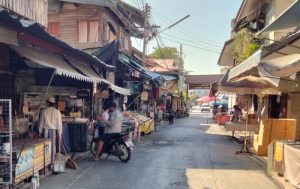
- Early shopping = no crowds.
On the return to Suphanburi we visited the Thai Buffalo Conservation Village on the basis of a recommendation from a friend – a difficult-to-agree-with recommendation. But the barista coffee at nearby CJ More was excellent.
-
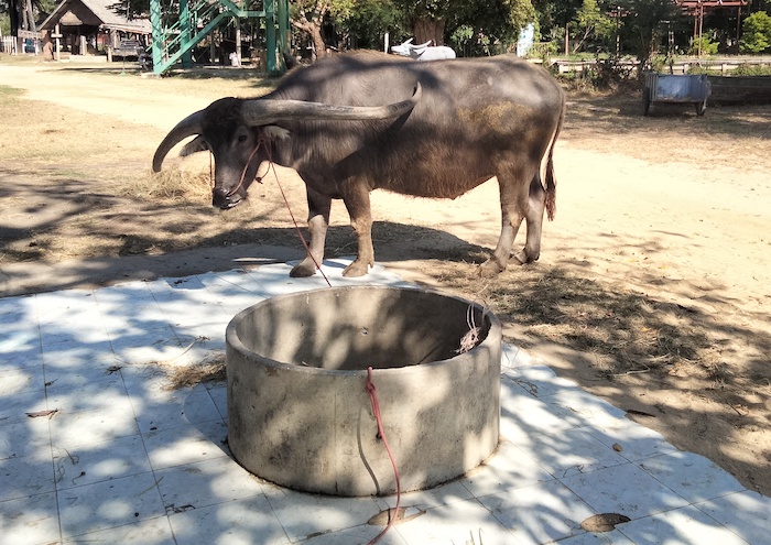
- Buffalo numbers in Thailand are falling.
-

- Rice is ground in these devices, powered by a plodding buffalo.
-

- Middle aged buffalo
-
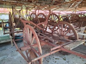
- Drays hauled by buffalo.
-

- Workers’ Hut.
On return to town we found our way to Wat Phra Si Rattana Mahathat.
-

- Wat Phra Si Rattana Mahathat
More photographs of Wat Phra Si Rattana Mahathat
After a couple of false starts we located a solitary prang at the corner of Sompan Kong Soi 3 Road and Mailaman Road 327. It is a brick structure – old without being ancient. It remains unidentified to the writer.
-
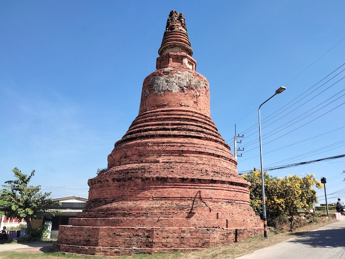
- Unidentified Prang in Suphanburi.
Approaching Kanchanaburi we skirted the town and headed to Sangklaburi up in the Tenasserim Hills, choosing not to visit Hellfire Pass until our return to Kanchanaburi a few days later.
-

- Hellfire Pass. Photograph from our Southern Thailand Road Trip in July 2022.
The Tenasserim Hills, stretching north-south 1700 kilometres from around Mae Sot down the southern spine of Thailand and into the Malay Peninsula to nearly Singapore are a driver’s delight. The road to Sangklaburi is a very twisty, turning route, hard on brakes, exhilarating to negotiate (mindful of passengers), and great scenery – some of the best on offer in western Thailand. And, of course, there’s plenty of crazies overtaking on bends, blind or otherwise.
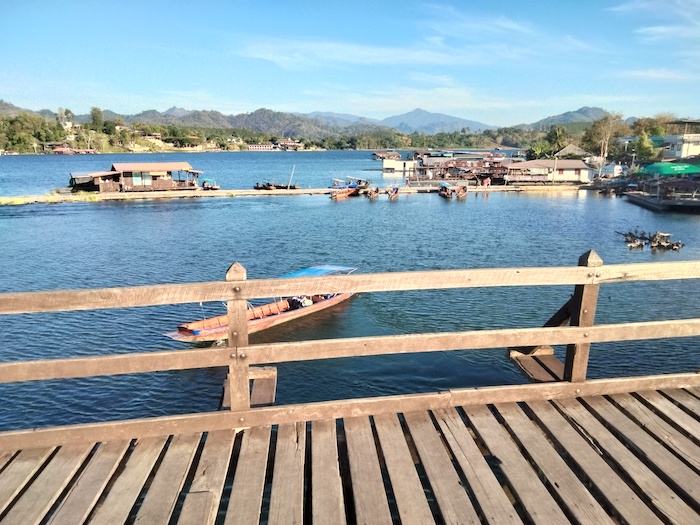
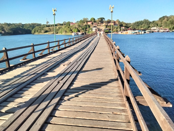
The first destination on arrival in Sangklaburi was Mon Bridge (full name Uttamanusorn Bridge) that links the town’s Thai and Mon communities across the Songaria River where it flows into the huge Khao Laem (Vajiralonkorn) Reservoir, Thailand’s first hydro-electric dam.
-

- The Sangaria River and Khao Laem Reservoir from Mon Bridge.
-

- At 430 metres, Mon Bridge is Thailand’s longest wooden bridge.
About 430 metres in length (be wary of longer claims by people who clearly haven’t visited it or wouldn’t know a metre from their elbow), Mon Bridge is Thailand’s longest wooden bridge and (probably) the world’s second longest after the U Bein Bridge in Myanmar.
-
- Sangaria River/Khao Laem Reservoir.
-
- The bridge is nearly inundated in the rain season.
Our homestay accommodation was a bit ordinary. On seeing the tilt tray recovery vehicle in the driveway we were initially not sure if we had arrived at the correct location. Despite the cracks in the floor and the flooding shower, Mine Host’s side hustle was adequate.
Later in the evening we walked out of a couple of restaurants (no service) before we found an excellent Mon establishment next to Walking Street that was speedy, served tasty food and was good value.
Sangklaburi to River Kwai Resotel, Sai Yok, Kanchanaburi
Next morning we decided to do a longtail boat tour of the Khao Laem Reservoir, departing from the Mon side of of the Uttamanusorn Bridge.
-

- SANGKLABURI AND KHAO LAEM RESERVOIR
-
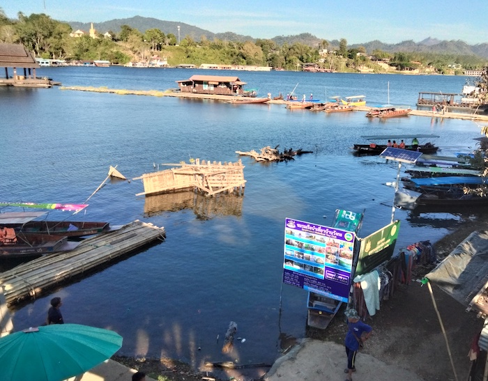
- The departure point for boat tours of the reservoir.
We selected the ‘Three Temples and a Japanese Cliff’ boat trip from the six electives that were on offer. The variable water level in the reservoir meant that it was a ‘Two Temples, an Indicator Flag and a Japanese Cliff’ boat trip. Not to worry – the scenery was excellent.
-
- All that is visible of Wat Wang Wiwekaram.
-

- Community hall at site of Wat Wang Wiwekaram.
-

- Japanese Cliff.
The boat captain’s description of the second temple (if you count the flag poking above the water as a temple) was, necessarily, of the nature of “you should have been here yesterday” (April when the water level is lowest).
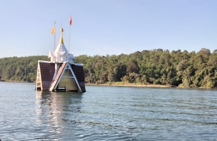
The third temple, Old Wat Somdet, is on the eastern side of the Reservoir and very interesting it is, too. In Sangklaburi town it has been replaced by a temple of the same name (but of very different character).
-

- The boat landing varies with the water level.
-
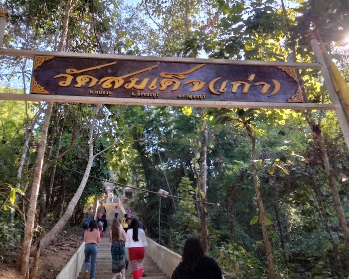
- Steps to the temple.
-

- Old Som Det Temple – of indeterminate age.
More photographs of Old Som Det
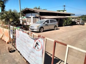
Satisfied with our financial injection to the local economy we headed to the Myanmar/Thai border, a 20+ kilometre adventure drive through the hills. Internal conflict in Myanmar meant that the border was closed which allowed more time to see the ‘real Thailand’ at the thriving roadside market selling useless junk.
-

- At the border of Thailand and Myanmar.
-
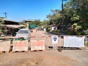
- Because of internal conflict in Myanmar the crossing point was closed.
-
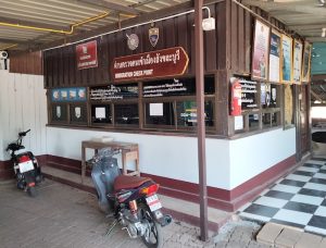
- Immigration Office is now being used as a carpark.
-
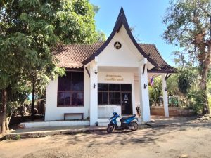
- Customs Office
-
- Thai/Myanmar crossing point – not currently open.
The insipid, three white structures on a patch of lawn near the border were the ‘attraction’. All they lacked was some of the usual, gaily coloured, juvenile signage. Did we see the real Three Pagodas?
We retraced our route to Sanglaklaburi and continued on to the River Kwai Resotel at Sai Yok, an upmarket resort where we spent two restful nights. Excellent restaurant, however, they need to replace about 30% of their plates – chips and cracks.
-
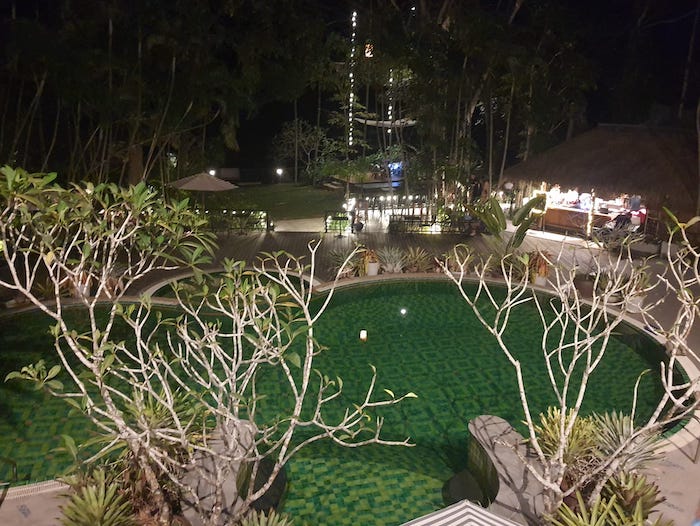
- In the restaurant overlooking the pool.
We visited the Burma Railway at Krasae Cave while having a look around Sai Yok.
-
- River Kwai at Krasae Cave
-

- Bridge at Krasae. Part of the infamous Burma Death Railway.
Sai Yok, Kanchanaburi to Thung Khok, Suphanburi
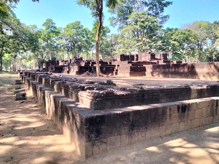
Leaving the resort late we headed south-east on Saeng Chuto Road (Highway 323 – the way to Kanchanaburi) before turning south to Prasat Muang Singh Historical Park, about 30 kilometres west of Kanchanburi.
-

- Prasat Muang Singh
This beautifully maintained Historical Park is the most westerly exemplar of the Khmer style temples in Thailand.
-
- All that remains of the second monumenrt.
-

- Entries align
-

- Outer wall
More photographs of Prasat Muang Singh
Kanchanuburi War Memorials
Our hoped-for visit to Hellfire Pass was stymied by pesky public holidays. The Hellfire Pass Interpretive Centre is run by the Australian Government and, though xmas day is not an official holiday in Thailand, the Centre observes Australian public holidays.
In any case, the displays at the Centre have been bowdlerised/made palatable (toned down is the official term) to an unrecognisable degree, unworthy of the memory of the men who suffered there. Consider this weak, mealy-mouthed excerpt from the Australian government official website:
The building of any centre raises complex issues of interpretation, particularly if the history it displays is ‘difficult’.
In Australia, some ex-prisoners of war feared that the interpretive centre might play down the atrocities perpetrated by the Japanese, or might suggest that their work on the railway had contributed to the Japanese war effort.
The Thai government preferred that the interpretive centre promote reconciliation, rather than dwell on the circumstances of the Japanese occupation some 50 years earlier.
The designers of the interpretive centre aimed to present the story of captivity in a balanced way with minimum use of physical artefacts.
Disgusting wokeism insulting to Colonel Sir Ernest Edward “Weary” Dunlop and his men who suffered so much. It wasn’t just Australians. British, Dutch and some Americans suffered unspeakable atrocities there. And thousands of Thai, Malay, Tamil, Javanese and Burmese civilians were ‘press ganged’ into working on the railway – the modern sanitised version of their mass murder by starvation and overwork is that they were “paid labourers”.
The Burma Railway – the Railway of Death – is a major attraction in Kanchanaburi. Its macabre genesis and attendant museums are important reminders of the evils of war and man’s inhumanity to man when power is left unchecked.
The JEATH Museum on the River Kwai (one of two JEATH Museums in Kanachanburi) is like a mad woman’s breakfast with exhibits looking tired and lacking a specific theme. While most are worthwhile, many are garbage. Overall recommendation – visit the meticulously maintained War Cemetery and then go to the Death Railway Museum and Research Centre over the road. These two quality establishments will give a full appreciation of the enormity of the inhumanity perpetrated by the Imperial Japanese Army during World War II.
After a late lunch, and consideration of an overnight stay in Kanchanaburi, I decided to push towards Khon Kaen for an hour or so. We eventually settled on the White House Hotel at Thung Khok for the night.
Thung Khok to Khon Kaen
As much as I tried to force Google Maps into taking a more north-easterly route it eventually took us Mitraphap Road on the Saraburi Bypass. This is Route 2/AH12, the main road from Saraburi to Khon Kaen. It was an absolute mobile melee – madness on wheels. While the highway did not deteriorate into a carpark, at 30-50km/h with no end in sight there were lots of other places I’d rather be. Punters returning to their home town/village for New Year, slow moving trucks, delivery drivers, tourists, tradesmen trying to get to their next job, and the usual allotment of maniac drivers. Kilometre after kilometre of slowish, dangerous, pressure driving. After 20 kilometres of this I was looking for an exit, any exit. The next escape route was nine kilometres up ahead. I didn’t care where it took us as long as it was off Route 2 (AH12).
Our revised Rural Roads route took us through open roads, farmland, hills, forests, small villages, a windfarm, into Chaiyapum and onto Khon Kaen – a much more pleasant drive.
-

- We drove through the Huai Bong Windfarm at Dan Khun Thot on the way home.
But at 530 kilometres from Thung Khok to Khon Kaen it was still a big day of driving with an average of more than 60 km/h – full on.
Western Thailand Road Trip
Distance
2200 kilometres.
Duration
Seven days.
Provinces
Khon Kaen, Chaiyapum, Nakhom Ratchasima, Ayutthaya, Suphanburi, Kanchanaburi, Saraburi.
Download GPX File
11036-Western Thailand
© Kim Epton 2023
1933 words, 37 photographs, one image.
Feel free to use any part of this document but please do the right thing and give attribution to adventures.net.au. It will enhance the SEO of your website/blog and Adventures.
See Terms of Use.