
The aim of this trip was to confirm the source of the Murchison River, after two previous inconclusive expeditions.
A secondary aim was to ascertain its correct length with a view of proving it to (possibly) be Western Australia’s longest river. The Hope/Yalgar flows through Lake Annean and joins the Murchison at Moorarie, via the Ord, 140 kilometres from the source. In times of flood more water flows down the Hope/Yalgar River than the length of the Murchison upriver from the confluence of the two. If this is indeed the true hydrological course of the Murchison then it would be Western Australia’s longest river.
The river rises in the Robinson Ranges.
In 2006 I had made a trip to Doolgunna Station 135 kilometres north of Meekatharra to ascertain the source of the Murchison River. And in 2007, Phil Bianchi, Jeff Murray and I made a further trip to the area.
A few days after we got back to Perth from the 2007 trip, Jeff advised that he had been using the latest satellite technology to confirm our location of the source of the river and, in the process of doing so, he believed that he had pinpointed another, nearby branch that was longer than the one we tracked.
Clearly this needed on-the-ground investigation and determination.
And so it was that I set out with Jeff and Scott Murray on this third trip.
We arrived at Doolgunna homestead on Saturday 12 April 2008 and met with officers from the Department of Environment and Conservation who were on the station finishing flood control work. After poring over maps it was time to head west towards the source of the river. The sun was fast disappearing, making driving difficult, so we found a good campsite just off the track.
We were up early the next morning and headed to the site of the cairn we had built in 2007.
We had told Phil Bianchi, who was with us on that 2007 trip and helped us build the cairn, that we couldn’t just knock it over as it was now a historical marker and, instead, we would relocate it rock by rock to the new source. Phil couldn’t believe that we would go to that effort – so as proof we showed him the photograph of us placing the rocks in the back of my Nissan Patrol in preparation to shifting them to the new site.
-

- ‘Relocating’ rocks from the original cairn
Unless he’s reading this, he still believes we shifted the cairn rock by rock.
After knocking down the cairn, we moved around the watershed to come up the other side of it, about five kilometres to the east.
-

- Track around the watershed
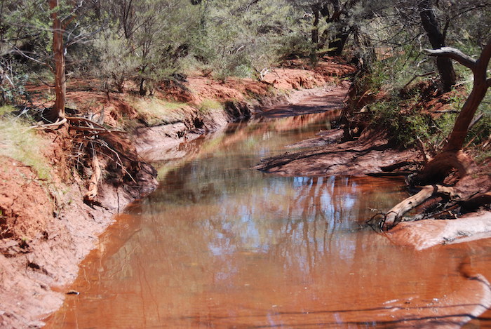
A winding station track took us to Central Bore. This tank is on the Murchison River.
-

- Central Bore on Doolgunna Station.
-

- The river has a defined course around Central Bore.
There are many small channels of the river around Central Bore. Each of us selected a likely looking channel and followed it up. I took the course trending to the west and Jeff and Scott took the two that trended more easterly. Within 500 metres I abandoned my gutter and moved to my right to meet up with the other two. Jeff had got onto the correct channel and we followed it for a few hundred metres. The channels here were at most two metres wide so, clearly, this was very close to the source.
-

- Jeff and Scott


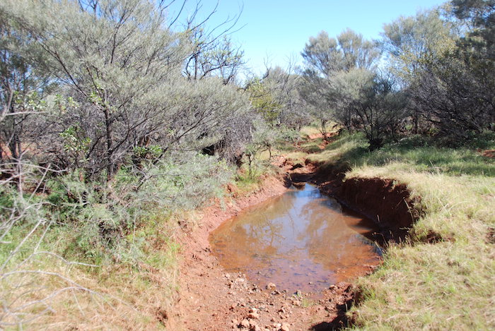
A number of small pools of water remained in some of the stretches. The mighty Murchison River is no more than a gutter at this point. The ‘river bed’ is about a metre wide and in some places no more than 300mm in width.
Eventually the ground began to rise and we knew we had selected the correct course. We broke through the scrub and came out on a barren, gravelly ironstone rise.
-

- Jeff
-
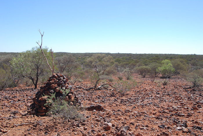
- Cairn
-

- The top of the hill where the river starts.
A short walk to the top of this hill and we were at the watershed – the source of the Murchison River.
In our overcrowded world, not many people have had the privilege of standing at the source of a mighty river, or indeed, any river. I had a feeling of satisfaction.
Fourteen years after being first ‘introduced’ to the river my Team had boated the feasible length of the river (a number of times) and after exhaustive investigations (and one false claim) we had determined the point where the water from storms and cyclones flowed down an ancient hill to meet up with other waters washed off surrounding ranges to become a defined watercourse – The Murchison River.
-

- Two GPSs on the cairn.
-

- Cairn.
After building a cairn, determining the position by GPS, and taking photographs we returned to the vehicles and headed back to Perth.
The source of the Murchison River is:
UTM 50J 0710637mE 7164643mN
Degrees Lat Long -25.6207837°, 119.0977497°
Degrees Minutes -25°37.24702′, 119°05.86498′
Degrees Minutes Seconds -25°37’14.8212″, 119°05’51.8989″

Go to the first Murchison Source Expedition 2006.
Go to the second Murchison Source Expedition 2007.
Go to more information about the Murchison River.
© Kim Epton 2015-2024
875 words, 15 photographs.
Feel free to use any part of this document but please do the right thing and give attribution to adventures.net.au. It will enhance the SEO of your website/blog and Adventures.
See Terms of Use.